
Cloudy and mild under a persistent weather pattern
A wintry mix for the southwest corner of the state Wednesday
Go Deeper.
Create an account or log in to save stories.
Like this?
Thanks for liking this story! We have added it to a list of your favorite stories.


Southwestern Minnesota sees rain and a little snow Wednesday, but the prevailing trend across the state into the weekend is a stagnant trend that keeps skies mostly cloudy and temperatures mild.
Wednesday’s forecast
Unlike the last few days, the fog Wednesday morning was not as thick in Minnesota as other mornings earlier this week, and it was predominantly along the eastern edge of the state. The densest fog is impacting Wisconsin now, because the center of an area of high pressure and the lightest winds have shifted east.
That high pressure is still dominating Minnesota’s weather though, and it is influencing the track of a storm system, essentially blocking it and keeping that storm and most of its moisture south of the state.
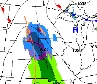
Only the very southwestern edge of Minnesota is being clipped with what has mostly been drizzle and light rain as of 9:30 a.m., and it will have some light snow mixing in as well. This precipitation lasts into the afternoon hours and diminishes by evening, with no more than an inch of snow expected.
Turn Up Your Support
MPR News helps you turn down the noise and build shared understanding. Turn up your support for this public resource and keep trusted journalism accessible to all.
The rest of the state is unlikely to see precipitation from that weather system, other than maybe a stray flurry. However, it has brought widespread cloud cover across the state. This is kept morning temperatures very mild, with many places 20 to 30 degrees above average lows. There were a couple morning lows in the teens in northern Minnesota, where there were a few breaks of clearer skies overnight, but most of the state is started in the 20s, with even some 30s west.
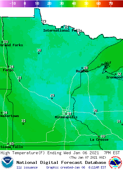
Because of the cloudy skies, temperatures do not rise much, with highs in the upper 20s to mid-30s, but this is also above average for January.
Extended forecast
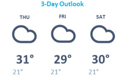
Snow chances stay remote the rest of the week. There is an area of light snow that approaches Minnesota Friday, but it appears our current pattern, including the high pressure, keeps most of that moisture from getting to the state. Instead, the trend of mostly cloudy skies and areas of fog will continue, probably through the weekend. This also keeps overnight temperatures very mild for January, and highs slightly above average, mostly in the 20s and low 30s across the state.
Here is that forecast for the Twin Cities:
The stagnant pattern should start to erode somewhat early next week, and a few weather models bring snow back around next Wednesday or Thursday.
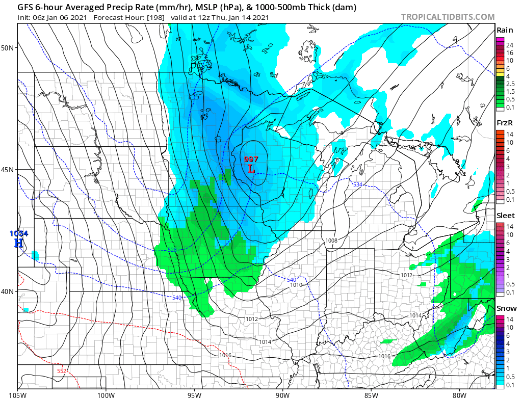
We will monitor that possibility and keep you updated here in Updraft!
Programming note
You can hear my live weather updates on Minnesota Public Radio at 7:48 a.m. Monday through Friday morning.

