
Displays of frost and ice continue thanks to morning fog
Snow chances across Minnesota stay slim for the next week
Go Deeper.
Create an account or log in to save stories.
Like this?
Thanks for liking this story! We have added it to a list of your favorite stories.


A persistent weather pattern keeps Minnesota shrouded in morning fog, with mostly cloudy skies and mild temperatures into the weekend.
That morning fog has been making for some beautiful displays of hoar frost and rime ice across Minnesota over the past week.
Here is an incredible look at rime ice forming early Thursday on a Minnesota Department of Transportation webcam near Carlton:
Thursday’s forecast
After a brief reprieve for most of Minnesota Wednesday, a wider area of fog returned Thursday morning. Most of it was light enough that no dense fog advisories were issued, however, there are a few areas in central Minnesota and the Arrowhead with visibility still under a mile as of 9 a.m., so drive with care.
Turn Up Your Support
MPR News helps you turn down the noise and build shared understanding. Turn up your support for this public resource and keep trusted journalism accessible to all.
Under widespread cloud cover, the state stayed very mild overnight, with most places starting in the teens and 20s, which is 10 to 20 degrees above average. The only cooler spot was northwestern Minnesota, which saw clearer skies overnight, allowing a few morning lows to drop into the single digits.
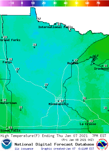
Because skies stay predominantly cloudy through the day, temperature only rise 5 to 10 degrees by afternoon, putting most highs in the upper 20s, which is still above average.
Extended forecast
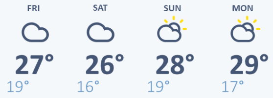
The stagnant pattern keeps temperatures above average and skies mostly cloudy through the weekend. The temperatures include overnight lows that continue to run 10 to 20 degrees above average most nights, and highs in the 20s and occasional 30s.
Here is the Twin Cities forecast through Monday:
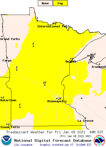
Areas of fog remain a concern, and it is expected to be widespread again Friday morning.
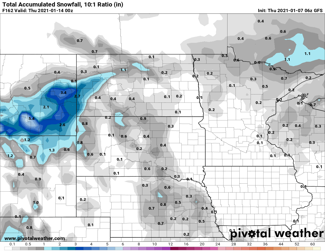
Meanwhile, the high pressure bringing this very stable airmass also keeps much moisture from coming our way. No significant storms will impact Minnesota for at least the next week. Any snow that manages to make it into the state would likely only be flurries or a dusting.
This is the total snowfall forecast through next Wednesday:
The second half of next week could finally turn more active. We’ll keep you updated for any snow chances!
Programming note
You can hear my live weather updates on Minnesota Public Radio at 7:48 a.m. Monday through Friday morning.

