Windy, wintry weather continues Friday, then a quieter weekend

Why were some snow totals less than expected?
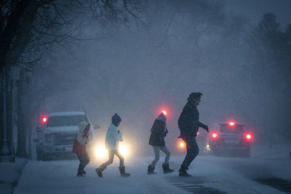
People dash across the street during a snowstorm.
People dash across the street outside the Cathedral of St. Paul during a storm in December. A persistent winter storm continues to bring gusty winds and a messy mix of precipitation across Minnesota Friday. 
Leila Navidi | Star Tribune via AP 2020

A persistent winter storm continues to bring gusty winds and a messy mix of precipitation across Minnesota Friday. Then the weekend turns quieter and cooler.

The snowstorm that has been impacting Minnesota since Thursday is still going, but for parts of the state, including the Twin Cities, it did not bring as much heavy snow as forecast.

This was a challenging forecast from the start because it was dependent on an area of low pressure stalling near Minnesota and pushing moisture back into the state.

Thus, timing of how long the low lingered, available moisture, and our recent mild temperatures (how “wet” the snow was versus how much rain mixed in) all played a factor.

Create a More Connected Minnesota

MPR News is your trusted resource for the news you need. With your support, MPR News brings accessible, courageous journalism and authentic conversation to everyone - free of paywalls and barriers. Your gift makes a difference.

Less moisture than expected, plus temperatures staying just above freezing in many places and leading to a “wet snow,” played a large role in areas that saw reduced snow totals.

Here some of the snowfall reports as of 9 a.m. Friday:

weather graphic
Snow reports as of 9 a.m. Friday
National Weather Service

Central Minnesota, including the Brainerd Lakes area, already have totals up to 4 and 5 inches. The Twin Cities has less than originally expected but, keeping with the forecast, snow totals have been higher on the south side of the metro area, such as the 4.5 inches reported in Rosemount.  

Southeastern Minnesota has seen the highest amounts, with up to 6 inches reported as of 9 a.m. for cities including Owatonna and Albert Lea.

Friday’s forecast

As of Friday morning, that low pressure center is still sitting in northeastern Iowa, funneling moisture and gusty winds into Minnesota.

weather graphic
6 a.m. Friday surface weather analysis
National Weather Service

It is expected to keep bringing light to moderate bands of snow across southern Minnesota through the day, although temperatures are so mild, rain will occasionally mix in. 

For northern Minnesota, there is very spotty light snow. Freezing drizzle is also likely, but not enough to cause widespread problems but watch for slick roads.

weather graphic
Precipitation forecast late Friday morning
National Weather Service

In terms of accumulation, most of Minnesota will see less than an inch of additional snow Friday, however south-central Minnesota, especially Mankato and southward, could get an additional 2 to 4 inches.

Although the snow totals with this storm were not as significant as projected, the winds definitely did increase as forecast. Even with predominantly light snow Friday, winds that could gust over 50 mph in southwestern Minnesota may produce whiteout conditions.

weather graphic
Forecast peak wind gusts Friday
National Weather Service
weather graphic
Blizzard warning and winter weather advisory until 6 p.m. Friday
National Weather Service

Thus, the blizzard warning for southwest and south-central Minnesota is still in effect until 6 p.m. (red), while much of the rest of the state remains under a winter weather advisory (purple).

Temperatures stayed very mild overnight, with most of the state near or even above freezing Friday morning, making for that wet snow.

Those temperatures stay predominantly steady through the day, and may even drop slightly in western Minnesota as the storm starts to clear and slightly cooler air moves in.

weather graphic
Friday afternoon high temperatures
National Weather Service

The precipitation will move out from northwest to southeast from Friday afternoon through the evening.

Weekend forecast

Behind the storm, skies stay cloudy Saturday with the potential for lingering flurries in southeastern Minnesota and light snow in the Arrowhead. Sunday looks dry but is also mostly cloudy with a few more breaks of sunshine possible.

Temperatures cool slightly compared to the recent mild weather, with highs in the 20s for almost the entire state. This is still above average for January. 

Here is that forecast for the Twin Cities:

weather graphic
Twin Cities forecast through Monday
National Weather Service

Programming note

You can hear my live weather updates on Minnesota Public Radio at 7:48 a.m. Monday through Friday morning.