
Flake chance in some areas this Sunday; cooler Monday
Mild temps return on Wednesday
Go Deeper.
Create an account or log in to save stories.
Like this?
Thanks for liking this story! We have added it to a list of your favorite stories.


Some people are dealing with icy roads and sidewalks this Sunday.
A winter weather advisory continues until noon for southwestern Wisconsin, including counties just over the border from southeastern Minnesota. Freezing drizzle is the culprit that’s causing the icy spots.
Some side-streets, sidewalks and driveways in the Twin Cities are still slippery, due to the slushy snow of Friday which froze over, plus a bit of freezing drizzle from yesterday. Here’s a safety tip for walking when there are icy patches:
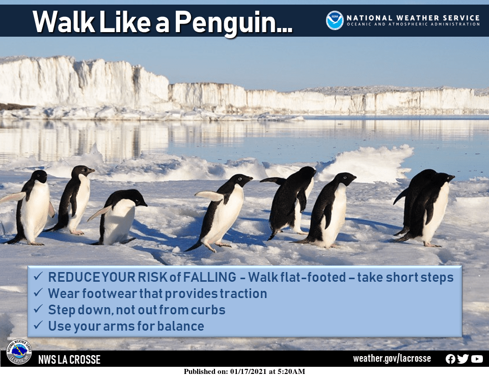
It’s always a good idea to wear grippy shoes in winter. My wife and I also have some mini-spikes that slip over our hiking boots. We enjoyed a nice long walk together yesterday, even though many sidewalks and side streets were icy.
Turn Up Your Support
MPR News helps you turn down the noise and build shared understanding. Turn up your support for this public resource and keep trusted journalism accessible to all.
Snow chances
There were areas of light snow in parts of northwestern Minnesota late Sunday morning. The light snow is expected to spread to the southeast Sunday afternoon and evening. Our best chance of light snow showers in the metro area is late Sunday afternoon and Sunday evening. There could also be some patchy freezing drizzle today.
You can hear updated weather information for Minnesota and western Wisconsin on the MPR network, and you’ll see updated weather info on the MPR News live weather blog.
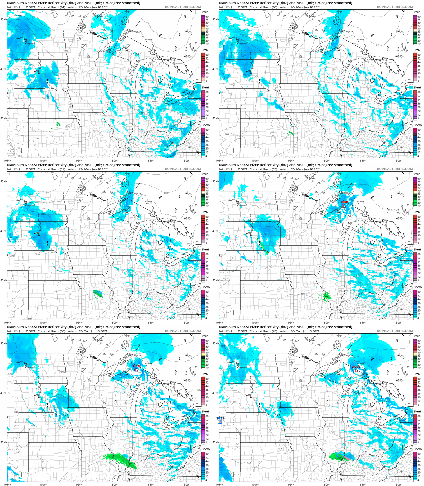
On Monday, the best chance of light snow showers will be in southwestern Minnesota and far northeastern Minnesota. The National Oceanic and Atmospheric Administration’s North American Mesoscale (NAM) forecast model shows the potential precipitation pattern Monday through Monday evening:
Temperature trends
Sunday highs will be in the 20s across most of Minnesota plus western Wisconsin. A few spots in southwestern Minnesota could reach the lower 30s.
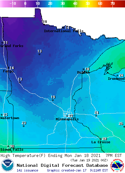
Monday highs will be in the teens north, with 20s in the metro area and southern Minnesota:
Monday afternoon wind gusts are expected to be in the 10-15 mph range:
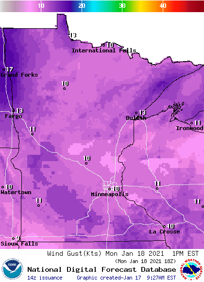
Plotted winds are in knots, with 10 knots equal to 11.5 mph.
Back to temperatures, Twin Cities metro area highs are projected to be around 20 degrees on Tuesday, followed by mid 30s Wednesday and lower 30s on Thursday. It’ll be much colder on Friday, with a high in the middle teens.
We could see a stretch of cool weather from next Sunday into the following week. The NWS Climate Prediction Center shows a tendency for below-normal temperatures from Jan. 24 through Jan. 30:

Winter scorecard
We’re half-way through meteorological winter, which covers our three coldest months: December, January and February. The first half of meteorological winter was very mild in Minnesota and western Wisconsin.
December was 5.6 degrees warmer than normal in the Twin Cities, and the first half of January was 9.8 degrees warmer than normal. Our December snowfall was about one inch above normal at MSP airport, and our snowfall was about three inches below normal for the first half of January.
Programming note
You can hear my live weather updates on MPR News at 7:35 a.m., 9:35 a.m. and 4:39 p.m. each Saturday and Sunday.

