
Temperatures soar then plunge by Friday
Most of Minnesota will see snow over the weekend
Go Deeper.
Create an account or log in to save stories.
Like this?
Thanks for liking this story! We have added it to a list of your favorite stories.


Following milder weather Wednesday and Thursday, temperatures dive again late-week, then more snow targets Minnesota Saturday and Sunday.
Wednesday’s forecast
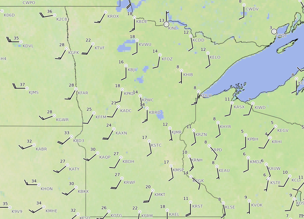
Unlike most mornings, where temperatures warm as you go south across Minnesota, the contrast Wednesday morning is west to east.
Under the influence of a strong warm front, winds across Minnesota started shifting southerly Tuesday evening. As that happened, warmer air started moving across the state, increasing temperatures overnight.
Since the wind shift impacted western Minnesota first, that part of the state had more time for temperatures to rise. So, as of 9 a.m., temperatures range from near 30 in the west to teens and single digits in the east.
Turn Up Your Support
MPR News helps you turn down the noise and build shared understanding. Turn up your support for this public resource and keep trusted journalism accessible to all.
The warming trend continues all day, bringing most highs into the 30s, which is 10 to 20 degrees above average for most of the state.

The breezy conditions driving those temperatures also increase into the afternoon, causing gusts from 20 to 30 mph in the afternoon for much of the state, and possibly over 40 mph in northwestern Minnesota.
The storm causing Wednesday’s conditions is well to the north in Canada, but northern Minnesota is getting clipped with light snow from it, and very light rain or freezing rain could mix in during the afternoon as temperatures warm.
Because of this, northern Minnesota stays mostly cloudy through the day, while the rest of the state sees more sunshine, especially in the afternoon.
Turning colder again
Already by Wednesday afternoon, the wind direction shifts again, with winds coming from the west. This cuts off the warmest air, but for southern Minnesota, it keeps temperatures fairly steady in the 20s and low 30s Wednesday night and Thursday.
For northern Minnesota, temperatures also stay mild overnight Wednesday, but a cold front passing through the state Thursday impacts the northern edge of the state first, causing temperatures to fall through the day.
Most of northern Minnesota will only be in the teens or single-digits by Thursday afternoon. Here is that forecast temperature trend for International Falls Thursday, showing that plunge (temperature in red and wind chill in blue):
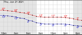
Thursday also stays breezy, adding to the chill.
The cold air spreads across all of Minnesota by Thursday night, starting Friday off below zero north and in the single-digits south, and staying below average all day. Even more of the state is likely to start Saturday with negative temperatures.
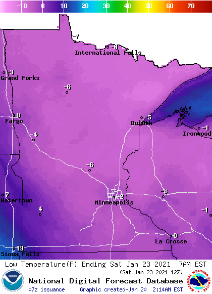
For most of Minnesota, the cold either Friday morning or Saturday morning (varies by location) will be the chilliest weather we have seen so far this January.
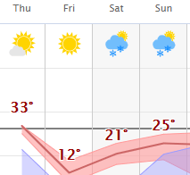
Highs finally return to more seasonable cold by Saturday afternoon, with teens north and 20s south. Here is that forecast for the Twin Cities showing the dramatic temperature swings:
Weekend snow
The cold front passing through Minnesota Thursday is expected to bring a few flurries to a light dusting of snow with it.
Then, the best chance for widespread snow comes Saturday into Sunday, with a storm expected to track well south of the state. Currently, it looks like more of the snow accumulation will be in southern Minnesota and limited to a few inches.
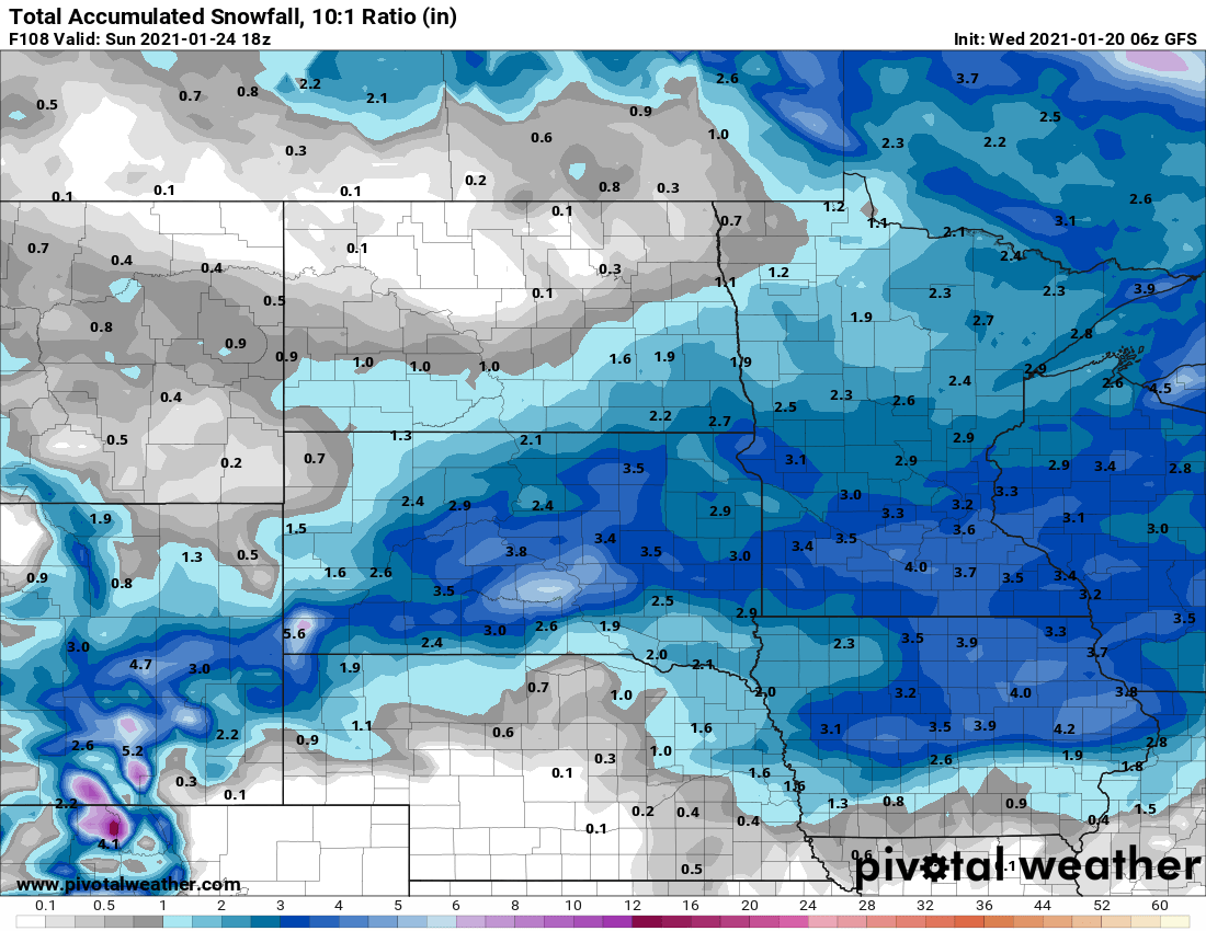
Timing is forecast to bring snow in Saturday morning, tapering off Sunday morning or possibly in the afternoon. We will keep you updated on the timing and forecast snow amounts as that storm makes its way toward Minnesota!
Programming note
You can hear my live weather updates on Minnesota Public Radio at 7:48 a.m. Monday through Friday morning.

