Snow moves in today, lingers into Saturday night
Highest snow totals southern Minnesota
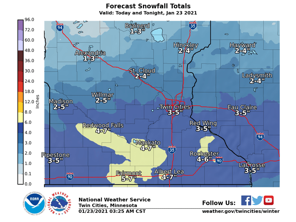
Weekend snow forecast
National Weather Service
Go Deeper.
Create an account or log in to save stories.
Like this?
Thanks for liking this story! We have added it to a list of your favorite stories.
