
The final week of January will be the coldest of the month
Snow chances across Minnesota stay slim until the weekend
Go Deeper.
Create an account or log in to save stories.
Like this?
Thanks for liking this story! We have added it to a list of your favorite stories.


Colder air stays in place across Minnesota much of the week, bringing parts of Minnesota, including the Twin Cities, a chance at seeing below-zero temperatures for the first time all month.
The state saw another round of snow over this past weekend, although as snowstorms go it caused minimal problems as winds stayed lower and it was a “dry” snow making it lighter to shovel.
Here are some of the reported totals, with the highest report being 6 inches in southwestern Minnesota, in Westbrook:
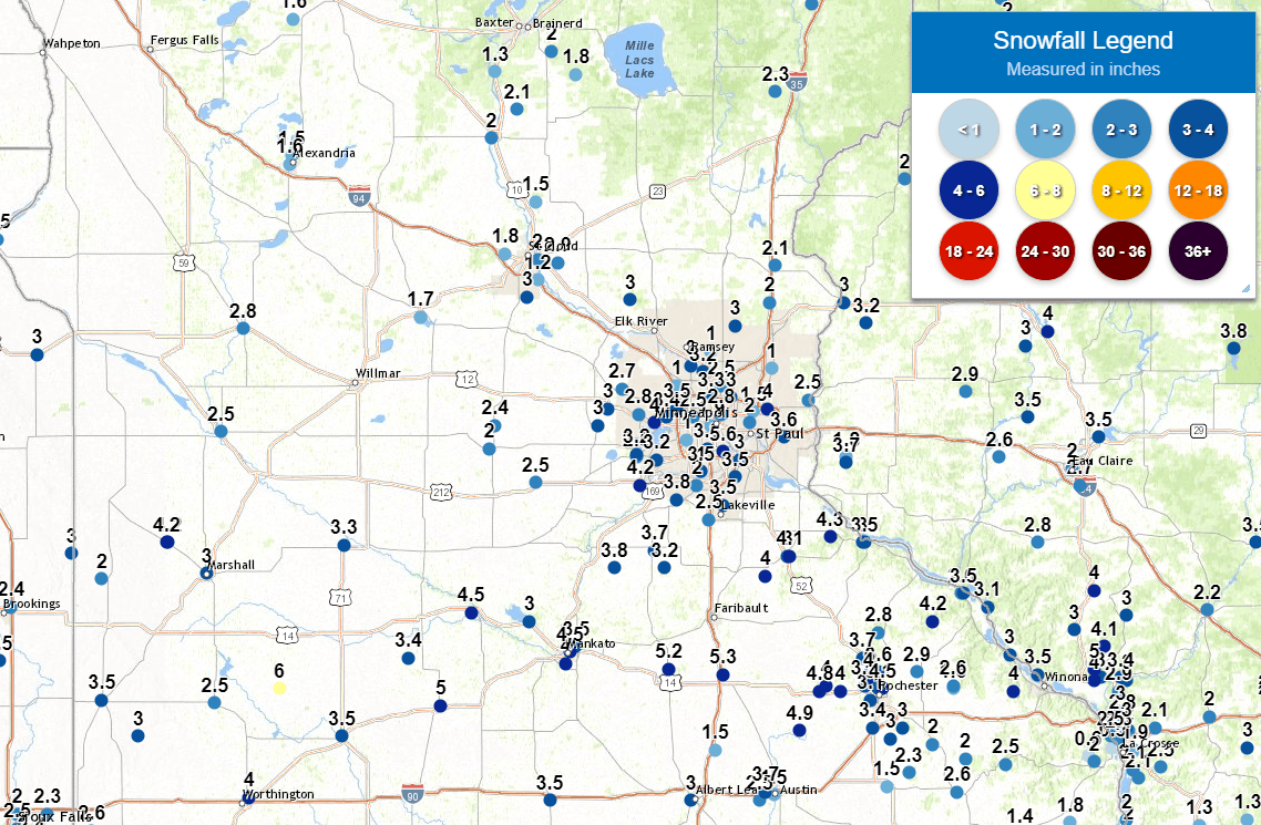
Much of the Twin Cities area saw 3 to 4 inches, and the highest report was at the Minneapolis−St. Paul International Airport, with 5.6 inches.
Monday’s weather
Cooler air has now moved in behind that storm, and Monday started off seasonably cold for late January, with a few below-zero readings in northeastern Minnesota, then most of the state in the single digits.
Turn Up Your Support
MPR News helps you turn down the noise and build shared understanding. Turn up your support for this public resource and keep trusted journalism accessible to all.
Under a cooler flow with winds predominantly from the east to northeast through the day, temperatures do not warm much. Single digits north and teens south put most of the state 5 to 15 degrees below our average highs.

That wind direction is due to Minnesota sitting on the southeast side of high pressure in Canada. There is also a winter storm sliding south of Minnesota.
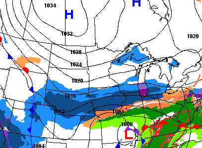
Being between these two pressure systems keeps Minnesota a little breezy Monday, so the wind chill will make the already cold temperatures feel 10 to 20 degrees colder.
The storm south of Minnesota may bring the southern edge of the state a few flurries Monday, but otherwise dry skies are expected.
Colder temperatures through late week
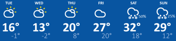
The influence of the high pressure to our north keeps temperatures below average through Thursday. Most highs across Minnesota will be in the single digits north and teens south, with a few more teens and low 20s by Thursday.
The biggest forecasting challenge is overnight lows. The high pressure brings clearer skies, which during the overnights allow temperatures to plunge. Right now, it looks like Wednesday and Thursday mornings will be the coldest this week, with most of the state below zero.
However, another storm sliding south of Minnesota Wednesday will likely bring a few more clouds into southern Minnesota especially, which could prevent overnight temperatures from getting as cold.
Some portions of southern Minnesota, including the Twin Cities, still have not seen any temperatures below zero this January, which is unusual. Typically, the official Twin Cities temperature falls below zero 11 times in January.
By Friday, the pattern turns milder again, with most of Minnesota back in the 20s or low 30s.
Staying dry
The same pattern that gives us the cooler weather also keeps us predominantly dry through the week, with storms staying south of the state. As that pattern shifts and temperatures turn milder, we do bring back a chance for precipitation Saturday into Sunday.
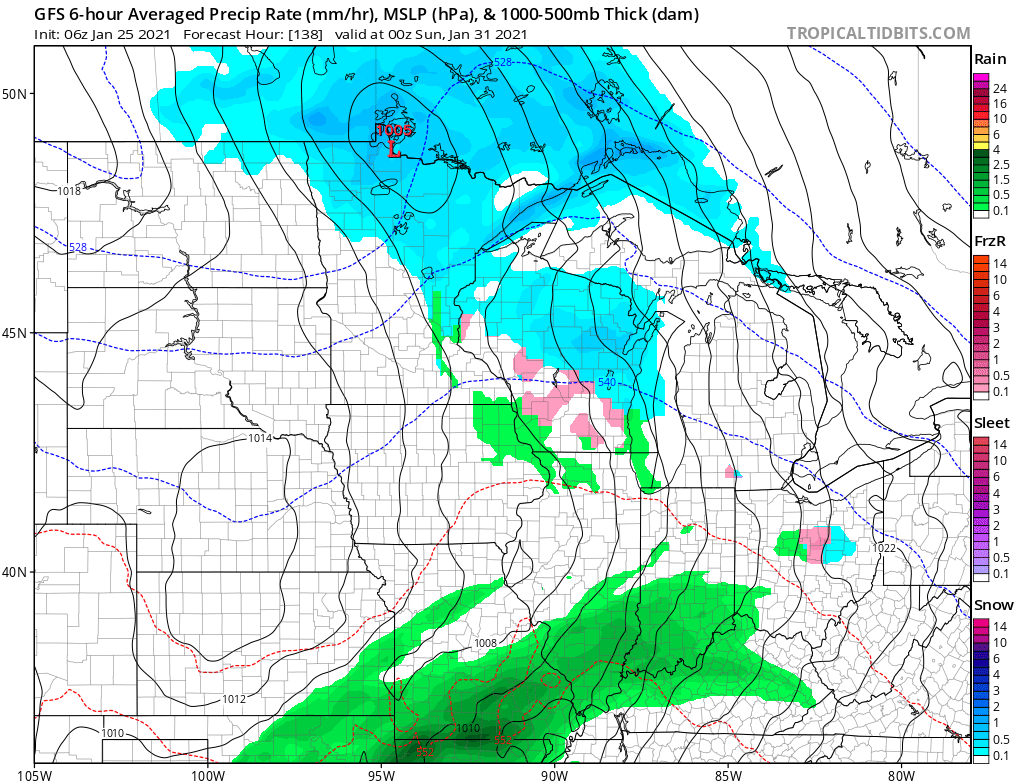
Currently, the moisture with that storm does not look significant. However, with part of the state above freezing by Saturday, there may be a mix of wintry precipitation to cause travel concerns. We will keep you updated on that system as the weekend approaches!
Programming note
You can hear my live weather updates on Minnesota Public Radio at 7:48 a.m. Monday through Friday morning.

