
Icy conditions expected with weekend storm
Temperatures stay above average for the next week
Go Deeper.
Create an account or log in to save stories.
Like this?
Thanks for liking this story! We have added it to a list of your favorite stories.


A weekend storm is poised to bring a light but icy mix of freezing rain and snow. Meanwhile temperatures remain much milder, with highs in the 20s and 30s.
Friday’s forecast
Under widespread cloud cover and a milder wind flow from the southeast, all of Minnesota started warmer Friday than recent mornings. There were a few negative temperatures along the northern border, but central and southern Minnesota saw morning lows in the teens.
Daytime highs will also trend warmer, with the entire state back at or above above average and in the 20s.
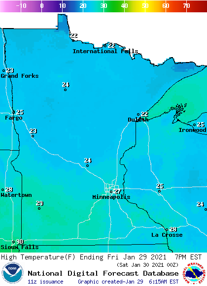
Cloudy skies linger through the day, with enough instability for occasional isolated flurries or a little freezing drizzle. Although the freezing precipitation has been minimal, it has created a few slick roads Friday morning, so drive with care.
Weekend storm
A storm sliding south of Minnesota over the weekend will already start moving more precipitation into the state Friday night.
Turn Up Your Support
MPR News helps you turn down the noise and build shared understanding. Turn up your support for this public resource and keep trusted journalism accessible to all.
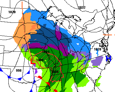
Because of the warmer air moving in over the recent colder weather and colder ground, the initial precipitation with the storm is expected to be light freezing rain and drizzle. Almost all of Minnesota has a chance for freezing precipitation, except the very northern edge of a state and the Arrowhead may see predominantly snow
The timing of the ice is from Friday night through Saturday morning, then the precipitation starts converting more snow Saturday afternoon.
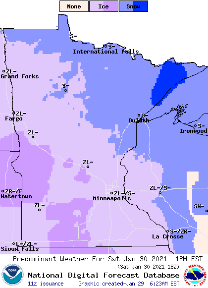
Ice accumulation should stay minimal, but it will be enough to cause slick spots on the roads.
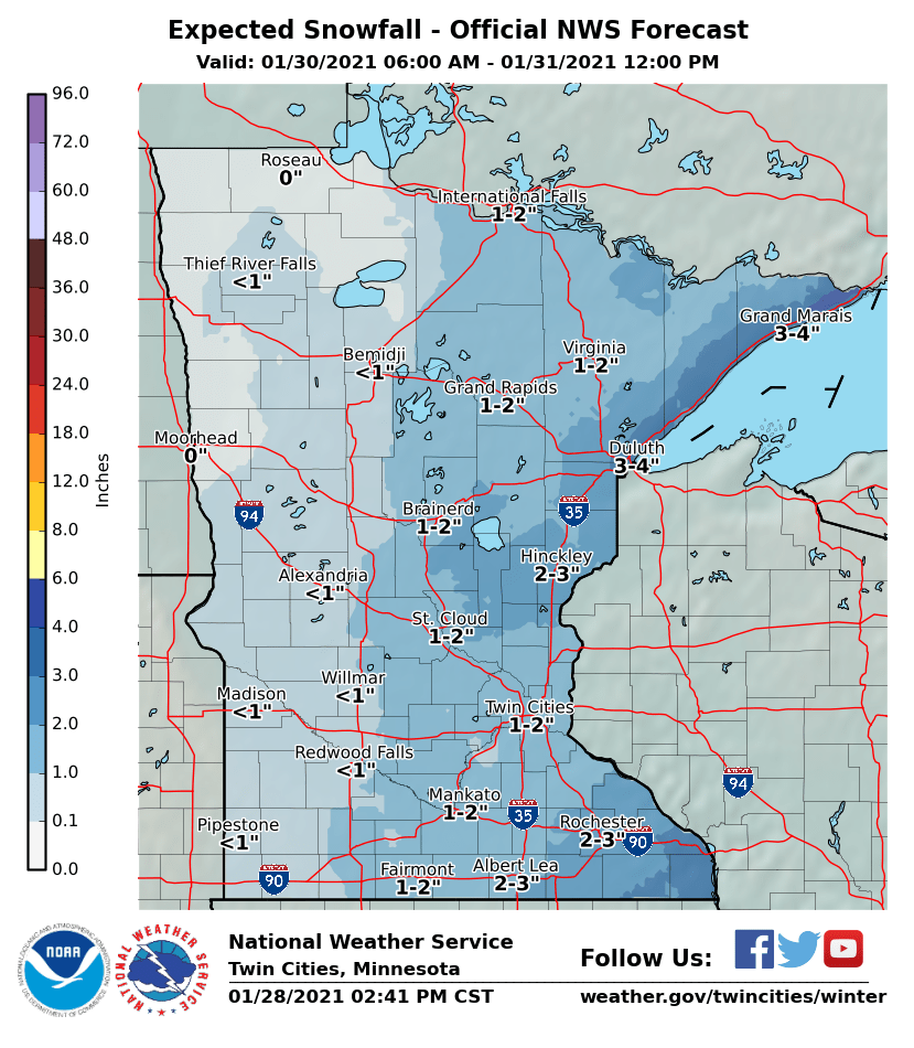
Light snow then continues through Saturday evening and moves out Sunday morning. Most of the state can expect under 2 inches, with slightly higher amounts possibly in southeastern Minnesota and along the North Shore.
Staying milder
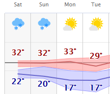
Temperatures stay milder not just through the weekend, but most of next week. By Saturday, a few more temperatures in the low 30s are likely. Most of next week, highs make it at least into the 20s, with occasional 30s, especially for southern Minnesota.
Here is that forecast for the Twin Cities:
However, a potential late week snowstorm looks poised to bring colder air back at the end of next week.
We’ll keep you updated as that storm approaches!
Programming note
You can hear my live weather updates on Minnesota Public Radio at 7:48 a.m. Monday through Friday morning.

