
Areas of freezing drizzle, then some snow
Advisories for much of Minnesota through Saturday night
Go Deeper.
Create an account or log in to save stories.
Like this?
Thanks for liking this story! We have added it to a list of your favorite stories.


A low pressure system passing to our south will spin moisture over Minnesota and Wisconsin today and tonight. The temperature profile of the atmosphere will allow periods of drizzle this Saturday, which will freeze on contact with any untreated roads and sidewalks. You can expect icy spots today, Some locations in the southern half of Minnesota could see one-tenth of an inch or so of ice. Precipitation could be mixed with a bit of snow this morning and early afternoon, then it transitions to all snow and continues overnight and into Sunday morning. The snow may linger into Sunday afternoon in northeastern Minnesota and western Wisconsin.
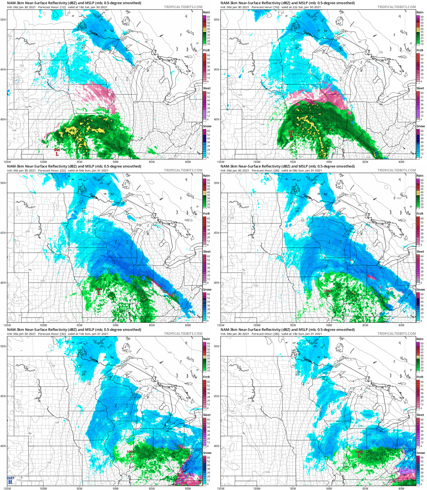
The National Oceanic and Atmospheric Administration’s North American Mesoscale (NAM) forecast model shows the potential precipitation pattern from noon Saturday through noon Sunday:
Advisories and snow amounts this weekend
Winter weather advisories cover most of Minnesota and parts of Wisconsin today and tonight.
Turn Up Your Support
MPR News helps you turn down the noise and build shared understanding. Turn up your support for this public resource and keep trusted journalism accessible to all.
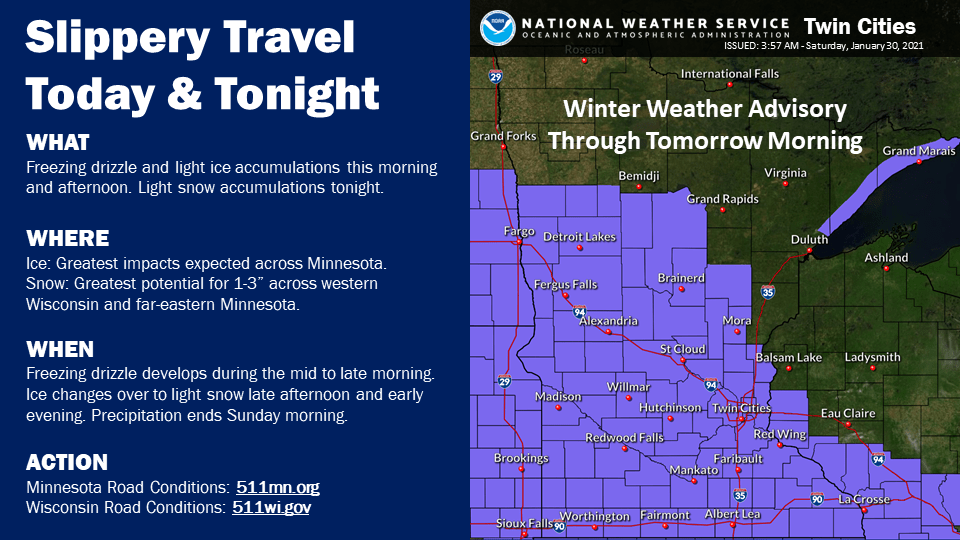
The winter weather advisory runs from Saturday through Saturday night in the Twin Cities metro area, ending at 6 a.m. Sunday. The advisory ends at 6 p.m. Saturday in west-central Minnesota and at midnight in southwestern Minnesota.
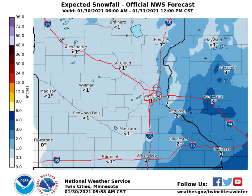
Weekend snow amounts will be around one inch in the metro area, but higher to the southeast:
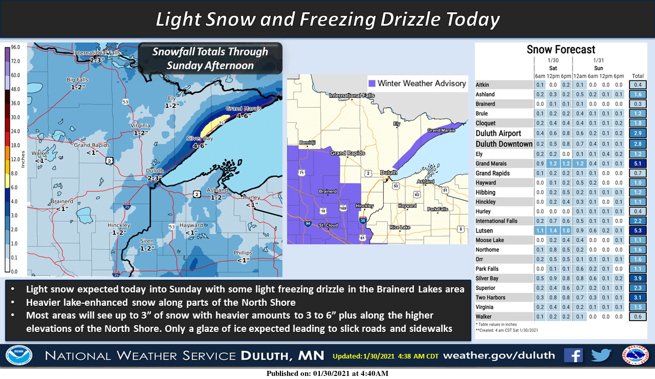
Areas along the North Shore could see several inches of snow:
You can hear updated weather information for Minnesota and western Wisconsin on the MPR network, and you’ll see updated weather info on the MPR News live weather blog.
Minnesota road conditions can be found here. Wisconsin road conditions can be found here.
Temperature trends
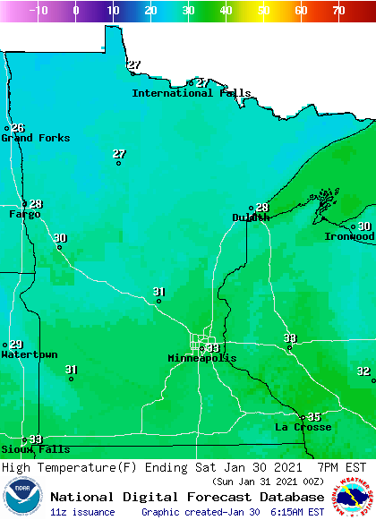
Our average Twin Cities high temperature is 25 degrees on Jan. 30. Metro area highs will probably creep into the lower 30s this Saturday. Southern and central Minnesota and much of western Wisconsin will also reach the lower 30s, with mainly 20s elsewhere:
Saturday will be breezy, with wind gusts in the 16-22 mph range in most areas.
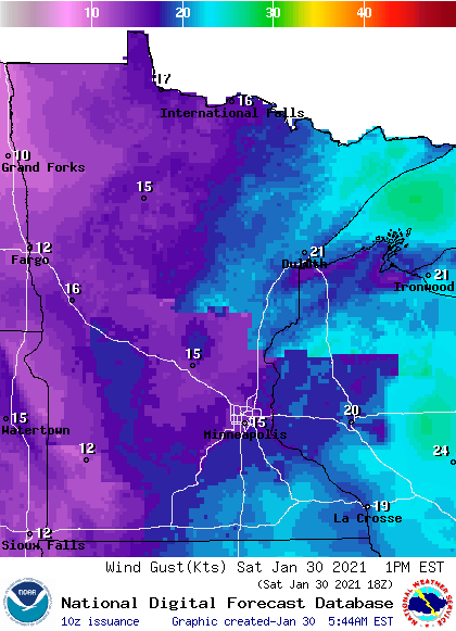
Plotted gusts are in knots, with 15 knots equal to 17.3 mph
This Updraft blog will be updated around 10:15 a.m. with info on our Sunday weather plus a look at the week ahead.
Programming note
You can hear my live weather updates on MPR News at 7:35 a.m., 9:35 a.m. and 4:39 p.m. each Saturday and Sunday.

