
Some flakes at times this afternoon; mild temps linger
Sharply colder temps on Friday
Go Deeper.
Create an account or log in to save stories.
Like this?
Thanks for liking this story! We have added it to a list of your favorite stories.


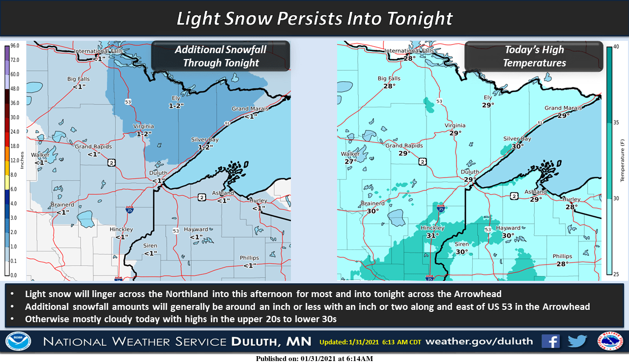
A low-pressure system is moving slowly away this afternoon, but moisture on the back side of the low will bring periods of light snow to parts of eastern Minnesota and western Wisconsin. Some locations will only see occasional flurries.
Here’s the NWS snow outlook for northeastern Minnesota and northwestern Wisconsin:
The Twin Cities metro area will see some patchy light snow at times into early Sunday afternoon, followed by a chance of flurries later this afternoon and this evening.
Snow reports from northeastern Minnesota can be found here. This is how the weekend snow map looked at mid-morning this Sunday:
Turn Up Your Support
MPR News helps you turn down the noise and build shared understanding. Turn up your support for this public resource and keep trusted journalism accessible to all.
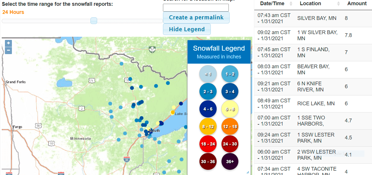
Of note are the 8-inch snow report from Silver Bay and the 7-inch report from Finland, Minnesota. Southeastern Minnesota snow reports can be be viewed here. You can slide the southeastern Minnesota snow plot to see some impressive snow totals in southeastern Wisconsin and northeastern Illinois, including a few 8-to-11 inch totals.
You can hear updated weather information for Minnesota and western Wisconsin on the MPR network, and you’ll see updated weather info on the MPR News live weather blog.
Minnesota road conditions can be found here. Wisconsin road conditions can be found here.
Temperature trends
Sunday afternoon highs will be in the lower 30s across much of southern and central Minnesota and western Wisconsin. Much of northern Minnesota will see highs in the 20s.
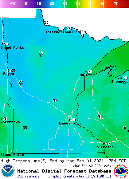
Our average Twin Cities high temperature is 25 degrees on Feb 1. Metro area highs will be around 30 on Monday. Much of Minnesota will have Monday highs in the 20s, with lower 30s expected across southeastern Minnesota and western Wisconsin:
Monday wind gusts will be mainly under 10 mph:
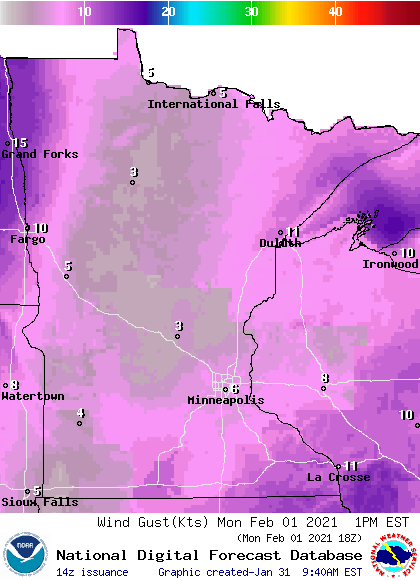
Gusts will be a bit higher in far northeastern and far northwestern Minnesota.
Plotted wind gusts are in knots, with 6 knots equal to about 7 mph.
Back to temperatures, metro-area highs are projected to be around 30 degrees on Tuesday, followed by mid 30s Wednesday and upper 20s on Thursday. We may see falling temps by Thursday afternoon. Our Friday high may only reach the mid-to-upper teens.
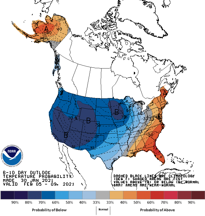
Colder-than-normal temps are expected next weekend, possibly topping out in the lower teens. The cold air may linger into the beginning of the following week. The NWS Climate Prediction Center shows a strong tendency for below-normal temps in Minnesota and Wisconsin from Feb. 5 to Feb 9:
Thursday snow?
NOAA’s Global Forecast System (GFS) model shows some snow spreading across Minnesota and Wisconsin Wednesday night into Thursday:
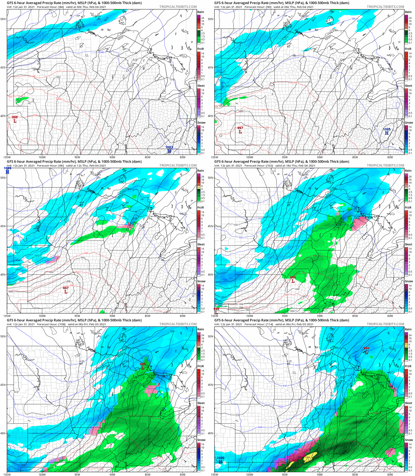
There may be some rain or a rain/snow mix in southern Minnesota when the precipitation begins. Check forecast updates over the next few days.
Programming note
You can hear my live weather updates on MPR News at 7:35 a.m., 9:35 a.m. and 4:39 p.m. each Saturday and Sunday.

