
A wintry mix targets Minnesota Thursday, then brutal cold
Tuesday and Wednesday remain mild and mostly cloudy

Go Deeper.
Create an account or log in to save stories.
Like this?
Thanks for liking this story! We have added it to a list of your favorite stories.


Temperatures stay above average through Wednesday, then a strong winter storm brings rain, snow, and ice, followed by what may be Minnesota’s coldest weather all winter.
Tuesday and Wednesday
Minnesota was off to another mild start for this time of year Tuesday, with most of the state seeing morning lows in the teens.
Under stagnant high pressure and light winds, widespread fog developed overnight, especially across central and southern Minnesota.
The thickest morning fog has been in the southwestern corner of the state, with many visibilities still under a mile as of 9 a.m. Tuesday morning, so drive with care.
Turn Up Your Support
MPR News helps you turn down the noise and build shared understanding. Turn up your support for this public resource and keep trusted journalism accessible to all.
Fog lifts through the morning, but the rest of the day remains mostly cloudy, with only a few peaks of sunshine likely. Despite the cloud cover, winds from the south help the entire state warm into the mid and upper 20s for highs Tuesday.
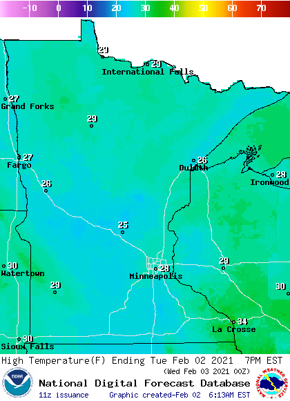
Wednesday starts off similarly, with morning lows in the teens and low 20s, and a few areas of fog expected. It also stays mostly cloudy through the day, but the one noticeable difference is even warmer highs, with most of the state in the 30s.
Rain and snow return
A wintry mix starts to spread across the state by Wednesday evening and then overnight, due to a storm tracking south of Minnesota.
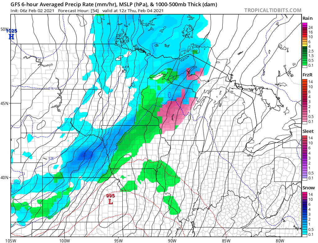
Coming off of the warm weather Wednesday, it will be mild enough for a mix of light rain, freezing rain, and snow overnight Wednesday.
The storm brings much colder air with it, causing temperatures to fall on Thursday. As the cold takes hold, the mixed precipitation should change predominantly to snow by Thursday morning and stay snow the rest of Thursday before winding down Thursday evening.
Because the storm is south of the state, Minnesota is not forecast to get the heaviest snow. That is more likely in Iowa and parts of Wisconsin. Much of Minnesota will see less than 2 inches of snow, with some totals up to 4 inches along the eastern edge of the state.
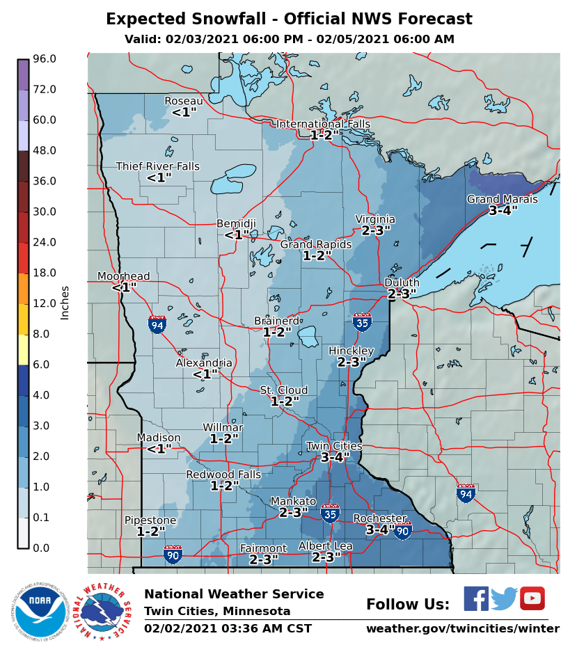
However, snow totals could be reduced from even that much depending on how much of the initial precipitation is rain versus snow.
The storm also brings high winds Thursday, with gusts over 20 and 30 mph and possibly higher. That means what little snow there is will be blowing and could reduce visibilities.
Arctic air
Behind the storm, colder air continues to advance across Minnesota through the weekend. High and lows continue to get colder each day through at least Sunday, at which point almost all of Minnesota is expected to have highs below zero.
Here is that plummeting temperature trend for the Twin Cities:
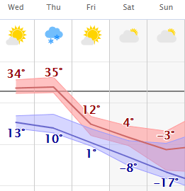
Overnight lows by Sunday and Monday morning will dip into the negative teens and 20s, which will feel like 20 to 40 below when the wind chill is factored in.

It will be a persistent cold snap, with the entirety of next week expected to stay well below average.
For most of Minnesota this will be the coldest weather so far this winter, and it may end up being the coldest stretch of the entire winter.
Programming note
You can hear my live weather updates on Minnesota Public Radio at 7:48 a.m. Monday through Friday morning.

