
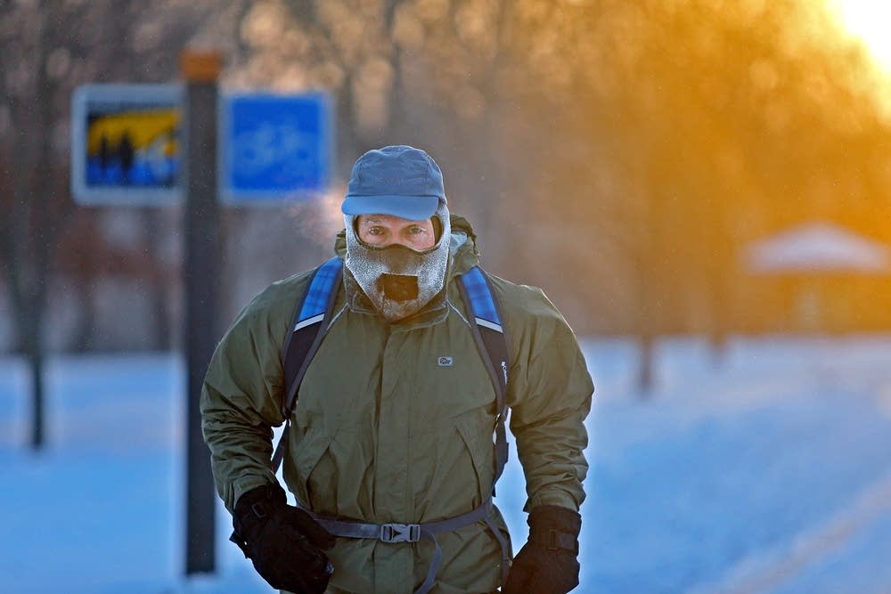
As snow moves out Thursday, the cold moves in
Gusty winds push wind chills below zero by afternoon
Go Deeper.
Create an account or log in to save stories.
Like this?
Thanks for liking this story! We have added it to a list of your favorite stories.


Areas of snow associated with a cold front move out quickly Thursday, but gusty winds remain and temperatures continue to fall through the day.
Snow, wind and cold Thursday
A potent cold front moved across Minnesota overnight, just finally clearing through the southeastern corner of the state Thursday morning.
As it passed, temperatures started plummeting, so there is a large temperature contrast as of 7 a.m. Northwestern Minnesota, where the front came in first, has already dropped into the teens, while the southeastern corner of the state, where colder air is just starting to hit, is in the 30s. By afternoon, temperatures drop even more, into the single digits and teens, although wind chills will put most of the state below zero.
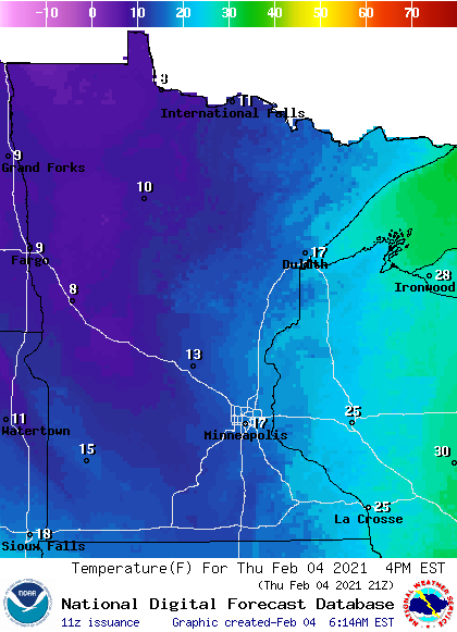
When the front initially moved in, temperatures were mild enough for areas of rain and freezing rain, so be aware that there are some slick roads Thursday morning.
Turn Up Your Support
MPR News helps you turn down the noise and build shared understanding. Turn up your support for this public resource and keep trusted journalism accessible to all.
As the cold front dropped temperatures, all the precipitation converted to snow, the main band of which has already exited the northwestern half of the state as of 7 a.m. (although there remain a few flurries and light snow areas behind the main band of snow).
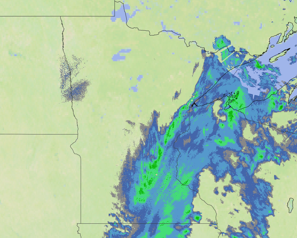
It will continue to clear through most of eastern Minnesota by late morning, with some snow lingering in the Arrowhead and southeastern Minnesota into the afternoon.
Most of eastern Minnesota can expect less than 2 additional inches of snow Thursday morning, with the edges of southeastern and northeastern Minnesota seeing a few additional totals of up to 3 or 4 inches.
Even after the snow ends, high winds over 30 mph, and possibly over 40 mph, continue through the afternoon and stay very gusty Friday, too.
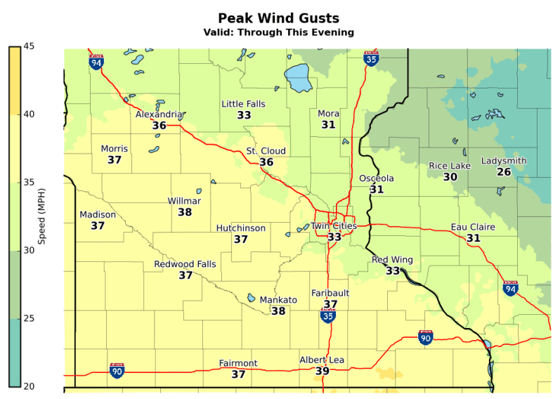
This will not only add to the aforementioned wind chill, but could cause areas of blowing snow through Thursday afternoon and evening.
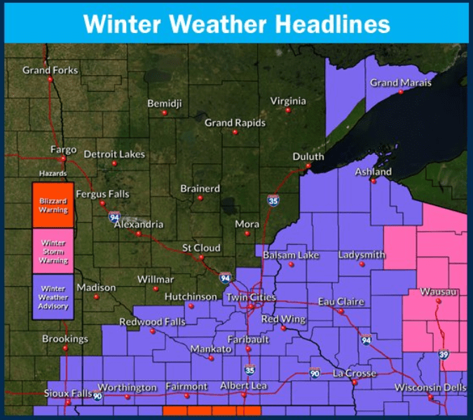
Because of the lingering snow, then the blowing snow potential, most of southern Minnesota and portions of the Arrowhead are under a winter weather advisory through Thursday night.
Behind the cold front, much colder air continues to funnel in, bringing subzero highs and dangerously cold wind chills by the weekend. That extended forecast will be updated around 9:30 a.m.
Programming note
You can hear my live weather updates on Minnesota Public Radio at 7:48 a.m. Monday through Friday morning.

