
Snow shifts eastward and temps plunge; arctic cold this weekend
Updated snow amounts
Go Deeper.
Create an account or log in to save stories.
Like this?
Thanks for liking this story! We have added it to a list of your favorite stories.


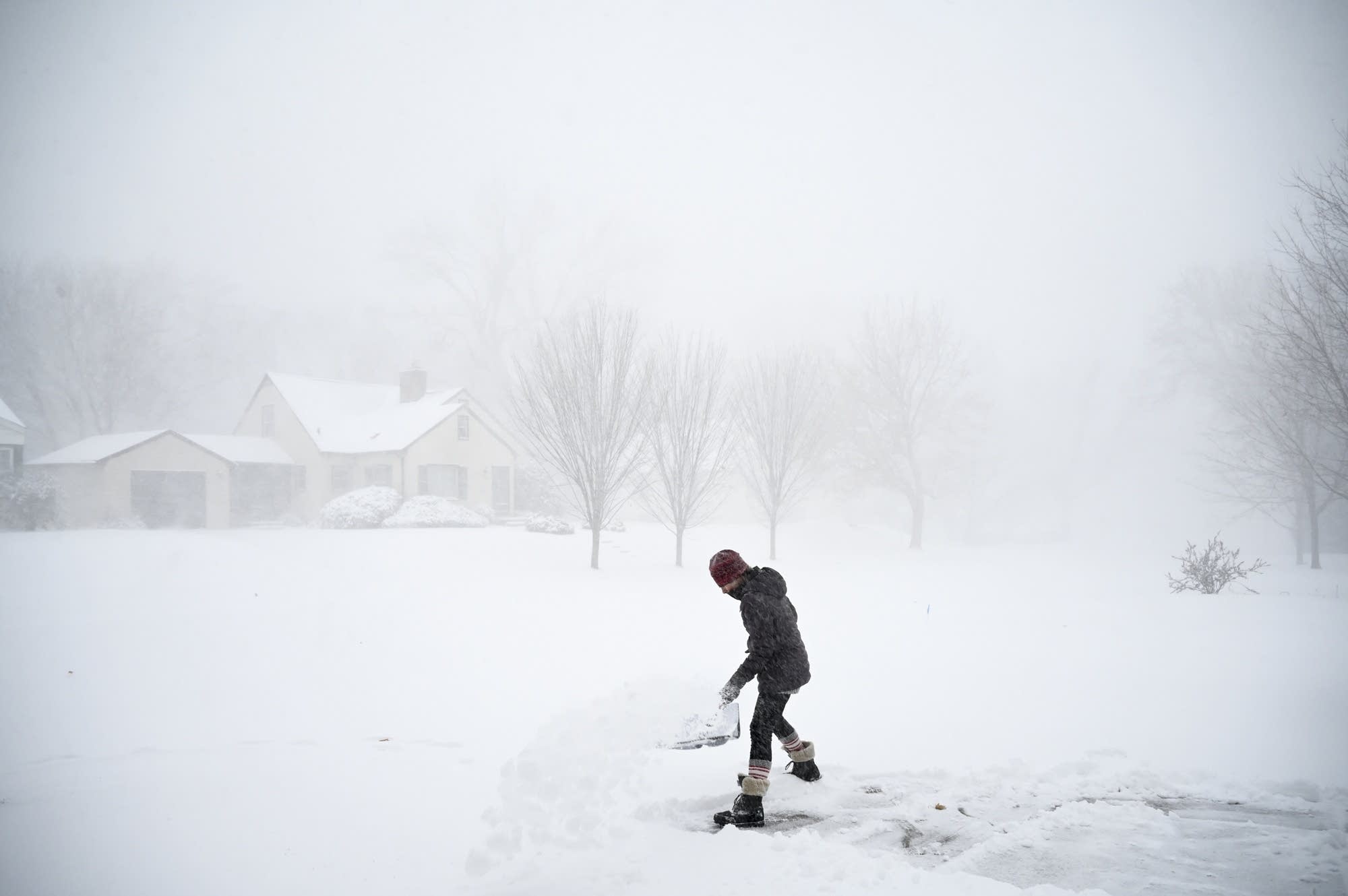
Accumulating snow had ended across most of the Twin Cities metro area by midday, but there could still be a stray afternoon flurry in the metro.
Snow is expected to continue into Thursday afternoon in southeastern Minnesota, northeastern Minnesota and western Wisconsin. The National Oceanic and Atmospheric Administration’s High Resolution Rapid-Refresh (HRRR) forecast model shows the potential precipitation pattern for Thursday afternoon and Thursday evening:

Snow will linger into Thursday night in parts of central and eastern Wisconsin.
A winter weather advisory continues until 3 p.m. this Thursday in counties just to the east and south of the metro area, as well as in south-central Minnesota. The advisory continues until midnight in southeastern Minnesota:
Turn Up Your Support
MPR News helps you turn down the noise and build shared understanding. Turn up your support for this public resource and keep trusted journalism accessible to all.
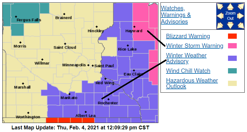
Here are details of the advisory in southeastern Minnesota:
URGENT - WINTER WEATHER MESSAGE National Weather Service La Crosse WI 1058 AM CST Thu Feb 4 2021 ...Several Bands of Snow Moving through the Area... .At 11 am, radar indicated several snow bands moving across northeast Iowa, southeast Minnesota, and western Wisconsin. Snow- covered roads have been reported across the entire region. Through 1 PM, expect up to 2 inches of additional snow west of the Mississippi River and 2 to 3 inches of additional snow across western Wisconsin. Snow totals will range from 3 to 7 inches by this evening. The highest snow totals will north of Interstate 94. Winds will begin to increase this afternoon with gusts of 25 to 35 mph causing blowing and drifting snow. By late afternoon and during the evening, some areas could see pockets of whiteout conditions in Iowa and Minnesota. The snow will diminish across central and north-central Wisconsin this evening but the higher winds will persist through midnight before diminishing. Travel could become dangerous in some areas later today into the overnight. IAZ008>010-018-019-029-030-MNZ086-087-094-095-WIZ061-050100- /O.CON.KARX.WW.Y.0006.000000T0000Z-210205T0600Z/ Mitchell-Howard-Winneshiek-Floyd-Chickasaw-Fayette-Clayton-Dodge- Olmsted-Mower-Fillmore-Grant- Including the cities of Osage, Cresco, Decorah, Charles City, New Hampton, Oelwein, Elkader, Dodge Center, Rochester, Austin, Preston, and Platteville 1058 AM CST Thu Feb 4 2021 ...WINTER WEATHER ADVISORY REMAINS IN EFFECT UNTIL MIDNIGHT CST TONIGHT... * WHAT...Mixed precipitation becoming all snow. Snow accumulations of 2 to 4 inches and ice accumulations of a light glaze. Winds gusting as high as 35 mph. * WHERE...Portions of southwest Wisconsin, north central and northeast Iowa and southeast Minnesota. * WHEN...Until midnight CST tonight. * IMPACTS...Plan on slippery road conditions. Patchy blowing snow could significantly reduce visibility. The hazardous conditions could impact the morning or evening commute. PRECAUTIONARY/PREPAREDNESS ACTIONS... Slow down and use caution while traveling. The latest road conditions for the state you are calling from can be obtained by calling 5 1 1.
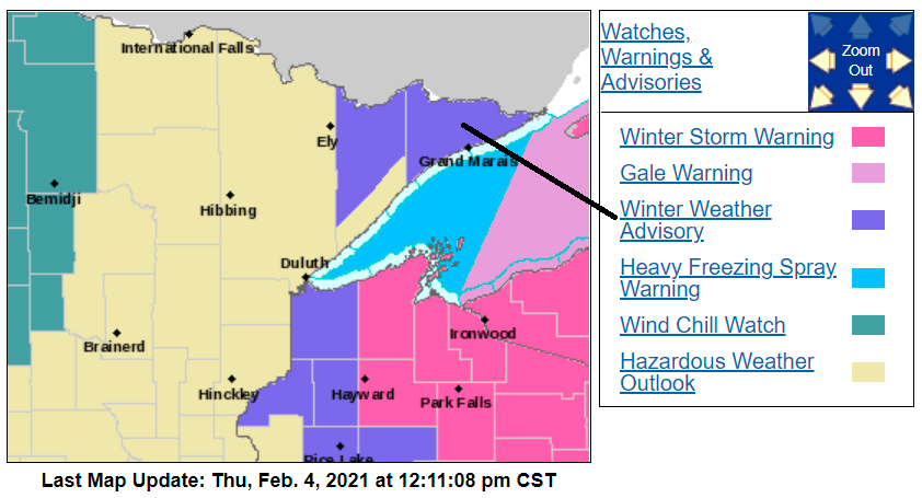
Hayward, Wis. and Park Falls, Wis. are in a winter storm warning until 6 a.m. Friday.
Parts of northeastern Minnesota will remain in a winter weather advisory until 6 a.m. Friday:
You can hear updated weather information for Minnesota and western Wisconsin on the MPR network, and you’ll see updated weather info on the MPR News live weather blog.
Minnesota road conditions can be found here. Wisconsin road conditions can be found here.
Snow reports
Some Minnesota locations from Redwood Falls to Hutchinson to Buffalo have reported 5 inches or more of snow today. I’ve seen mainly 2 inch to 3 inch totals across much of the seven-county Twin Cities metro area, but final totals could be delayed a few hours.
Snow reports can be found here. This is how the Thursday snowfall map looked at 11 a.m.:

You can hover over any snow report at the linked NWS site to see the exact location of the snow report plus the time of measurement. Some snow reports are from early this morning, so they don’t include the additional snow that fell later in the morning.
Snow reports for northeastern Minnesota can be found here.
Temperature trends
Much colder air will spreading across Minnesota and western Wisconsin this afternoon and evening. Overnight lows will drop below zero in northern Minnesota, with single-digits lows in central and southern Minnesota.
Friday highs will be in the single digits in northern and central Minnesota, with some lower teens in the far south:
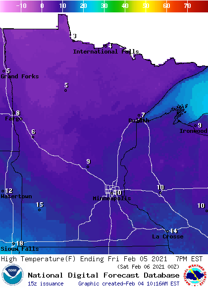
On Friday, the Twin Cities metro area is likely to see its coldest afternoon temps since Dec. 24.
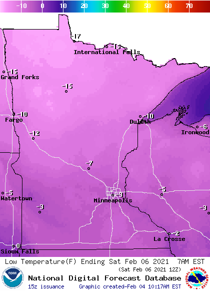
Low temps late Friday night and early Saturday Saturday morning will approach 20 below in far northern Minnesota, with single-digits below zero in the south:
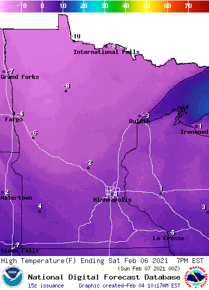
Saturday highs will be below zero across much of Minnesota, with highs creeping slighly above zero in parts of the far south:
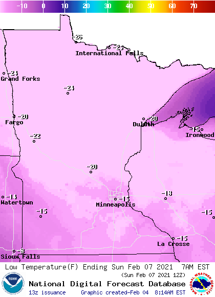
Sunday morning lows will be in the 20s below zero across northern and central Minnesota, with teens below zero in the south:
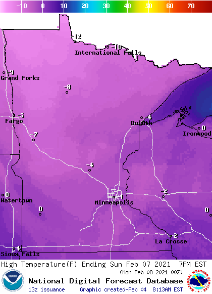
Sunday highs may stay below zero in most areas, creeping slightly above zero in the far southeast:
Dangerously cold wind chill temps are expected this weekend; in the 20s below zero to near 30 below zero range in the Twin Cities metro area and colder to the north:
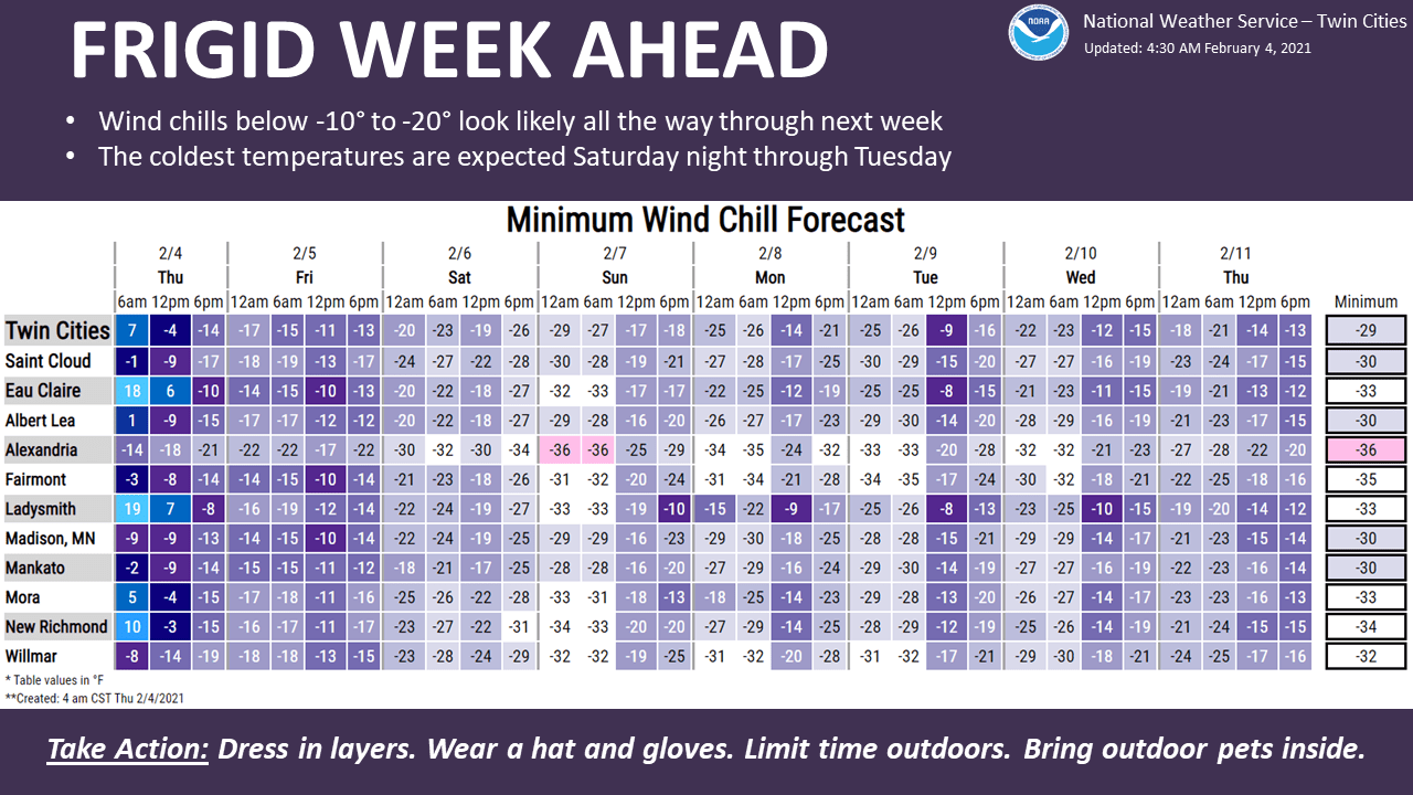
You’ll want to bring along warm clothes and a charged cell phone if you have weekend travel plans.

