
Arctic cold this Monday; dangerous wind chills up north
Wind chill warnings northern Minnesota
Go Deeper.
Create an account or log in to save stories.
Like this?
Thanks for liking this story! We have added it to a list of your favorite stories.


I’ll start out by saying that there are slick spots on some roads Monday morning, although we only had a dusting of snow Sunday night.
We’re starting out the morning with temps ranging from 30s below zero in parts of far northern Minnesota to single digits below zero in the far southeast.
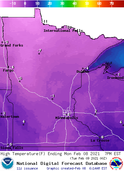
Highs stay below zero in the north, but creep slightly above zero in the south:
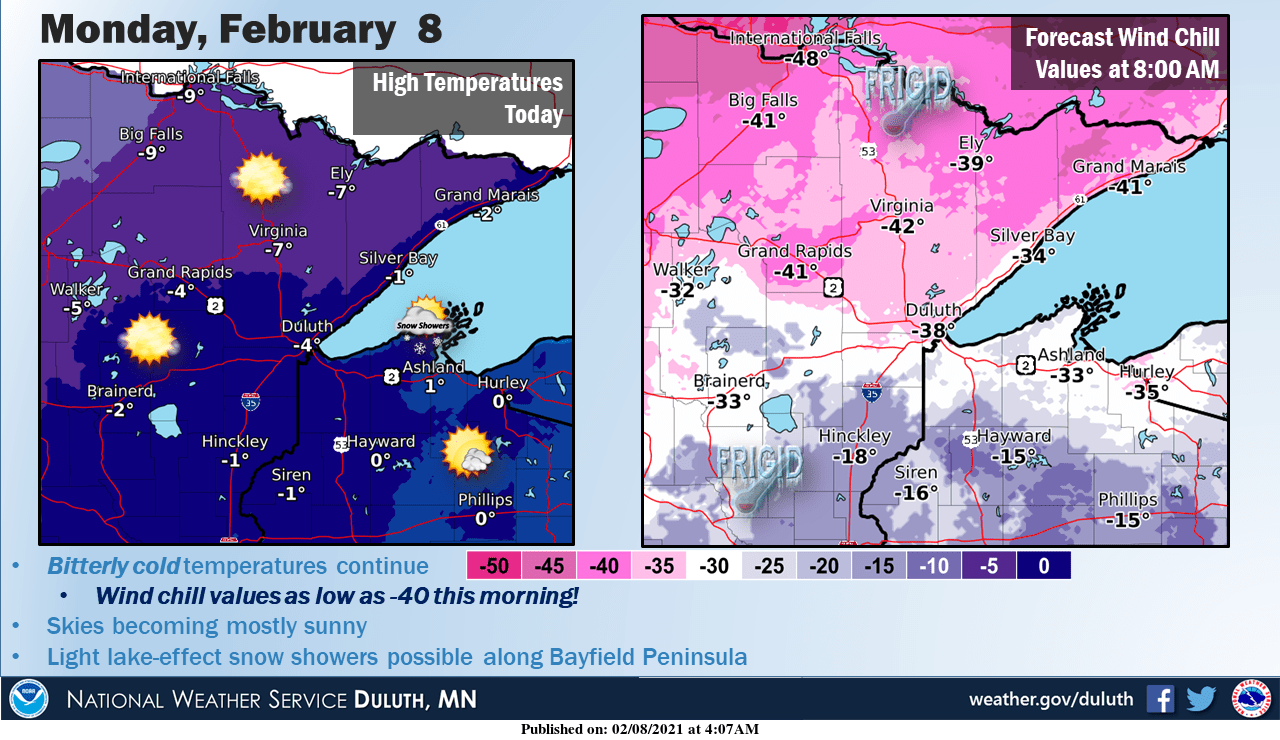
Wind chills in the 30s and 40s below zero are expected in the far north:
Turn Up Your Support
MPR News helps you turn down the noise and build shared understanding. Turn up your support for this public resource and keep trusted journalism accessible to all.
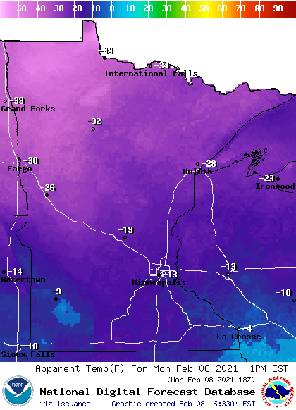
Wind chills ease slightly Monday afternoon:
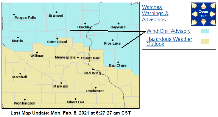
Wind chill warnings and advisories
Wind chill warnings (shaded darker blue) continue through Tuesday morning for roughly the northern third of Minnesota:


Here are details of the wind chill warnings in northeastern Minnesota:
URGENT - WINTER WEATHER MESSAGE National Weather Service Duluth MN 339 AM CST Mon Feb 8 2021 ...PROLONGED PERIOD OF BITTERLY COLD TEMPERATURES AND WIND CHILLS... MNZ010>012-018>021-026-082145- /O.CON.KDLH.WC.W.0001.000000T0000Z-210209T1800Z/ Koochiching-North St. Louis-Northern Cook and Lake-North Itasca- Central St. Louis-Southern Lake-Southern Cook-South Itasca- Including the cities of International Falls, Ely, Isabella, Bigfork, Hibbing, Two Harbors, Silver Bay, Grand Marais, and Grand Rapids 339 AM CST Mon Feb 8 2021 ...WIND CHILL WARNING REMAINS IN EFFECT UNTIL NOON CST TUESDAY... * WHAT...Dangerously cold wind chills. Wind chills as low as 45 below zero. * WHERE...Northern Cook and Lake, South Itasca, Koochiching, Southern Cook, Southern Lake, North St. Louis, North Itasca and Central St. Louis Counties. This includes the Tribal Lands of the Grand Portage Reservation and the Bois Forte Band, Deer Creek, Nett Lake and, Lake Vermillion areas. * WHEN...Until noon CST Tuesday. * IMPACTS...The dangerously cold wind chills could cause frostbite on exposed skin in as little as 10 minutes. PRECAUTIONARY/PREPAREDNESS ACTIONS... Avoid outside activities if possible. When outside, make sure you wear appropriate clothing, a hat, and gloves.
Counties just to the north of the metro area and over toward Eau Claire, Wis., are in the wind chill advisory until 10 a.m. Monday, but the advisory continues until noon Tuesday in places like Morris, St. Cloud, Brainerd and Fergus Falls:
Southeastern Minnesota could see some light snow showers Monday morning.
This Updraft blog will be updated around 9:30 a.m. with a look at the week ahead.

