
Not quite as cold Tuesday
A few more places finally make it above zero
Go Deeper.
Create an account or log in to save stories.
Like this?
Thanks for liking this story! We have added it to a list of your favorite stories.


Although still well below average, Tuesday brings one of the milder days relative to the cold this week, with some parts of central Minnesota making it above zero for the first time since last Thursday.
Tuesday’s forecast
There is a very light area of snow moving through south-central Minnesota, including the Twin Cities, Tuesday morning.
The snow should entirely clear the state by late morning, and leave only a dusting in most places, but it is enough to cause a few slick spots on the roads, so drive with care.
Otherwise, the state is off to another frigid start with all but a few spots in southwestern Minnesota below zero, and temperatures as low as minus 20 or chillier along the northern edge of the state.
Turn Up Your Support
MPR News helps you turn down the noise and build shared understanding. Turn up your support for this public resource and keep trusted journalism accessible to all.
Mostly sunny skies and a slight southwest wind flow make Tuesday the mildest day of the week for most of the state, with much of the southern half of the state making it above zero.
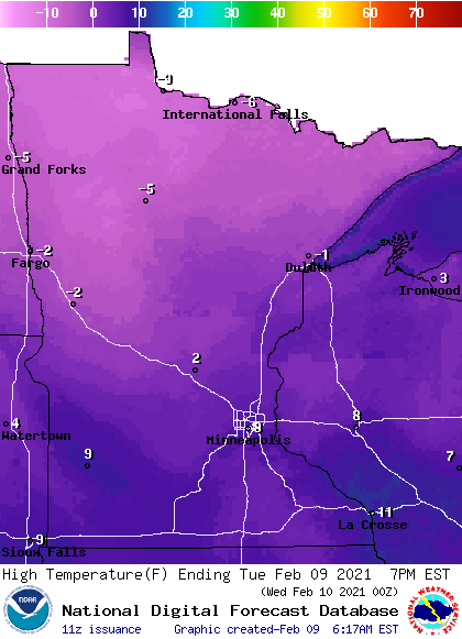
For St. Cloud, for example, this would be the first temperature above zero since Thursday (although St. Cloud did briefly make it to zero Monday).
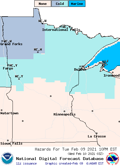
Wind chills stay 10 to 20 below much of the day, and 30 below or lower at times for the northern edge of the state, with the entire state under at least a wind chill advisory until 10 a.m. Most of northern Minnesota stays under advisories or warnings all day, and some extend out to Sunday, such as the wind chill warning in northwestern Minnesota.
The weather turns even colder again late week, with most of the state back below zero for highs.
That extended forecast will be updated around 9 a.m.
Programming note
You can hear my live weather updates on Minnesota Public Radio at 7:48 a.m. Monday through Friday morning.

