
Temperatures drop again by the weekend
As our climate changes, these cold winter stretches are becoming less frigid
Go Deeper.
Create an account or log in to save stories.
Like this?
Thanks for liking this story! We have added it to a list of your favorite stories.


Wednesday brings one more day of slightly milder temperatures before another extended period of below-zero weather return. While this is the chilliest stretch of the winter, it is significantly warmer than what our winters used to bring.
Warming winters
The cold stretch Minnesota is currently under is certainly significant, and especially with wind chills added in, it has brought dangerous cold.
However, it is been nowhere close to setting longer term records for things like extended stretches of time below zero.
In fact, you may have noticed if you have lived in Minnesota many years, the cold stretches are often not as extreme as they used to be.
Turn Up Your Support
MPR News helps you turn down the noise and build shared understanding. Turn up your support for this public resource and keep trusted journalism accessible to all.
Winters in Minnesota have warmed over recent decades, and that includes our coldest weather of the year trending less cold.
For example, around 1970, the lowest winter temperature for the Twin Cities averaged about minus 26. By 2020, it was averaging minus 14 (in 2021 so far the lowest temperature has been minus 16).

That puts the average lowest winter temperature over 12 degrees higher than 50 years ago!
Wednesday’s forecast
Although definitely not the coldest morning Minnesota has seen recently, the state started off frigid again, with morning lows ranging from the negative 20s north to a few single digits south.
Under mostly sunny skies, highs will be similar to Tuesday, with single digits for the southern half of the state and negative single digits north.
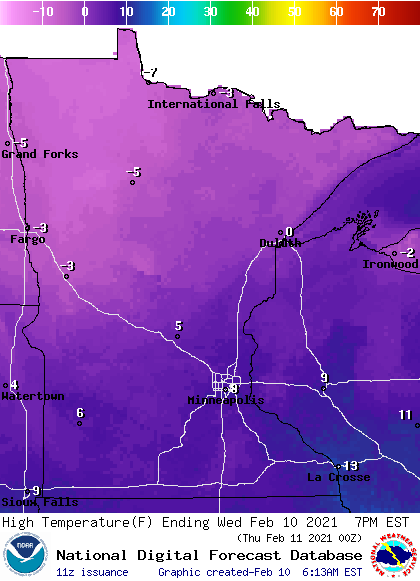
Despite this being 15 to 25 degrees below average, between Tuesday and Wednesday, the state is seeing the mildest weather of the week.
However, the wind chill is still dangerously cold, with northern Minnesota under a wind chill warning until 10 a.m. for “feels like” temperatures as low as minus 35, and the area has a wind chill advisory in effect through Sunday.
Another dangerously cold weekend
Already by Thursday, a disturbance that moves across Minnesota brings back winds from the north and starts to nudge temperatures down again.
That disturbance also brings some snow with it for southern Minnesota, but the air will be so cold it cannot hold much moisture, keeping snow totals to just a dusting for most places.
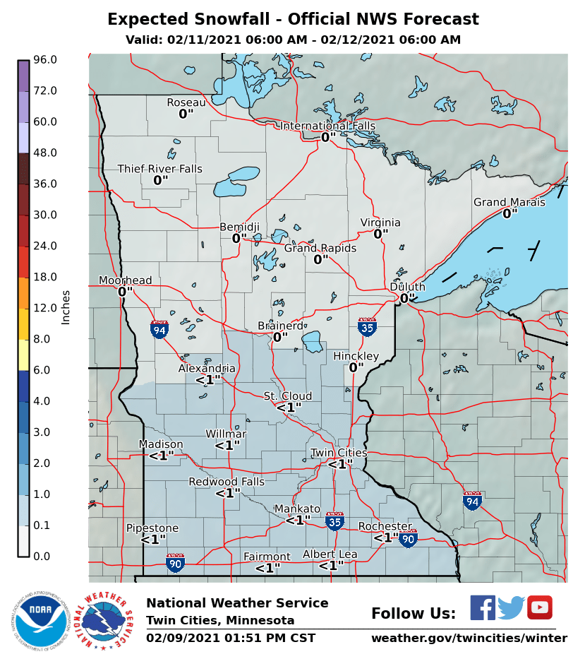
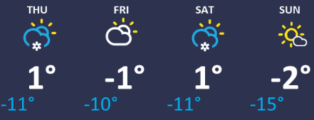
Temperatures continue to drop slightly Friday, putting most of Minnesota back below zero for highs and lows, and that more arctic air lingers through the weekend. Here is that forecast for the Twin Cities:
The wind continues to make the cold even more dangerous, with much of the region seeing wind chills of 20 to 40 below over the weekend, especially in the overnight and morning hours.
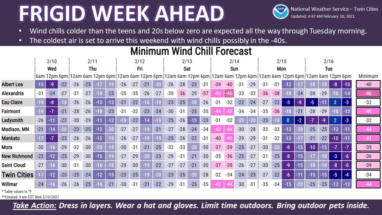
For northern Minnesota, wind chills could exceed 50 below at times, so stay safe if you need to be outdoors!
Programming note
You can hear my live weather updates on Minnesota Public Radio at 7:48 a.m. Monday through Friday morning.

