
Arctic chill through Tuesday a.m.; temps trend upward later this week
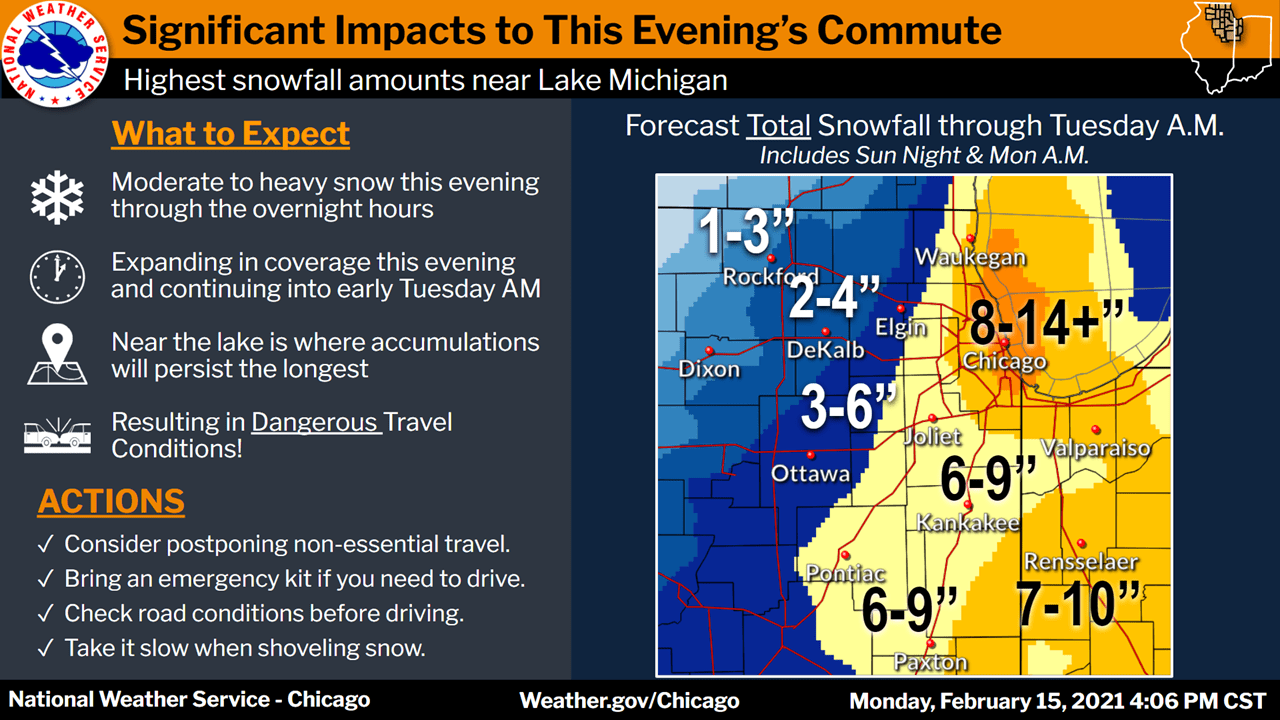
Chicago braces for heavy snow
Go Deeper.
Create an account or log in to save stories.
Like this?
Thanks for liking this story! We have added it to a list of your favorite stories.


It was great to see the temperature at Minneapolis-St. paul International Airport touch zero degrees Monday afternoon. It was our first official reading at the airport that wasn’t below zero since last Thursday! We aren’t even close to the record, which is 186 consecutive hours of zero or lower, according to the Minnesota State Climatology Office:
Since 1873, the temperature in the Twin Cities has remained at or below zero for at least four consecutive days a total of 27 times, with the most recent occurrence being a five-day stretch ending January 18th, 1994. The longest such streak on record was seven days, from January 1-7, 1912.
The same stretch in 1912 clocked in at 186 consecutive hourly observations with temperatures at or below zero. The stretch in 1994 lasted 142 hours. More recent zero-or-colder stretches include 86 hours from 11pm January 12 to 1pm January 16, 2009 and 93 hours from 5pm January 31, 1996 to 1pm February 4, 1996.
After mild temps for most of January and February, we’ve been racking up a lot of cold hourly readings this month:

Very cold overnight and Tuesday
Lows by Tuesday morning are expected to reach the 20s below zero for most of Minnesota and western Wisconsin, with some 30s below in far northern Minnesota. The Twin Cities airport might escape minus 20, but 20s below zero are expected in at least the outer suburbs.
Wind chill advisories (light blue) cover most of Minnesota and western Wisconsin Monday night and into Tuesday morning, for wind chills in the minus 25 to minus 35 range:
Turn Up Your Support
MPR News helps you turn down the noise and build shared understanding. Turn up your support for this public resource and keep trusted journalism accessible to all.
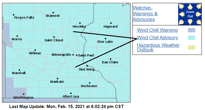
The wind chill advisory in the Twin Cities runs from 9 p.m. Monday to 9 a.m. Tuesday.
You can hear updated weather information for Minnesota and western Wisconsin on the MPR network, and you’ll see updated weather info on the MPR News live weather blog.
Winter storm hits Chicago
Chicago will be hit with heavy snow Monday night into Tuesday morning:
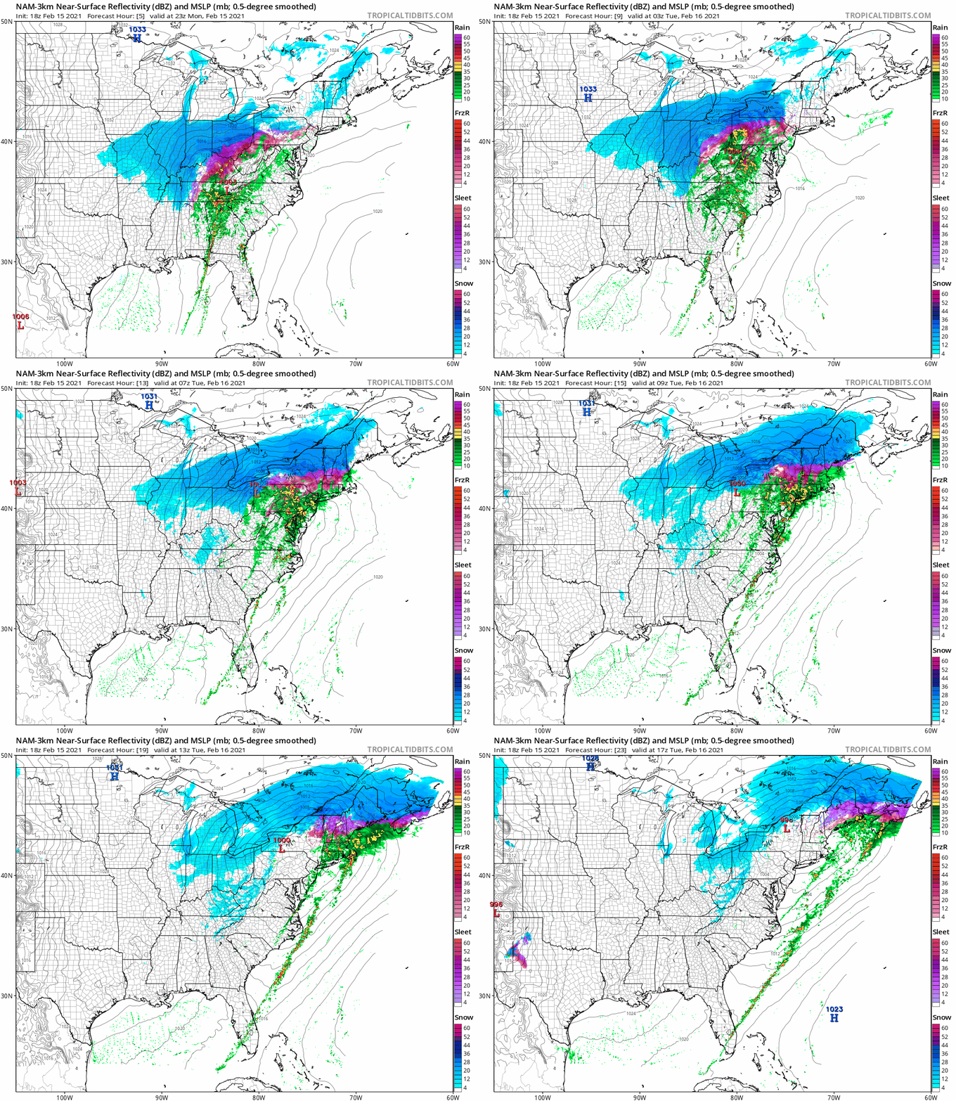
A low pressure system will bring snow to several states. The National Oceanic and Atmospheric Administration’s North American Mesoscale (NAM) forecast model shows the potential precipitation pattern for Monday evening through Tuesday morning:
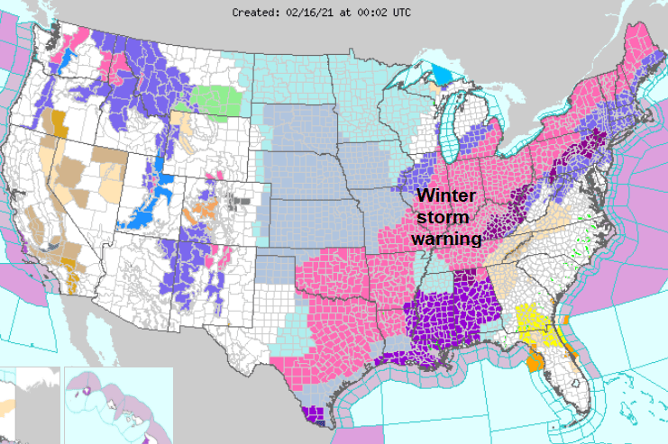
As of Monday evening, winter storm warnings covered a wide swath from Texas to New England:
Temperature trends
Temperatures advance slowly upward later this week into this weekend. Twin Cities metro area highs are projected to hit around 12 degrees on Wednesday, then 16 Thursday and around 20 on Friday. We could see highs in the lower 20s Saturday, then upper 20s on Sunday.
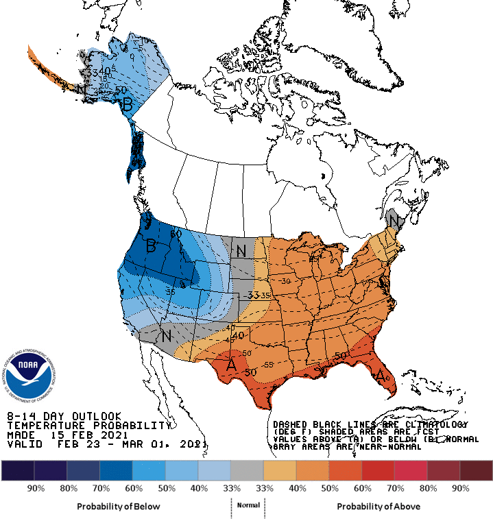
We might end the month with a stretch of relatively mild days. The National Weather Service Climate Prediction Center shows a tendency for above-normal temperatures in Minnesota and western Wisconsin from Feb. 23 through March 1:
Texas snow cover
Here’s something you don’t see very often — the result of the Sunday snowstorm that hit most of Texas:
Parts of Texas will see another snowstorm Tuesday night and Wednesday.
Programming note
You can hear my live weather updates on MPR News at 7:35 a.m., 9:35 a.m. and 4:39 p.m. each Saturday and Sunday.

