
From frigid to 40s by next week
Snow Wednesday will cause slick roads
Go Deeper.
Create an account or log in to save stories.
Like this?
Thanks for liking this story! We have added it to a list of your favorite stories.


Minnesota continues a slow warmup as we head toward the weekend. Meanwhile, slightly warmer air means increasing chances for snow accumulation.
Wednesday’s weather
The state started Wednesday with a large temperature contrast, ranging from near 30 below in northern Minnesota to temperatures near zero south. Part of this contrast was because clear skies and light winds allowed temperatures to drop more quickly north.
Because of the cold north, even light winds could put wind chills to minus 35 at times, so most of northern Minnesota is under a wind chill advisory Wednesday morning.
Even with the cold start, the entire state makes it above zero by the afternoon, with highs in the single digits to low teens.
Turn Up Your Support
MPR News helps you turn down the noise and build shared understanding. Turn up your support for this public resource and keep trusted journalism accessible to all.

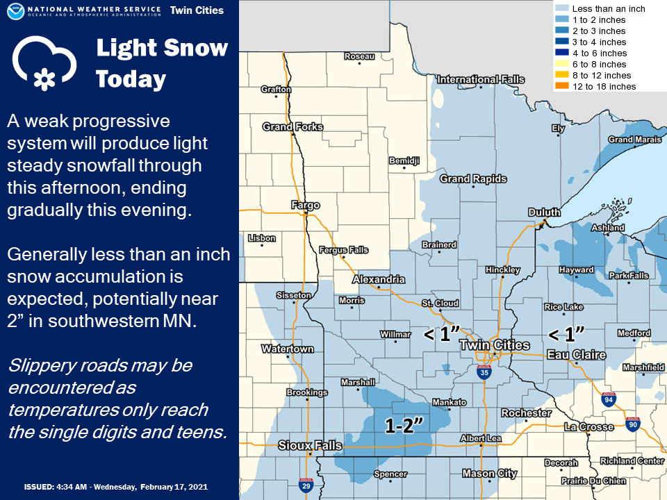
As of 9 a.m., a weak disturbance was already moving light snow across southern Minnesota, including the Twin Cities. That unsettled weather brings light snow chances to much of the state through the morning and into the afternoon.
Even though the snow remains light, with most places seeing under an inch, it will be enough to cause slick spots on the roads, so drive with care.
The warmup continues
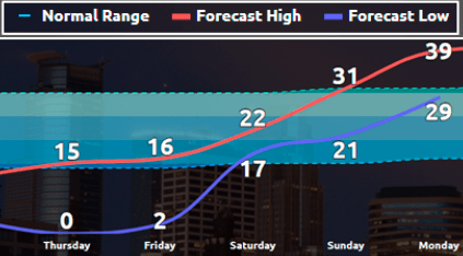
Temperatures continue to slowly warm the rest of the week, with most of Minnesota seeing highs in the 20s by Saturday.
Much of the state makes it into the 30s Sunday, which finally brings all of state back at or above average. For perspective, the average high for Feb. 17 is 30 in the Twin Cities and 23 in International Falls on the Canadian border.
The milder weather lasts with highs most of next week in the 30s and even a few 40s south.
Here is that forecast for the Twin Cities:
Warmer air can hold more moisture, so snow is possible a couple more times through the weekend.
Thursday holds another chance for a dusting across the state. Sunday, a storm sliding south of the state may bring a couple of inches, especially to southern Minnesota.
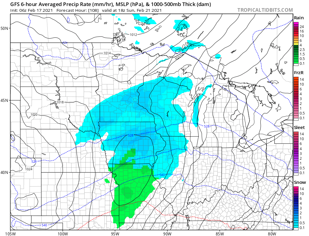
There is more uncertainty with the weekend system, so we will keep you updated as it approaches!
Programming note
You can hear my live weather updates on Minnesota Public Radio at 7:48 a.m. Monday through Friday morning.

