
Highs in the 40s by Monday
Light snow keeps roads slick Thursday
Go Deeper.
Create an account or log in to save stories.
Like this?
Thanks for liking this story! We have added it to a list of your favorite stories.


Minnesota has finally turned the corner on the dangerous cold, and temperatures shoot back above average by next week.
Thursday’s weather
Thursday morning temperatures were not quite as frigid as our recent weather, with single digits across much of the state.
North-central Minnesota had a few temperatures in the negative teens. However, this was noticeably milder than Wednesday morning’s lows, some of which were colder than 20 below zero near the northern border.
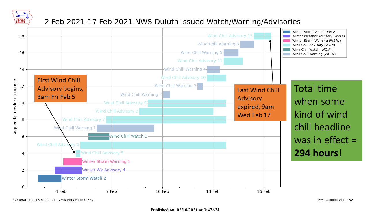
More significantly, the morning temperatures were finally mild enough that the state started Thursday with no wind chill warnings or advisories.
Turn Up Your Support
MPR News helps you turn down the noise and build shared understanding. Turn up your support for this public resource and keep trusted journalism accessible to all.
This is the first time in two weeks we have not had those wind chill concerns anywhere in Minnesota, ever since a strong storm Feb. 4 sent temperatures plummeting.
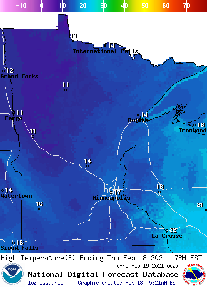
Highs will also be slightly warmer, with the majority of the state making it into the teens.
The weather stays unsettled enough for mostly cloudy skies and occasional flurries through the day, but most places will see no more than a dusting of snow.
The snow is causing slick spots on the roads though, so drive with care.
A thaw next week
Highs Friday also stay in the teens, but most of the state climbs into the 20s by Saturday. Widespread 30s Sunday put the entire state back at or above average. By Monday, a few spots in southern Minnesota have a good chance of hitting the low 40s.
Here is that forecast for the Twin Cities:
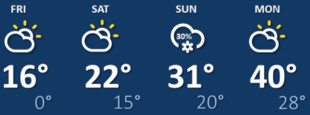
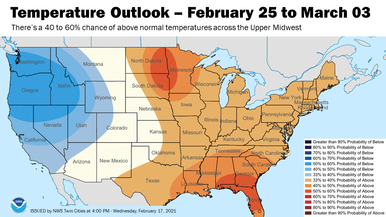
The warmer weather is here to stay, too. All of next week stays above average, with highs mostly in the 30s and those occasional 40s south. The extended outlook also shows above-average temperatures are probable through at least early March.
There is still a good chance for accumulating snow Sunday, thanks to a storm that will pass south of Minnesota.
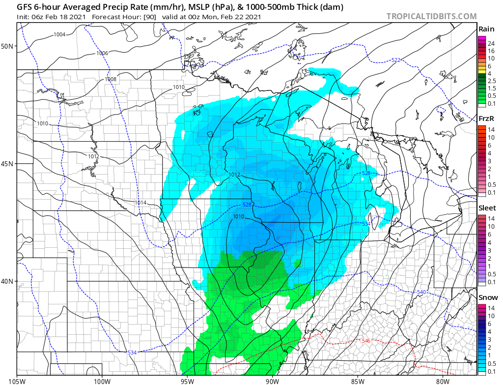
However, it currently looks like most of the state will see under 2 inches of snow. We will keep you updated through the weekend!
Programming note
You can hear my live weather updates on Minnesota Public Radio at 7:48 a.m. Monday through Friday morning.

