
Weekend forecast: 20s, then 30s; Sunday flakes
Highest snow totals south on Sunday
Go Deeper.
Create an account or log in to save stories.
Like this?
Thanks for liking this story! We have added it to a list of your favorite stories.


What does 30 degrees feel like? To some of us, it may seem like a distant memory; the official Twin Cities temperature hasn’t reached 30 degrees or warmer since Feb. 4!
Temperature trends
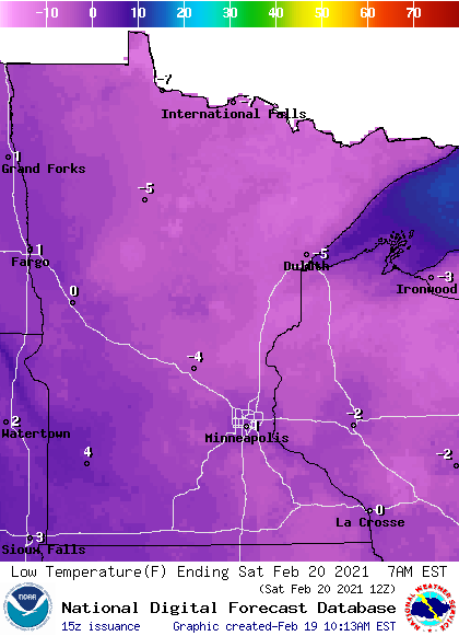
Low temps early Saturday morning will be in the single digits below zero in northern Minnesota and slightly above zero in the south:
Saturday highs reach the 20s in most areas:
Turn Up Your Support
MPR News helps you turn down the noise and build shared understanding. Turn up your support for this public resource and keep trusted journalism accessible to all.
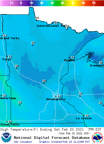
Twin Cities metro area highs are expected to reach the lower 20s this Saturday.
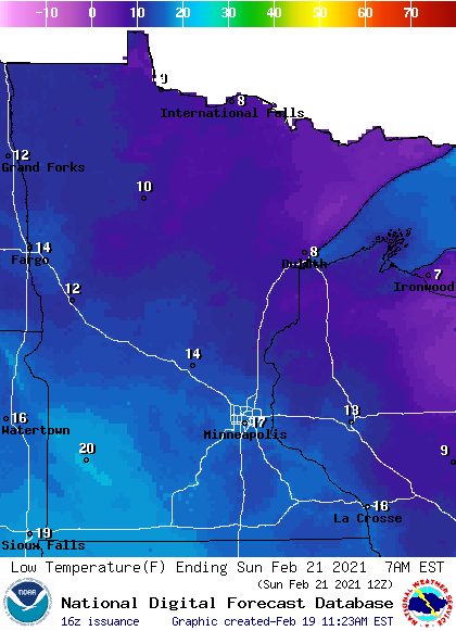
Low temps early Sunday morning will be in the teens in most areas, with some single digit lows in north-central and northeastern Minnesota:
Sunday highs reach the lower 30s in most locations, with 20s in northeastern Minnesota:
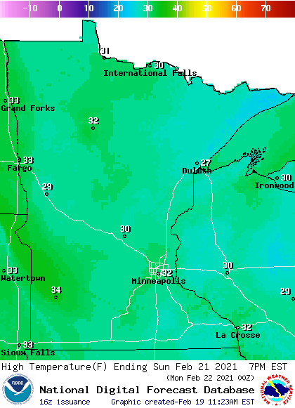
Our average Twin Cities high temperature is 31 degrees on Feb. 21, so we could actually see a slightly above-average high this Sunday. That hasn’t happened since Feb. 4!
Snow cover
With milder temps in the forecast, many Minnesotans will be spending more time outdoors this weekend. If sledding, cross-county skiing or snowmobiling are in your plans, you’ll be interested in Minnesota snow depths. Here’s the latest snow depth report:
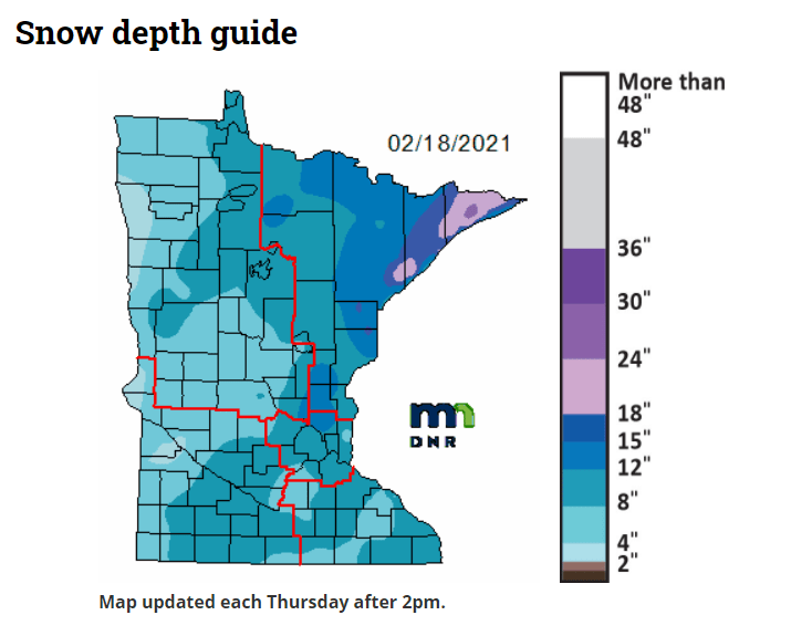
The official Twin Cities snow depth, measured at MSP airport, is 8 inches right now. Anoka county and Isanti County have 12 inches or more of snow cover and there’s also more than a foot of snow on the ground in northeastern Minnesota and parts of north-central Minnesota. The darkest blue in northeastern Minnesota indicates 15 or more inches of snow depth, with over 18 inches of snow on the ground in portions of Lake and Cook counties.
Sunday snow
Most of southern and central Minnesota and much of Wisconsin will see additional snow this Sunday.
The National Oceanic and Atmospheric Administration’s North American Mesoscale (NAM) forecast model shows the potential precipitation pattern for Sunday morning through Sunday evening:
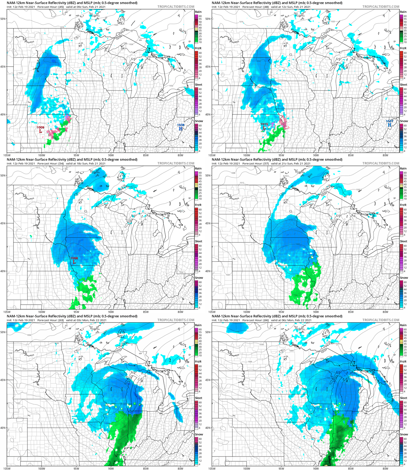
At this point, it looks like the Twin Cities metro area will see about an inch of snow Sunday/Sunday evening, with some two-inch or higher totals possible in far southern Minnesota. If the track of Sunday’s low pressure system changes, snow forecast will change…check forecast updates.
You can hear updated weather information for Minnesota and western Wisconsin on the MPR network, and you’ll see updated weather info on the MPR News live weather blog.
Programming note
You can hear my live weather updates on MPR News at 7:35 a.m., 9:35 a.m. and 4:39 p.m. each Saturday and Sunday.

