
From thunderstorms to heavy snow Wednesday
A major storm brings widespread impacts to Minnesota
Go Deeper.
Create an account or log in to save stories.
Like this?
Thanks for liking this story! We have added it to a list of your favorite stories.


Updated: 9:21 a.m.
A potent storm brings rain, thunderstorms, snow and high winds across Minnesota Wednesday.
Wednesday’s storm
A winter storm that will track across southern Minnesota during the day Wednesday is already bringing rain as of 8 a.m.
Although not as high as Tuesday morning, temperatures are still well above average Wednesday morning, ranging from upper 20s north to a few 50s southeast.
Highs make it above freezing for the entire state, with mid-30s north to 50s southeast.
Turn Up Your Support
MPR News helps you turn down the noise and build shared understanding. Turn up your support for this public resource and keep trusted journalism accessible to all.
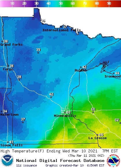
Those temperatures are important, because it impacts the type of precipitation different parts of Minnesota sees through the day.
For much of southern Minnesota, precipitation remains mostly rain, but a little non-accumulating snow could mix in late Wednesday as temperatures fall. However, with this being a strong storm, there will be a few thunderstorms in southern Minnesota, and where the warmer air stays in place southeast, a couple thunderstorms may turn severe during the afternoon or evening.
Many places will see rainfall varying from a quarter-inch to an inch of rain.
For central and northern Minnesota, temperatures fall more quickly late Wednesday afternoon and evening that the precipitation switches to snow by evening. From central Minnesota through the Arrowhead, there could be a wide swath that see 4 inches or more of snow, with portions of the Arrowhead getting over 6 inches.
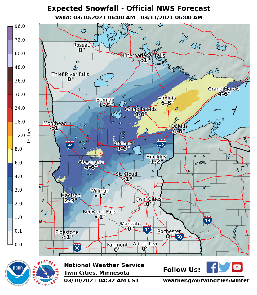
Northwestern Minnesota escapes the heavy snow because the track of the weather system does not bring as much moisture in that direction.
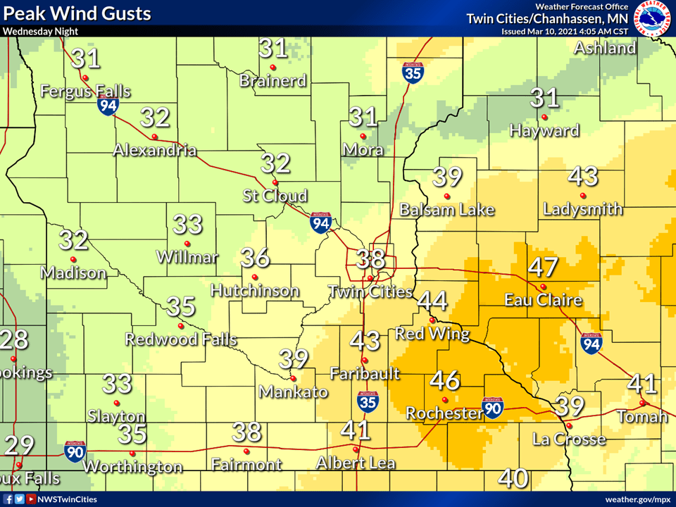
It also stays windy through the day thanks to the storm, with the highest winds expected late Wednesday night, when southeastern Minnesota could see gusts over 40 mph.
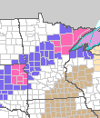
Because of all the facets of the storm, various parts of Minnesota are under winter weather advisories (purple), winter storm warnings (pink), and wind advisories (brown), beginning Wednesday afternoon and evening. The storm slowly moves out through the overnight, improving conditions by Thursday morning.
Some sunshine returns
As Wednesday’s storm departs, a minor disturbance could bring a little additional light rain and snow across northern Minnesota Thursday. Other than that area, the rest of the state sees more sunshine by Thursday afternoon. Highs will be in the 30s north and 40s for most of the state.
By Friday, high pressure dominates our weather bringing sunshine back for all of Minnesota. Temperatures, however, will be slightly cooler, with most of the state reaching highs only in the 30s, and a few low 40s south.
Highs rebound into the 40s and 50s by the weekend, putting most of Minnesota 10 to 15 degrees above average.
Saturday is also expected to be mostly sunny, however by Sunday, a storm to the south may clip southern Minnesota with rain and snow.
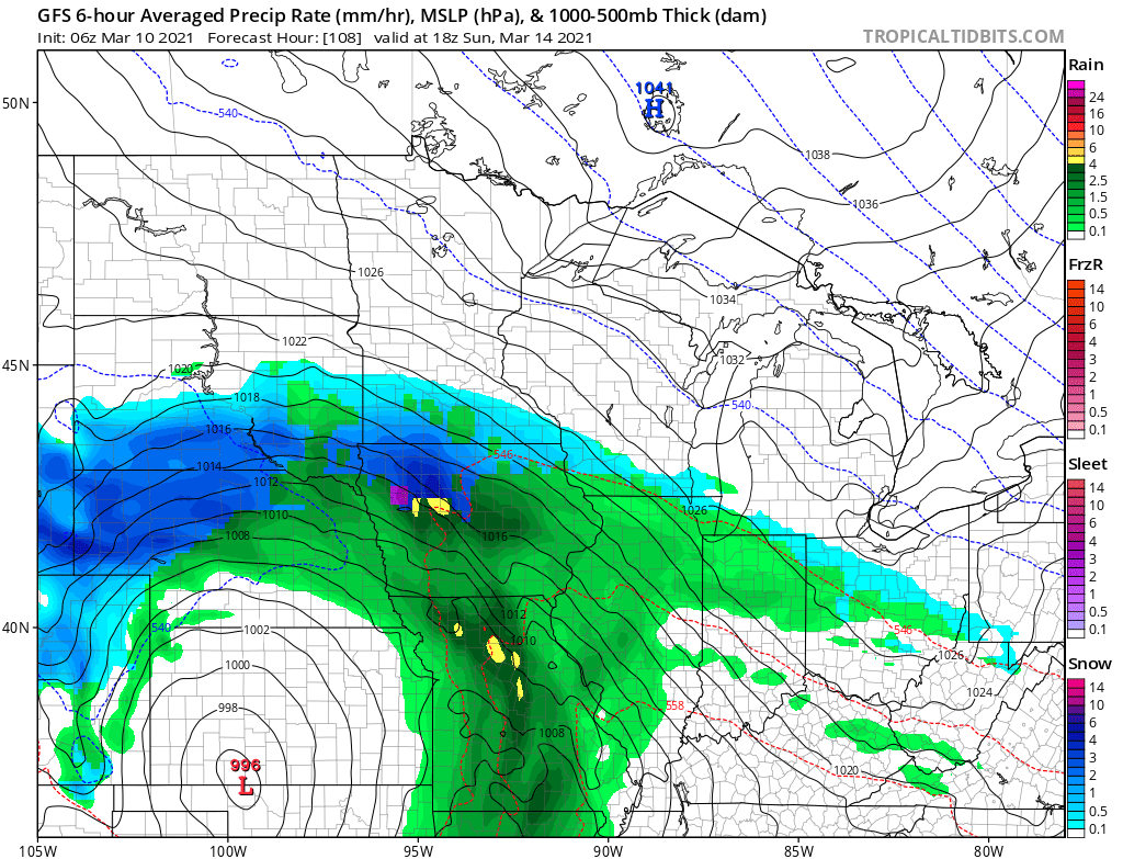
We’ll keep you updated on that chance as we get closer to the weekend.
Programming note
You can hear my live weather updates on Minnesota Public Radio at 7:48 a.m. Monday through Friday morning.

