
Staying slick Tuesday, then another big warmup
Statewide, 50s and 60s expected by the weekend
Go Deeper.
Create an account or log in to save stories.
Like this?
Thanks for liking this story! We have added it to a list of your favorite stories.


Icy conditions remain a concern Tuesday morning, but rising temperatures through the week will have snow and ice melting again.
Following Monday’s snowstorm, a lot of southern Minnesota is still digging out Tuesday. Not much measurable snow made it north of St. Cloud, while south-central and southeastern Minnesota set records. Here are some of the reports from Monday, the highest of which was a 12-inch report near Mankato.
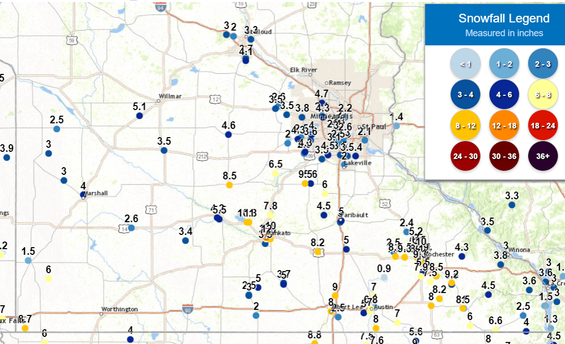
The official total of 7.9 inches in Rochester shattered the previous snowfall record for the day, which had been 2.1 inches.
Tuesday’s forecast
Although that snowstorm has moved out, pervasive low clouds linger Tuesday morning, and the weather remains somewhat unsettled. Because of the cloudy skies, temperatures stayed mild overnight, with most of the state starting in the 20s Tuesday.
Turn Up Your Support
MPR News helps you turn down the noise and build shared understanding. Turn up your support for this public resource and keep trusted journalism accessible to all.
Ample low-level moisture is causing a few problems across the state. In portions of northern Minnesota, there has been some light freezing drizzle making roads slick Tuesday morning. For southern Minnesota, in addition to snowy roads from Monday’s snow, there are areas of fog, including freezing fog, that add to travel concerns.
The freezing fog and drizzle conditions will improve through the morning as temperatures rise and clouds lift.
However, there is also enough moisture to produce isolated light snow or sprinkles during the day Tuesday. No significant accumulation is expected.
Highs across most of the state make it into the upper 30s to low 40s.
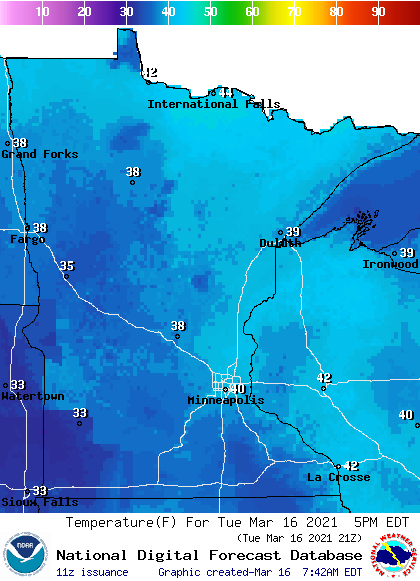
Extended forecast
Another storm that stays well south of the state could bring light snow and rain to southern Minnesota Tuesday night into Wednesday, but unlike Monday, there should be no significant accumulation.
Drier skies then prevail through the end of the week, until a storm that could bring back rain chances possibly Sunday and into Monday.
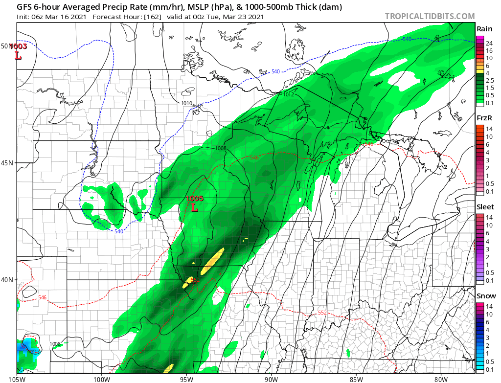
By then, temperatures will be mild enough that most of the precipitation is expected as rain.
Temperatures continue to rise slightly each day through the end of the week, with most of the state back in the 50s by late week. Here is that forecast for the Twin Cities:
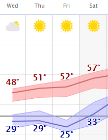
By Sunday, a few parts of southern Minnesota will likely see 60s again.
Programming note
You can hear my live weather updates on Minnesota Public Radio at 7:48 a.m. Monday through Friday morning.

