
Dry and sunny weather contribute to a weekend fire risk
Soaking rain targets Minnesota next week
Go Deeper.
Create an account or log in to save stories.
Like this?
Thanks for liking this story! We have added it to a list of your favorite stories.


The rest of this week stays dry and turns milder, but next week brings the return of much more active weather, including heavy rain chances.
Thursday’s forecast
With clear skies through much of the overnight, the state is started off seasonably cool Thursday morning, from teens in the Arrowhead to a few 30s south.
High pressure has settled right over the state which keeps winds light for most of the state, although it is breezier in southern Minnesota. The high pressure also means plenty of sunshine Thursday and drier conditions.
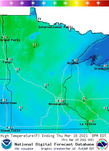
Under the additional sunshine, the entire state can expect highs from 5 to 15 degrees above average, with temperatures in the 40s and low 50s.
Turn Up Your Support
MPR News helps you turn down the noise and build shared understanding. Turn up your support for this public resource and keep trusted journalism accessible to all.
Widespread snow melt is expected during the day, at least for the places that still have snow. Because of the snowstorm earlier in the week, there is a reversal from the more typical pattern of northern Minnesota having more snow. Currently, southern Minnesota has the most snowpack while much of northern Minnesota is seeing bare ground.
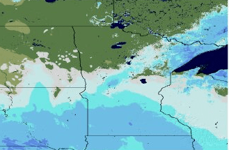
The cool snow can cap temperatures from getting as warm, so that is also why once again Thursday the warmest highs are likely to be north.
From too dry to very wet
Minnesota finished 2020 dry and most of the state saw below average precipitation over the winter. That has all of Minnesota at least “abnormally dry” and some areas in drought conditions as spring begins over the weekend.
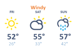
The dry and sunny weather pattern continues across Minnesota Friday and Saturday, putting more of the sate into the 50s as we head into the weekend.
However, conditions turn windy Saturday, and that windy and dry combination means a fire risk for northeastern Minnesota.

Those southerly winds warm us even more by Sunday, with 60s possible in southern Minnesota. More moisture and possibly spotty showers are also possible for portions of the state Sunday, which will reduce the fire risk.
Here is that forecast for the Twin Cities:
The early part of next week then turns much more active, with a couple rounds of rain possible between Monday and Wednesday. Temperatures will be mild enough that most of the precipitation is expected to come as rain, although some snow could mix in especially during the cooler weather overnight.
Most significantly, there could be heavy rain at times, and it is looking probable that especially southern Minnesota could see rain totals over an inch.
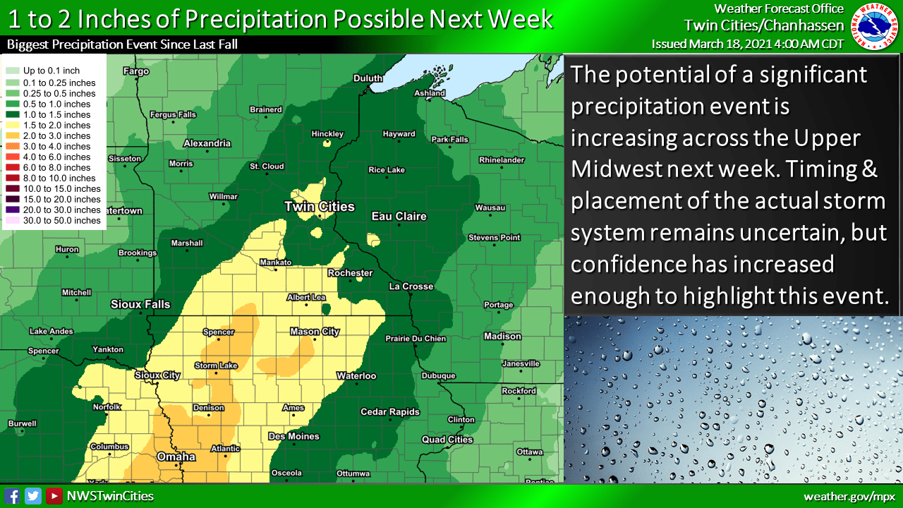
We will keep you posted on timing and expected precipitation amounts as next week approaches, but it is definitely looking like parts of the state could get a needed, soaking rain.
Programming note
You can hear my live weather updates on Minnesota Public Radio at 7:49 a.m. Monday through Friday morning.

