
The fire risk increases through Saturday
Rain moves in early next week and cools temperatures
Go Deeper.
Create an account or log in to save stories.
Like this?
Thanks for liking this story! We have added it to a list of your favorite stories.


Dry, mild, and breezy conditions lead to fire concerns through the end of the week, then next week starts off soggy.
Friday and Saturday
Much like Thursday, Minnesota is under the influence of high pressure Friday, bringing a similar forecast. That means widespread sunshine and dry conditions again.
One difference is that winds have shifted to a more southernly component and especially for western Minnesota, it gets breezier through the day, with gusts expected to top 20 and 30 mph by the afternoon and evening.

That warm flow started much of Minnesota milder Friday, with more 20s north, although there were still few teens, especially in the Arrowhead where winds were calmer overnight. Southern Minnesota was in the 20s and 30s for morning temperatures.
The warm winds will have even more of the state seeing highs in the 50s Friday, putting most of the state 10 to 15 degrees above average.
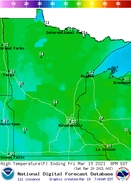
The dry, warm, and breezy conditions start to increase fire conditions Friday and elevate them even more Saturday, especially in central and northern Minnesota where there is little to no snow left on the ground.
Turn Up Your Support
MPR News helps you turn down the noise and build shared understanding. Turn up your support for this public resource and keep trusted journalism accessible to all.
By Saturday, much of the state can expect gusty southerly winds, and that dries the air and warms temperatures even more, putting portions of western and southern Minnesota near 60.
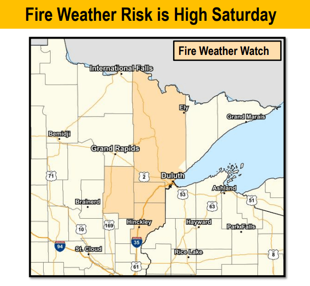
The continuing dry, windy, and warm conditions have portions of the Arrowhead already under a fire weather watch for Saturday.
Needed rain
Given the dry conditions across Minnesota, next week’s pattern change is a beneficial one in terms of ground moisture.
By Sunday, higher humidity and a chance for light showers returns across the state.
Then, Monday through Wednesday, a major storm is expected to track south of Minnesota, bringing widespread rain with it.
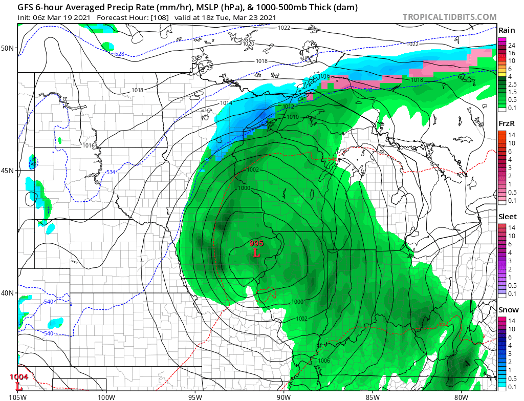
Because of the expected track of the storm, precipitation totals are expected to be heaviest south, and southeastern Minnesota especially could see one to two inches of rain or more. Precipitation diminishes as you head north.
The cloud cover and moisture also drop temperatures, with most of the state seeing highs back in the 40s, with a few 50s south by Monday and Tuesday. Here is that forecast for the Twin Cities:
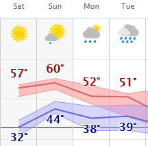
Although those temperatures are still above average for March, it will be cool enough that some light snow could mix in with the rain, particularly in northern Minnesota or anywhere during the cooler overnight weather.
Programming note
You can hear my live weather updates on Minnesota Public Radio at 7:49 a.m. Monday through Friday morning.

