
Heavy rain targets southern Minnesota
Portions of the state can expect over an inch of needed precipitation
Go Deeper.
Create an account or log in to save stories.
Like this?
Thanks for liking this story! We have added it to a list of your favorite stories.


After a mostly quiet Monday, precipitation moves in late and brings parts of Minnesota a soaking rain that lingers through midweek.
Monday’s forecast
Despite being behind a cold front that moved through Minnesota on Sunday, temperatures Monday morning were above average lows for late March, with most of the state in the upper 20s or 30s.
Winds have also died down significantly from the gusty conditions Sunday, but the light winds allowed fog to develop in portions of the Arrowhead and central Minnesota, with some visibilities a half mile or less. The fog lifts by late morning.
Highs make it into the 40s north and 50s south, under skies that start off sunny for most of the state.
Turn Up Your Support
MPR News helps you turn down the noise and build shared understanding. Turn up your support for this public resource and keep trusted journalism accessible to all.
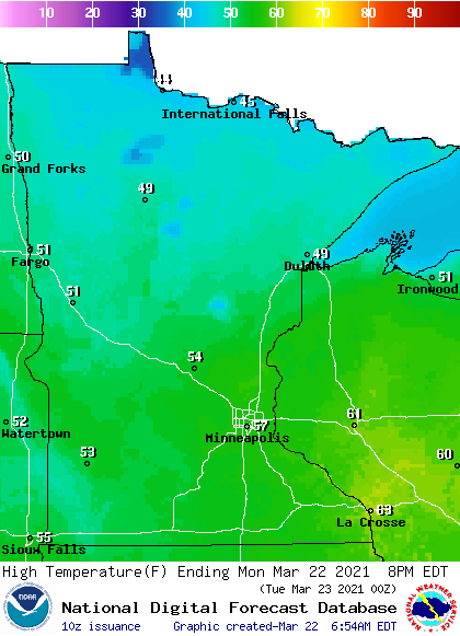
However, while northern Minnesota stays sunnier all day, southern Minnesota sees more clouds return in the afternoon. By Monday evening, rain begins to move in from the south.
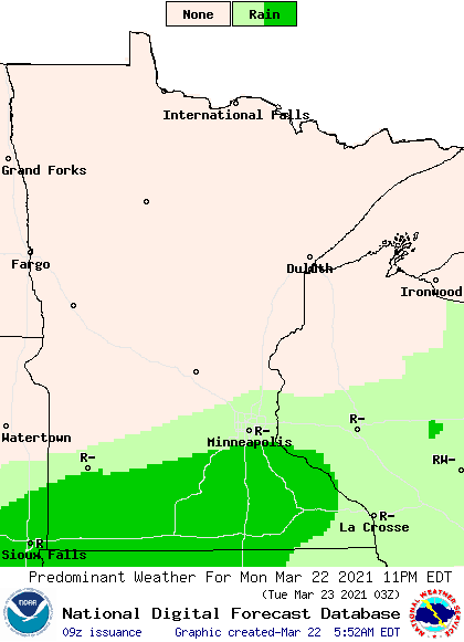
Soaking rain
That rain is the leading edge of a broad storms that will impact Minnesota through Wednesday. Because the storm is expected to track south of the state, then clip across southeastern Minnesota, rain is likely to be heaviest south and up through the North Shore.
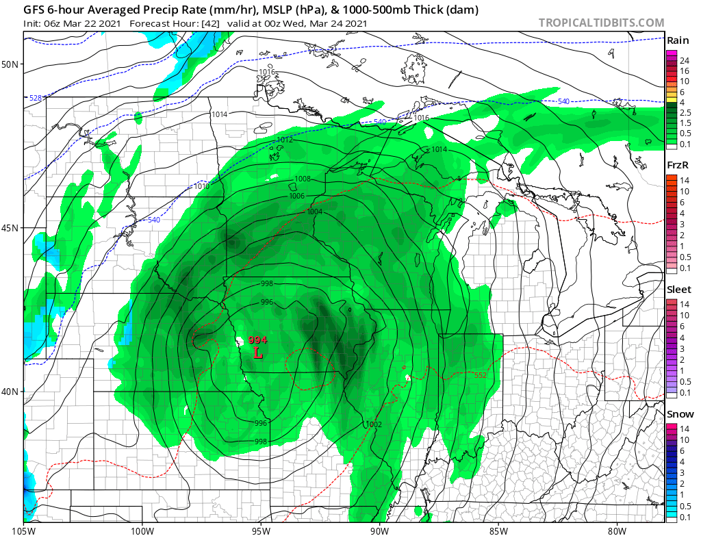
Those areas are forecast to see 1 to 2 inches of precipitation, then totals get lower as you head northwest. The northwestern corner of the state may miss the wet weather entirely.

Most of the precipitation Tuesday and Wednesday stays rain, although the Arrowhead especially could see some snow mixing in.
This is expected to be a beneficial weather event for Minnesota, as the entire state is “abnormally dry” with some areas in drought conditions.
The rain should clear out by Wednesday evening, with more sunshine returning by Thursday.
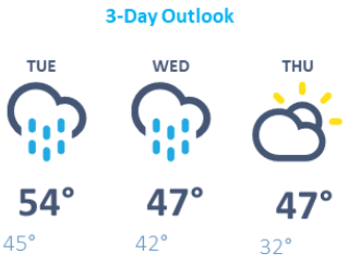
Temperatures dip with the lingering rain and cloud cover, with highs in the 40s and 50s Tuesday turning to more widespread 40s by Wednesday.
Even with more sun Thursday, temperatures are likely to remain in the 40s. Here is that forecast for the Twin Cities:
Programming note
You can hear my live weather updates on Minnesota Public Radio at 7:49 a.m. Monday through Friday morning.

