
Soaking rain moves across Minnesota
Snow mixes in north, including accumulating snow in the Arrowhead
Go Deeper.
Create an account or log in to save stories.
Like this?
Thanks for liking this story! We have added it to a list of your favorite stories.


Persistent rain is moving into Minnesota and will last through Wednesday, when parts of the state will see snow as the storm winds down.
A wet storm
A major storm that is centered in Kansas as of 9 a.m. Tuesday is funneling significant moisture in from the Gulf of Mexico and is already starting to bring some light bands of rain into Minnesota.
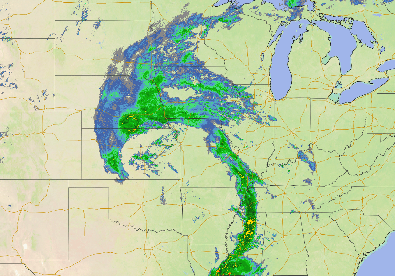
While most of the rain Tuesday morning stays light and spotty, the precipitation will become more widespread and consistent by the afternoon as the storm tracks northeast toward Minnesota, likely clipping the southeastern edge of the state early Wednesday.
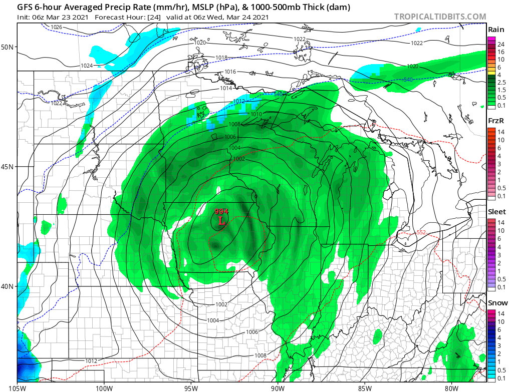
Tuesday stays milder, with highs in the upper 40s and 50s.
Turn Up Your Support
MPR News helps you turn down the noise and build shared understanding. Turn up your support for this public resource and keep trusted journalism accessible to all.
However, by Wednesday, Minnesota gets on the cooler side of the storm with highs mostly in the lower 40s. Especially in the Wednesday morning hours, temperatures could be chilly enough that much of the state will see some snow mix in with the rain.
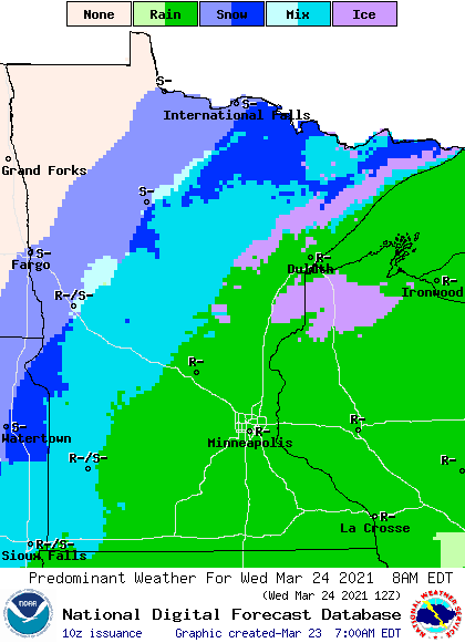
Southeastern Minnesota, including the Twin Cities, is the one area most likely to see the precipitation stay entirely rain.
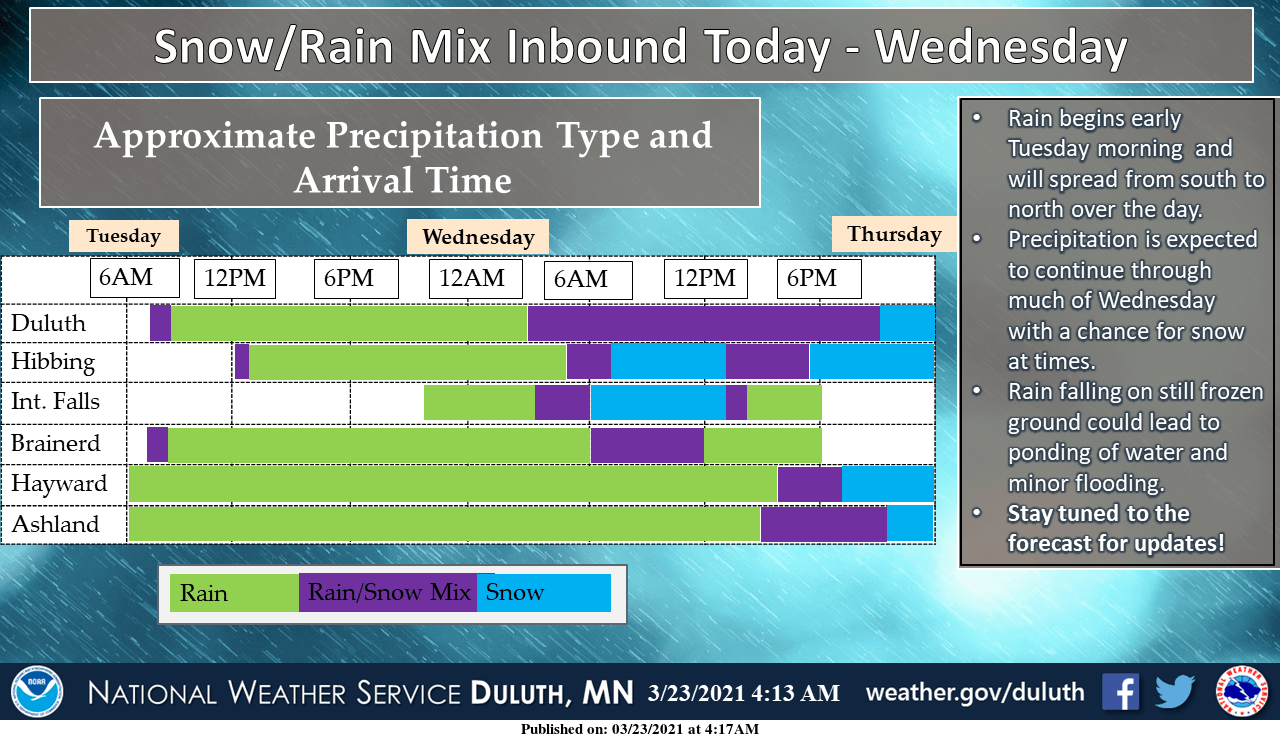
Snow accumulation is unlikely for most, although the Arrowhead may see 1 or 2 wet inches by Wednesday night. Here is the timing and precipitation types expected in northern Minnesota:
All of the precipitation starts winding down by Wednesday afternoon, and ends for most of the state Wednesday evening.
Due to the track of the storm, the heaviest rain falls in the southern half of Minnesota, where totals of 1 to 2 inches are forecast.

Less rain falls as you head north and west, and the precipitation could the northwestern corner of the state entirely.
Extended forecast
By Thursday dry skies and more sunshine return, with seasonable highs in the 30s for the Arrowhead, and 40s for the rest of the state. 50s return across southern Minnesota Friday and Saturday.
A disturbance could bring back some light rain from Friday evening through Saturday, with another chance for snow mixing in north. Significant rain or snow accumulation is not currently expected with that system.
Programming note
You can hear my live weather updates on Minnesota Public Radio at 7:49 a.m. Monday through Friday morning.

