
Soggy and snowy areas Wednesday
Another round of precipitation is likely Saturday
Go Deeper.
Create an account or log in to save stories.
Like this?
Thanks for liking this story! We have added it to a list of your favorite stories.


Rain and even areas of snow continue across Minnesota much of Wednesday, then the weather briefly turns quieter before another rain and snow chance on Saturday.
Wednesday’s forecast
The low pressure center of the storm that has been bringing the state precipitation since Tuesday tracked right over southeastern Minnesota early Wednesday and moving into Wisconsin as of 9:30 a.m.
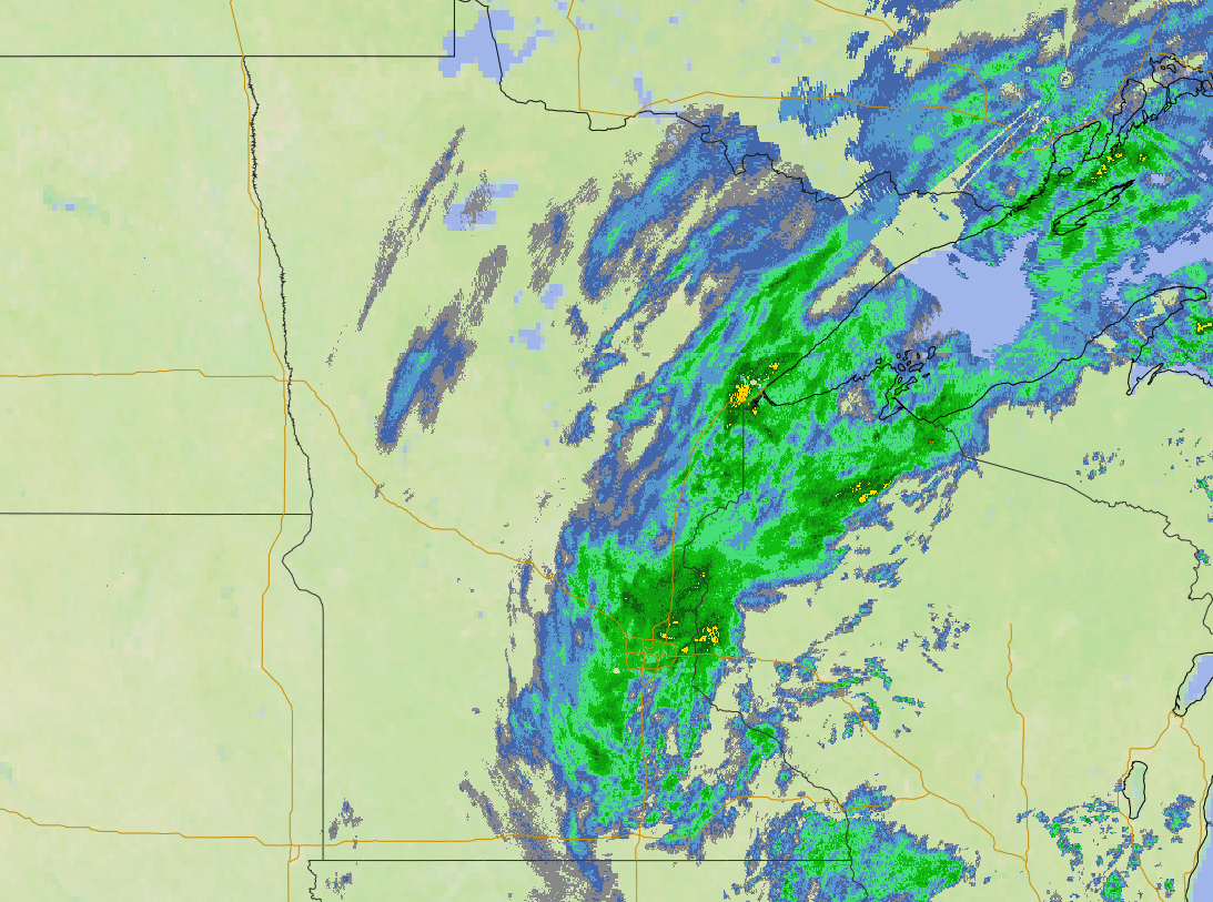
This is funneling more moisture into the state and created a persistent band of rain from eastern to southern Minnesota, including through the Twin Cities area, which is seeing many of the highest rainfall totals so far.
The position of the low pressure also puts the state on the cooler side of the storm now.
Turn Up Your Support
MPR News helps you turn down the noise and build shared understanding. Turn up your support for this public resource and keep trusted journalism accessible to all.
Morning temperatures were mild for March, in the 30s, with 40s southeast, but they raise little through the day. Highs will be in the 40s for most of the state but stay in the 30s across the Arrowhead.

The slightly colder temperatures in the Arrowhead are just cool enough that the precipitation has already changed to snow and will remain mostly snow with some rain mixing in through the day.
A few places could see over 4 inches of snow, leading to a winter weather advisory for most of the Arrowhead.

The precipitation stays more stubborn through Wednesday morning, starts winding down in the afternoon, and clears out for most of the state by the evening. Some snow may linger into the evening in the Arrowhead.
Additional rain totals will range from rain being unlikely in northwestern Minnesota up to about one-quarter inch in parts of eastern Minnesota.
Extended forecast
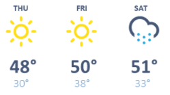
By Thursday dry skies and more sunshine return, with seasonable highs in the 30s for the Arrowhead, and 40s for the rest of the state, and even a few 50s west. A few more 50s also return across southern Minnesota Friday and Saturday.
Here is that forecast for the Twin Cities:
Friday also starts mostly sunny, but more clouds move in through the day. From Friday evening through Saturday, a weather disturbance brings a rain chance across Minnesota, with some snow likely north.
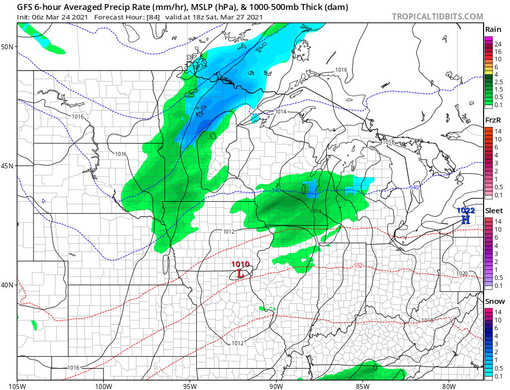
Currently, it looks like most of the rain will be about one-half inch or less, with perhaps a couple inches of snow north.
We will keep you updated on that forecast as the weekend approaches!
Programming note
You can hear my live weather updates on Minnesota Public Radio at 7:49 a.m. Monday through Friday morning.

