
Wet weather returns Saturday; highs Monday in the 60s, possibly 70s
Don’t get too spoiled by the warm weather, though
Go Deeper.
Create an account or log in to save stories.
Like this?
Thanks for liking this story! We have added it to a list of your favorite stories.


After more sunshine Thursday and part of Friday, wet weather returns for the first half of the weekend, followed by a big warmup.
Thursday’s forecast
The storm that brought heavy rain to portions of Minnesota Tuesday and Wednesday, along with some snow north, has moved out.
Clouds cleared for much of the state overnight, and morning temperatures were slightly above average with 20s and a few teens north and 30s south.
Most places with any lingering clouds clear by late morning, and under mostly sunny skies highs make it into the 50s for western and southern Minnesota, although cooler 30s stay in place for the Arrowhead.
Turn Up Your Support
MPR News helps you turn down the noise and build shared understanding. Turn up your support for this public resource and keep trusted journalism accessible to all.
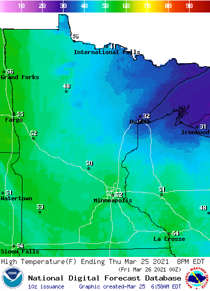
Southern Minnesota does see a few more clouds return in the afternoon due to a storm system that remains well south of the state.
Additional rain
Friday also starts off sunny, but clouds increase west to east through the day as another weather system targets Minnesota, but this next system appears quicker, weaker, and has less moisture than the storm that just soaked Minnesota.
So, as rain moves into western Minnesota Friday evening, then through the state Friday night, it will be much lighter and spottier rain.
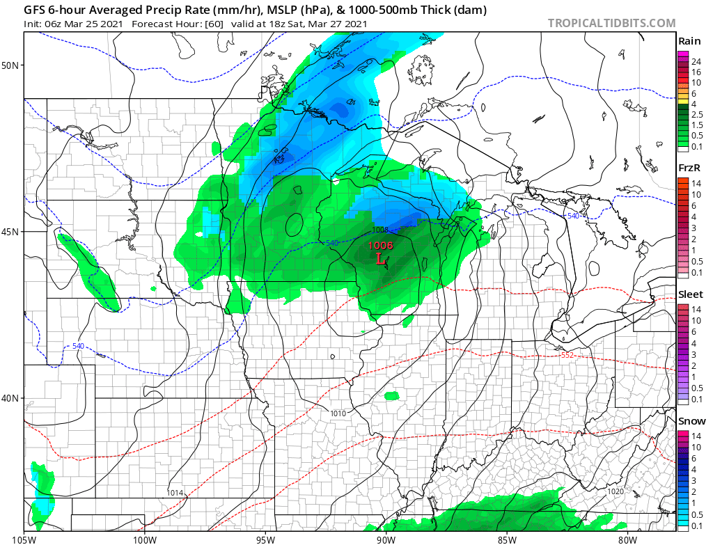
The scattered showers already depart by Saturday evening, with most of the state forecast to see between one-tenth and one-half inch of rain.
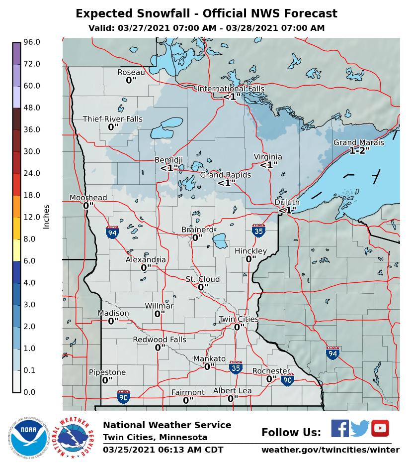
Temperatures in northern Minnesota will be cool enough for some snow to mix in, but any accumulation should stay under an inch of snow for most areas.
70s possible?
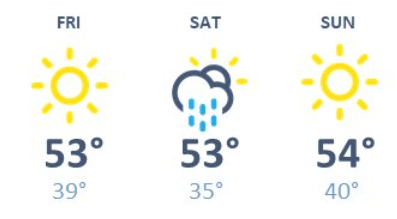
Even with the precipitation over the weekend, temperatures stay fairly consistent, with highs for most of Minnesota in the 40s and 50s south from Friday to Sunday.
Here is that forecast for the Twin Cities:
However, ahead of a strong warm front, gusty winds from the south are expected to send temperatures soaring Monday, with much of the state in the 60s and the Twin Cities could reach 70.
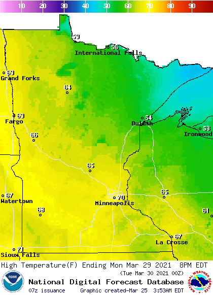
If that 70 degree milestone is hit for the Twin Cities, it will be two weeks earlier than average for the first 70 of the season.
Don’t get too spoiled by the warm weather, though. By next Wednesday, highs are likely to be back in the 30s and 40s.
Programming note
You can hear my live weather updates on Minnesota Public Radio at 7:49 a.m. Monday through Friday morning.

