
Temperatures go for a roller coaster ride next week
Rain and snow move across Minnesota Saturday
Go Deeper.
Create an account or log in to save stories.
Like this?
Thanks for liking this story! We have added it to a list of your favorite stories.


A weak storm brings showers across Minnesota into Saturday, then a big warmup pushes temperatures 20 degrees above average by Monday.
Friday’s forecast
Temperatures Friday morning started in the 20s for almost all of Minnesota, with low-level clouds across much of the state. Those clouds lift through the morning.
While there will be more clouds than Thursday, there will also be breaks of sunshine.
Under a wind flow that turns more southerly through the day, highs make it into the 40s for most of northern Minnesota, and 50s for the southern half of the state.
Turn Up Your Support
MPR News helps you turn down the noise and build shared understanding. Turn up your support for this public resource and keep trusted journalism accessible to all.
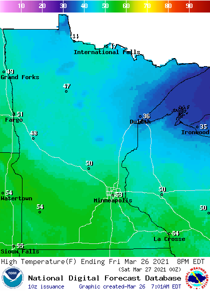
That is slightly above average for late March.
A few rain showers have already moved into northwestern Minnesota Friday morning, ahead of a slow-moving cold front that will pass through most of the state Saturday.
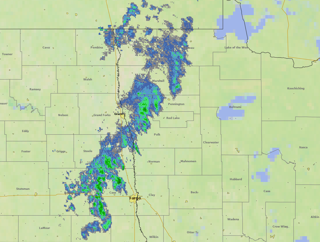
Western Minnesota will see spotty light rain showers through the day.
A wet Saturday
That rain becomes a more widespread late Friday and begins moving through the rest of Minnesota overnight. In northern Minnesota, temperatures will be cool enough for some snow to mix in.
Although significant accumulation is not expected, a little light freezing rain might also fall, so drive with care early Saturday. For the rest of the state, including the Twin Cities, all of the precipitation should come as rain.
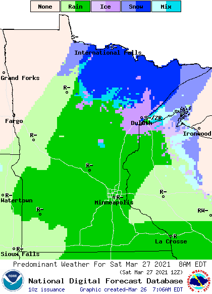
The wet weather moves out quickly, starting to clear western Minnesota by late Saturday morning, then entirely out of the state by Saturday evening.
Rainfall totals will be under one-quarter inch for most of the state, with portions of northern Minnesota seeing one-half inch.
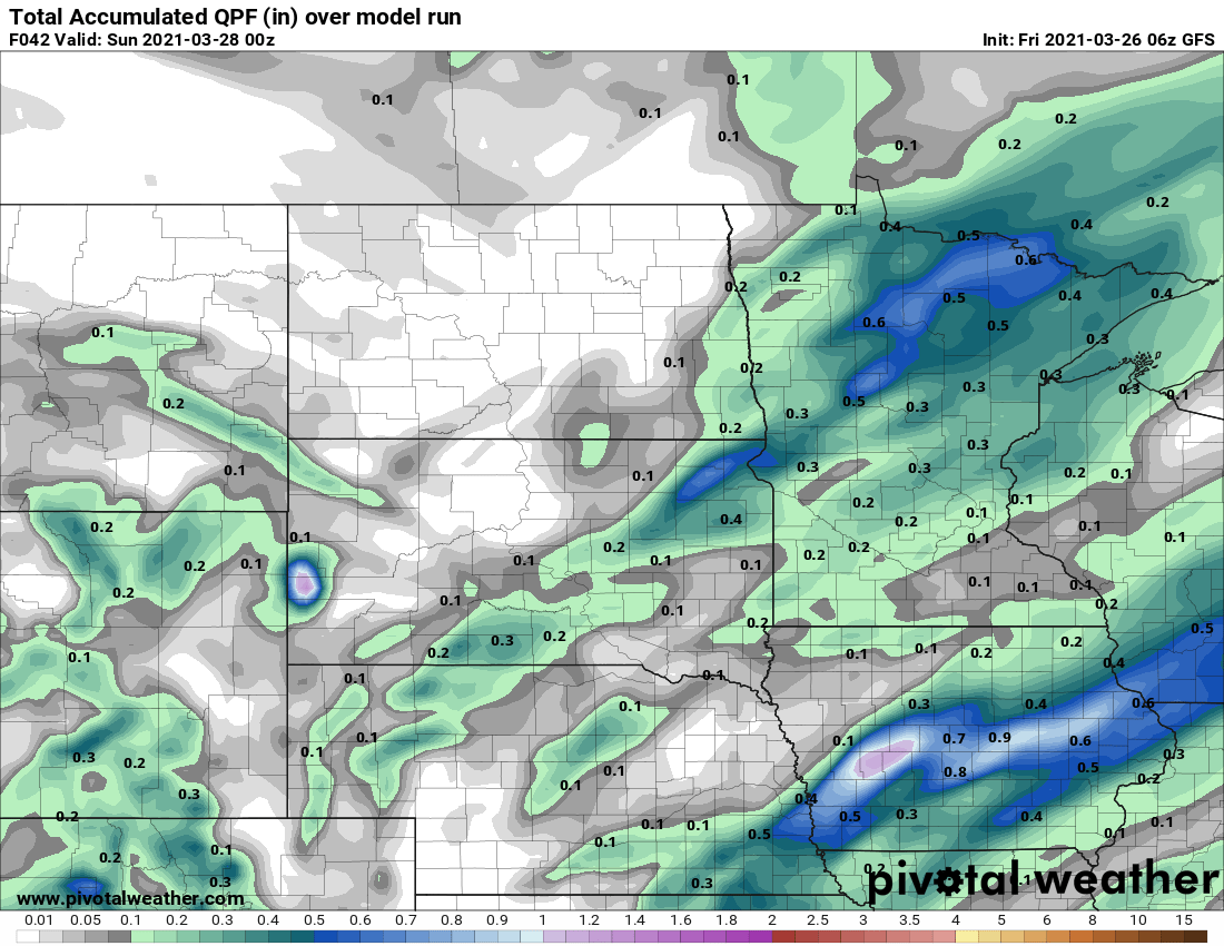
This is very beneficial, because much of northern Minnesota missed the significant rain earlier this week, and most of the area is in moderate drought conditions.
A temperature roller coaster
The precipitation Saturday keeps highs for most of Minnesota in the 40s, with a few 50s south. The return of sunshine Sunday nudges those temperatures a couple degrees warmer.
The big warmup comes Monday, when gusty winds from the south sends most of the state soaring into the 60s, with low 70s possible south.
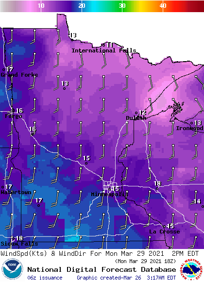
However, that warmup is followed by a strong cold front. Moisture with the storm currently looks limited, with only light rain and snow chances on Tuesday. The bigger impact is the return of much cooler air, plunging Minnesota back in to the 30s and 40s.
Here is that forecast for the Twin Cities:
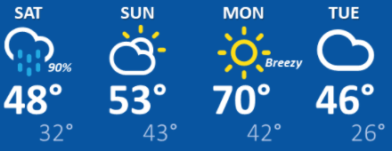
That colder air does not last long. Temperatures are expected to rebound back above average by the end of the week.
Programming note
You can hear my live weather updates on Minnesota Public Radio at 7:49 a.m. Monday through Friday morning.

