
Saturday showers, wintry mix in northeastern Minn.; plenty of Sunday sunshine
Winter weather advisory Saturday in northeastern Minn.
Go Deeper.
Create an account or log in to save stories.
Like this?
Thanks for liking this story! We have added it to a list of your favorite stories.


It can snow in late March. It sometimes snows in April. We’re expecting periods of rain in the Twin Cities metro area and much of central and southern Minnesota this afternoon, but northeastern Minnesota is getting a wintry mix of snow and light freezing rain.
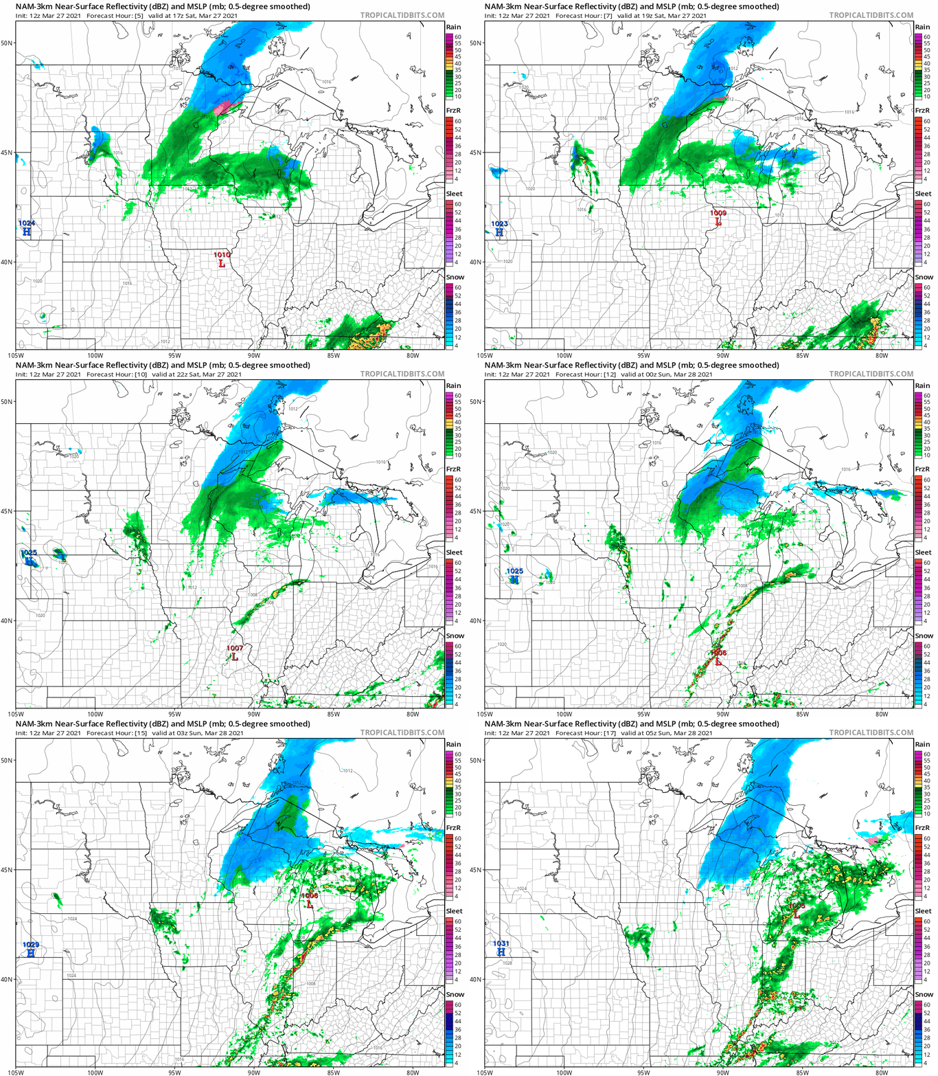
The National Oceanic and Atmospheric Administration’s North American Mesoscale (NAM) forecast model shows the potential precipitation pattern for Saturday afternoon and Saturday evening:
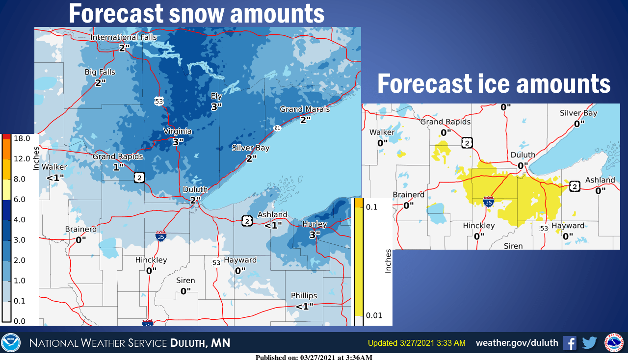
Here is the snow and wintry mix forecast for northeastern Minnesota:
A winter weather advisory continues until 4 p.m. in most of northeastern Minnesota and part of northwestern Wisconsin:
Turn Up Your Support
MPR News helps you turn down the noise and build shared understanding. Turn up your support for this public resource and keep trusted journalism accessible to all.
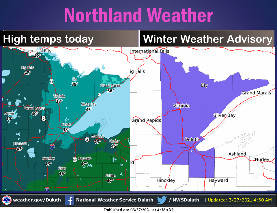
Here are details of the winter weather advisory, which includes Duluth:
URGENT - WINTER WEATHER MESSAGE National Weather Service Duluth MN 915 AM CDT Sat Mar 27 2021 ...WINTRY MIX CONTINUES THIS MORNING... .Snow is expected in northeastern Minnesota this morning with accumulations ranging from 2 to 4 inches. Freezing rain will be possible near the Twin Ports this morning. Ice accumulations of a few hundredths of an inch are possible, leading to slippery road conditions. Allow for extra time if traveling this morning. MNZ011-012-019-037-WIZ001-272100- /O.CON.KDLH.WW.Y.0011.000000T0000Z-210327T2100Z/ North St. Louis-Northern Cook and Lake-Central St. Louis- Carlton and South St. Louis-Douglas- Including the cities of Ely, Isabella, Hibbing, Duluth, and Superior 915 AM CDT Sat Mar 27 2021 ...WINTER WEATHER ADVISORY REMAINS IN EFFECT UNTIL 4 PM CDT THIS AFTERNOON... * WHAT...Mixed precipitation. Additional snow accumulations of up to two inches and ice accumulations of a light glaze. * WHERE...In Wisconsin, Douglas County. In Minnesota, North St. Louis, Central St. Louis, Northern Cook and Lake and Carlton and South St. Louis Counties. This includes the Tribal Lands of the Fond du Lac Band and the Bois Forte Band, Lake Vermilion and, Nett Lake areas. * WHEN...Until 4 PM CDT this afternoon. * IMPACTS...Plan on slippery road conditions. PRECAUTIONARY/PREPAREDNESS ACTIONS... Slow down and use caution while traveling. The latest road conditions can be obtained by calling 5 1 1. Road conditions can also be found at 511mn.org for Minnesota or 511wi.gov for Wisconsin. && $$ For more information from the National Weather Service visit http://weather.gov/Duluth
You can hear updated weather information for Minnesota and western Wisconsin on the MPR network, and you’ll see updated weather info on the MPR News live weather blog.
Snow reports for northeastern Minnesota will be posted by the NWS here.
Temperature trends
Northeastern Minnesota will see Saturday highs in the 30s, with mainly 40s across the rest of Minnesota. There could be a few lower 50s in southeastern Minnesota.
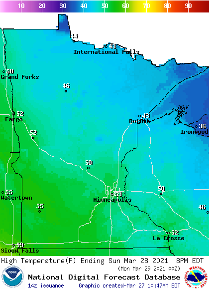
Sunday highs reach the 50s south, with 40s to the north:
Sunday afternoon wind gusts are expected to be in the 12-18 mph range in most areas:
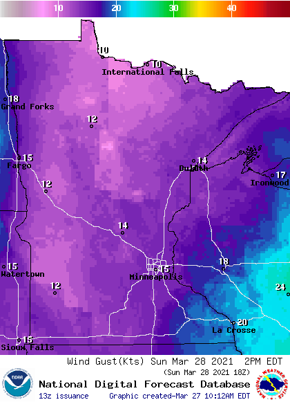
Plotted gusts are in knots, with 15 knots equal to about 17 mph. Gusts could top 20 mph in parts of southeastern Minnesota and southwestern Wisconsin on Sunday.
Back to temperatures, Monday highs will reach 70 degrees or higher in roughly the southern half of Minnesota, with 60s in most of northern Minnesota. Twin Cities metro area highs are projected to be around 70 on Monday, followed by upper 40s Tuesday, lower 40s Wednesday, 50 on Thursday and lower 60s on Friday.
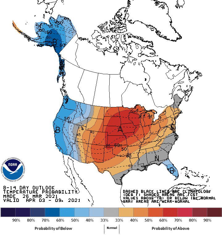
Next weekend and the start of the following week look mild to warm. The NWS Climate Prediction Center shows a strong tendency for above-normal temps in Minnesota and Wisconsin from April 3 through April 9:
Ice out in some lakes
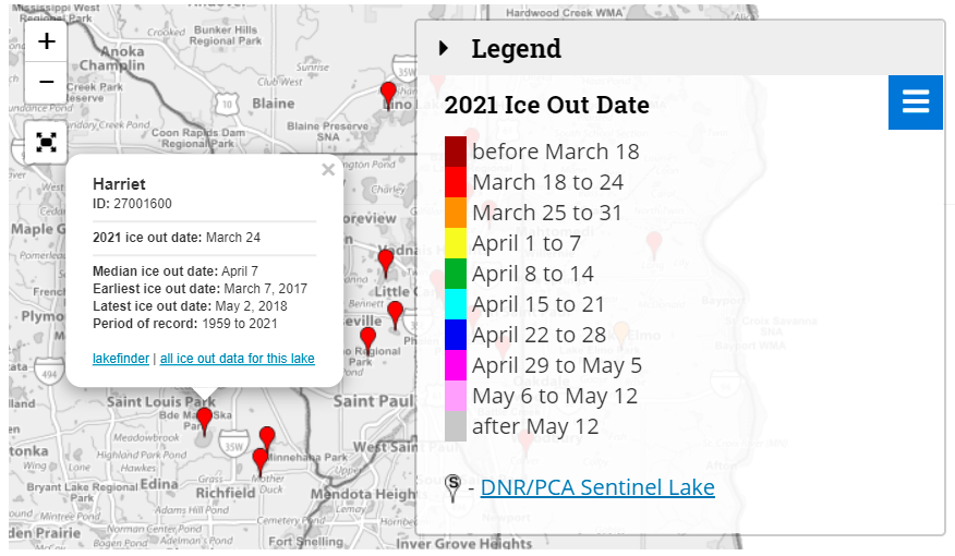
The Minnesota DNR lists ice out at Lake Harriet as March 24 this year:
Here’s a Saturday pic from the Lake Harriet Yacht Club cam, which is on the north side of Lake Harriet in Minneapolis:

I did notice some ice remaining on the south side of Lake Harriet during my drive on Friday, but most of the lake was ice-free.
You can see Minnesota ice out dates here.
Programming note
You can hear my live weather updates on MPR News at 7:35 a.m., 9:35 a.m. and 4:39 p.m. each Saturday and Sunday.

