
A bright and breezy Sunday; windy with a shot at 70 Monday
Tuesday and Wednesday look cool
Go Deeper.
Create an account or log in to save stories.
Like this?
Thanks for liking this story! We have added it to a list of your favorite stories.


This is a nice change from the rain (and snow in northeastern Minnesota) of Saturday. Our Sunday afternoon will feature quite a bit of sunshine, along with near-normal temps. Far western Minnesota may see increasing cloudiness by late Sunday afternoon.
Sunday highs are expected to reach the 50s in west-central and southwestern Minnesota, with mainly 40s elsewhere. Parts of northeastern Minnesota may top out in the upper 30s. Some spots in the Twin Cities metro area could touch 50 degrees. Our average Twin Cities high temp is 48 degrees this time of year.
Windy but much warmer on Monday
A cold front will move toward us from the Dakotas on Monday. The big pressure gradient out ahead of the front will generate strong winds in Minnesota and western Wisconsin on Monday.
Turn Up Your Support
MPR News helps you turn down the noise and build shared understanding. Turn up your support for this public resource and keep trusted journalism accessible to all.
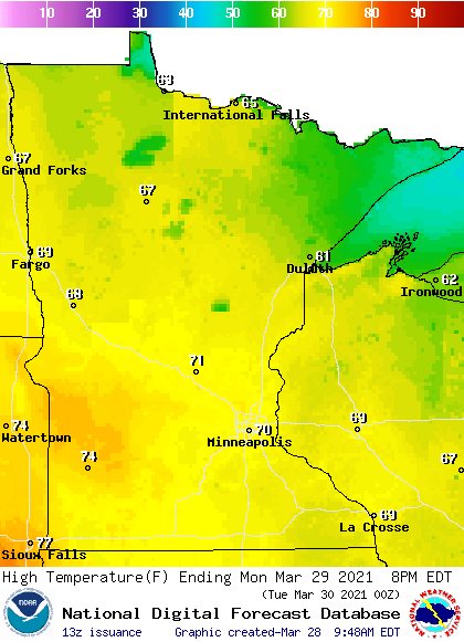
The strong southerly winds will allow Monday afternoon highs of 70 degrees or higher in roughly the southern half of Minnesota, with mainly 60s elsewhere:
Monday winds are expected to be in the 20-30 mph range, with gusts of 35-45 mph:
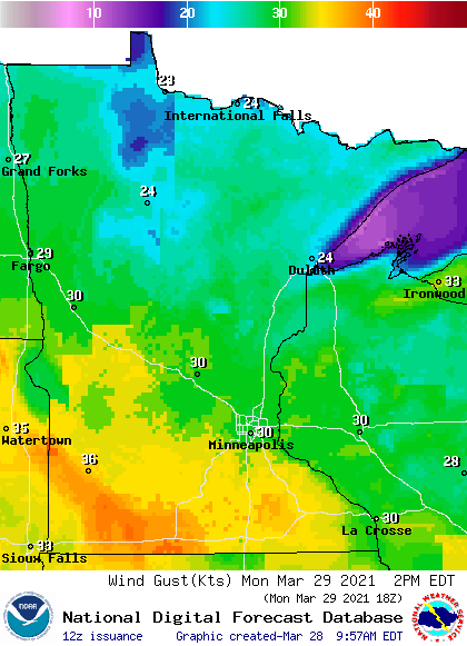
Plotted gusts are in knots, with 30 knots equal to 34.5 mph. The highest gusts are expected in southwestern and south-central Minnesota.
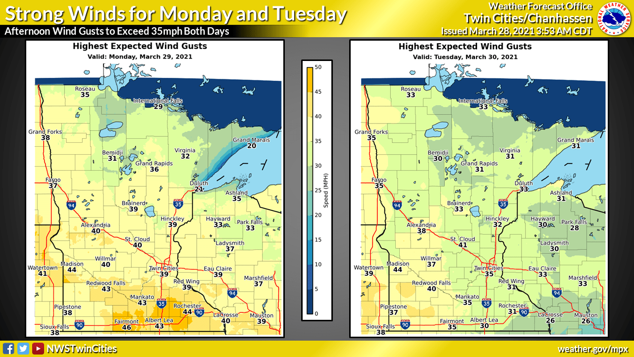
Tuesday will also be very windy. Here’s the NWS forecast of Monday and Tuesday peak wind gusts:
Shower chance Monday night
The advancing cold front could generate scattered showers Monday night and early Tuesday. The National Oceanic and Atmospheric Administration’s North American Mesoscale (NAM) forecast model shows the potential precipitation pattern for Monday evening through Tuesday morning:
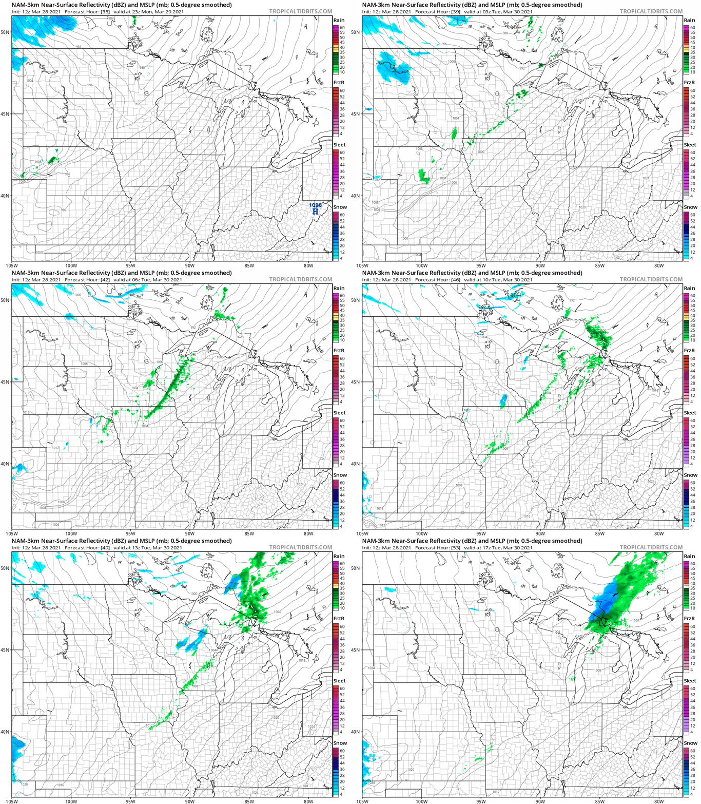
There could even be a few flakes in some areas late Monday night and early Tuesday morning.
Temperature trends
Twin Cities highs are projected to be in the mid 40s Tuesday and lower 40s on Wednesday. Then temps rebound …we’ll top out around 50 degrees on Thursday followed by lower 60s on Friday.
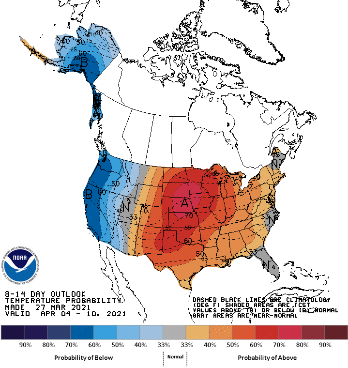
We could see Twin Cities highs in the 60s next weekend, and the following week also looks warmer than normal. The NWS Climate Prediction Center shows a strong tendency for above-normal temps in Minnesota and Wisconsin from April 4 through April 10:
Weather nugget: first 70
We’re forecasting a Twin Cities high temp of around 70 degrees on Monday.
The average date of our first 70 degree reading in the Twin Cities is April 13. In the past 5 years, the earliest date of our first 70 in the Twin Cities was March 8, 2016. The latest date of our first 70 in the Twin Cities in the past 5 years was April 23, 2018. There was a good reason for that late arrival of 70; MSP airport tallied 26.1 inches of snow in April of 2018!
Programming note
You can hear my live weather updates on MPR News at 7:35 a.m., 9:35 a.m. and 4:39 p.m. each Saturday and Sunday.

