
From 70s to 30s: Dramatic temperature changes ahead
Dry weather increases the fire concern across Minnesota
Go Deeper.
Create an account or log in to save stories.
Like this?
Thanks for liking this story! We have added it to a list of your favorite stories.


A strong storm brings a remarkable turn from warm to cold weather over the next two days, plus high winds that will cause a fire risk.
Monday’s forecast
Ahead of a potent warm front, southerly winds increased overnight, and Monday is turning noticeably windier.
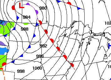
That warm air flow also kept temperatures very mild, and Minnesota saw morning lows mostly in the 30s and 40s.
Winds and temperatures crank up through the day. The warm pattern puts most of the state in the 60s and 70s for highs, which for many will be the warmest weather since last November. In the Twin Cities, if the temperature makes it to 70 as forecast, it will be about two weeks early for the for the first 70 of the season.
Turn Up Your Support
MPR News helps you turn down the noise and build shared understanding. Turn up your support for this public resource and keep trusted journalism accessible to all.
The gusty winds will exceed 30 and 40 mph by the afternoon, with western Minnesota likely to get gusts over 50 mph.
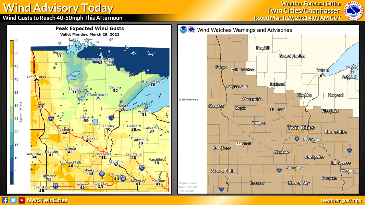
This has much of the state under a wind advisory, and high-profile vehicles should drive with care.
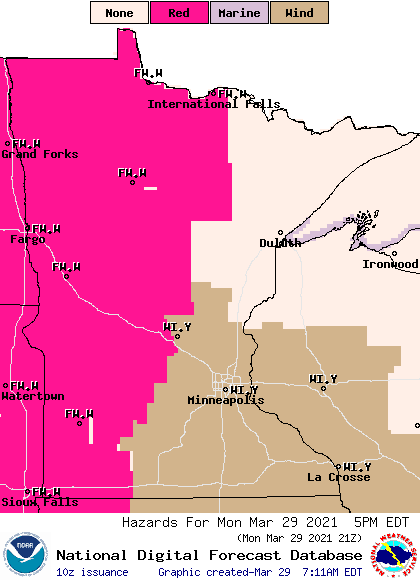
The wind brings another concern Monday afternoon and evening. The warm, dry air will lead to very low humidity in the afternoon and combined with high winds, there is a significant fire danger for western Minnesota.
Temperature rollercoaster
By Monday evening, the same storm that brought the warm front will move an equally potent cold front across Minnesota.

Many places will set their highs for Tuesday just after midnight, with little warmup Tuesday afternoon. That puts afternoon temperatures Tuesday in the 30s and low 40s for much of Minnesota, a 30- to 40-degree drop from Monday afternoon!
It will feel even chillier as breezy conditions continue Tuesday.
The cooler air stays in place Wednesday, although winds finally diminish, with most of the state seeing highs only in the 30s.
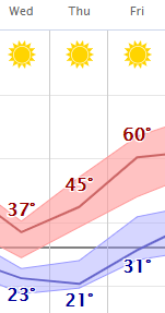
Southerly winds return by Thursday and another warmup starts, shooting temperatures for the majority of Minnesota back into the 60s by Friday.
At right is the forecast for the Twin Cities showing our “temperature rollercoaster” headed back up the second half of the week.
Staying dry
Minnesota is running very dry, with western and northern portions of the state under drought conditions, and the week ahead offers little help.
The cold front late Monday could bring some spotty rain overnight Monday into Tuesday morning, but most places will see little to no measurable precipitation.
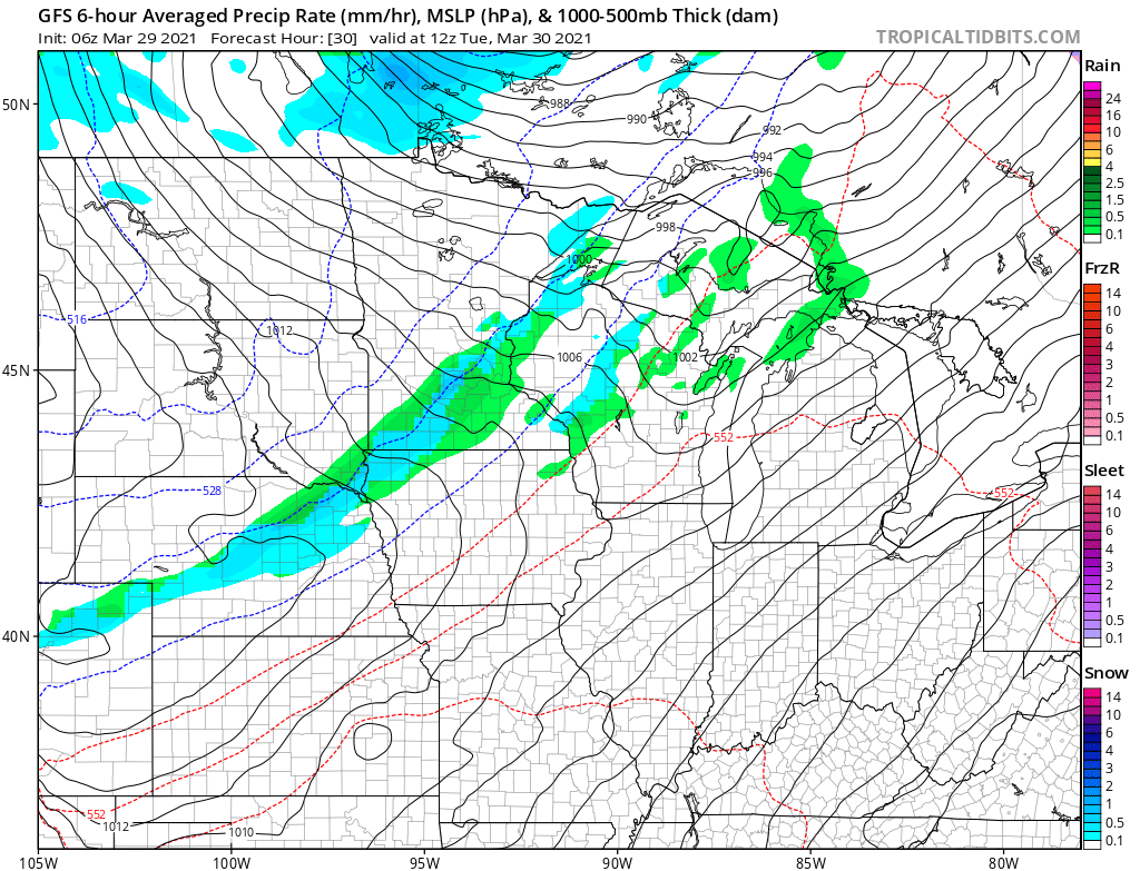
Northern Minnesota could also see a couple flurries Tuesday behind the cold front, but again, no accumulation is likely.
The remainder of the week currently looks dry, with mostly sunny skies prevailing.
Programming note
You can hear my live weather updates on Minnesota Public Radio at 7:49 a.m. Monday through Friday morning.

