
Warm highs in the 60s and 70s Monday
Gusty winds and low humidity raise the raise fire concerns
Go Deeper.
Create an account or log in to save stories.
Like this?
Thanks for liking this story! We have added it to a list of your favorite stories.


A strong warm front is bringing Minnesota its warmest day so far this year, but that comes along with gusty winds and a fire risk.
Monday’s forecast
Ahead of a potent warm front, southerly winds increased overnight, and Monday is starting off noticeably windier.
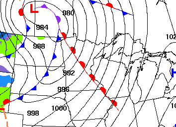
That warm air flow also kept temperatures very mild, and Minnesota is seeing morning lows mostly in the 30s and 40s.
Winds and temperatures crank up through the day. The warm flow puts most of the state in the 60s and 70s for highs, which for many will be the warmest weather since last November.
Turn Up Your Support
MPR News helps you turn down the noise and build shared understanding. Turn up your support for this public resource and keep trusted journalism accessible to all.
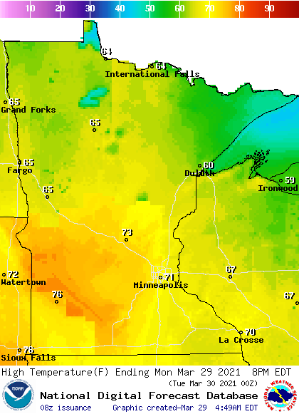
In the Twin Cities, if the temperature makes it to 70 as forecast, it will be about two weeks early for the for the first 70 of the season.
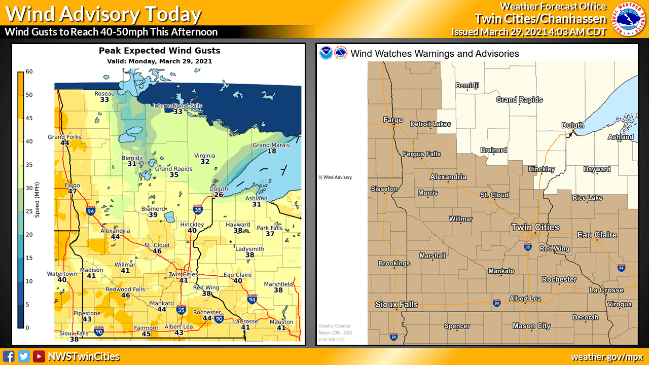
The gusty winds will exceed 30 and 40 mph by the afternoon, with western Minnesota likely to get gusts over 50 mph. This has much of the state under a wind advisory, and high-profile vehicles should drive with care.
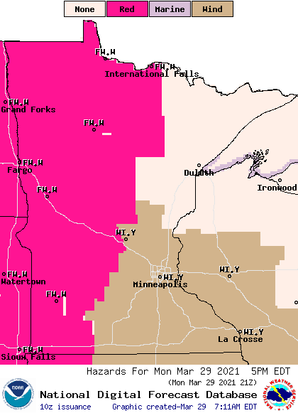
The wind brings another concern Monday afternoon and evening. The warm, dry air will lead to very low humidity in the afternoon and combined with high winds, there is a significant fire danger for western Minnesota.
The same storm bringing the warm air moves a cold front through Minnesota Monday evening and much colder air by Tuesday. That extended forecast will be updated around 9 a.m.
Programming note
You can hear my live weather updates on Minnesota Public Radio at 7:49 a.m. Monday through Friday morning.

