
Much colder for Tuesday
Gusty winds continue through the day
Go Deeper.
Create an account or log in to save stories.
Like this?
Thanks for liking this story! We have added it to a list of your favorite stories.


The same storm that brought record warmth to parts of Minnesota on Monday has now moved a cold front across the state, sending temperatures plummeting.
Tuesday’s forecast
Temperatures Monday afternoon ran 20 to 30 degrees above average, but already by the evening hours, a cold front was making its way through the state.
This sent temperatures diving overnight, although morning temperatures are slightly above average, ranging from the 20s north to 30s south.
Winds are still very gusty, and much of the state will continue to see gusts over 30 and 40 mph Tuesday. Here are the temperatures and winds as of 7 a.m. (each barb on the wind vane represents 10 mph and half barbs are 5 mph, with gusts in red):
Turn Up Your Support
MPR News helps you turn down the noise and build shared understanding. Turn up your support for this public resource and keep trusted journalism accessible to all.
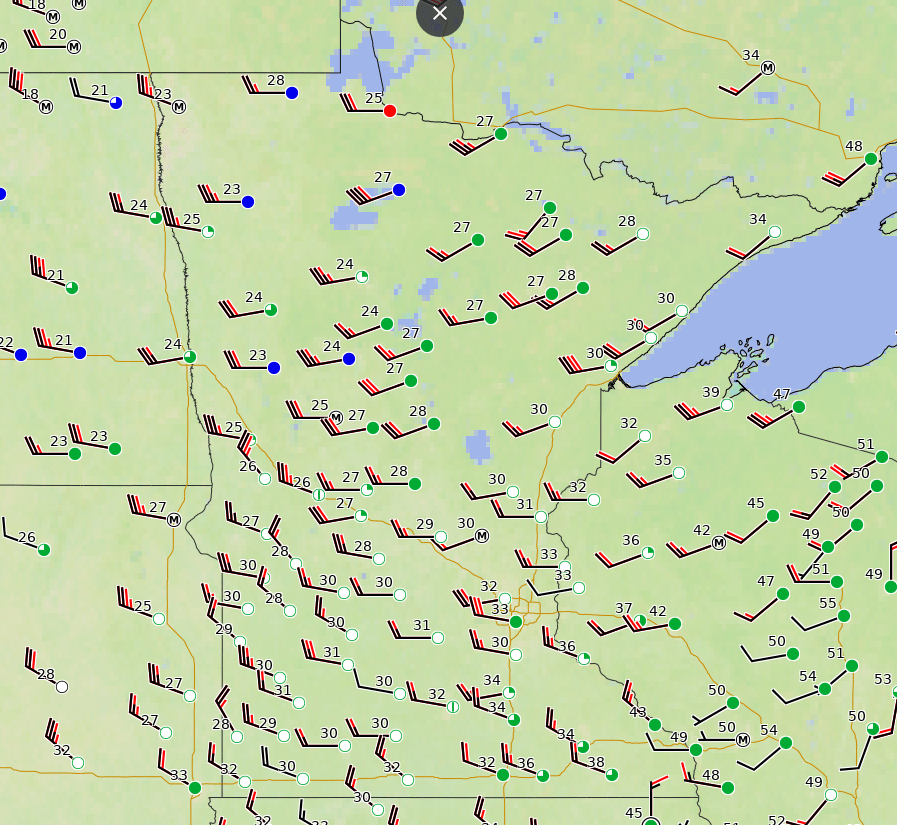
The front that passed through was mostly dry, but there have been a couple sprinkles south and flurries north, and skies stay mostly cloudy.
Temperatures rise little during the day, with most of the state seeing highs only in the 30s, and the high winds will make it feel even colder. It will be a noticeable contrast from Monday!
Warmer weather returns by the end of the week, and highs quickly shoot back into the 60s or milder.
Programming note
You can hear my live weather updates on Minnesota Public Radio at 7:49 a.m. Monday through Friday morning.

