
From subzero wind chills Wednesday to possible 80s this weekend
Predominantly dry weather continues until early next week
Go Deeper.
Create an account or log in to save stories.
Like this?
Thanks for liking this story! We have added it to a list of your favorite stories.


Following one of Minnesota’s few below average March days, the start of April turns very warm under plentiful sunshine.
Wednesday’s forecast
Under a persistent cooler flow from northwesterly winds, Minnesota started the final day of March slightly below average, with single-digits and teens north, and temperatures in the 20s south.
Those winds have diminished significantly from the high gusts of Monday and Tuesday, but it will still be breezy Wednesday, with gusts occasionally over 30 mph, especially in the morning. This is putting some of the morning wind chills below zero in northern Minnesota.
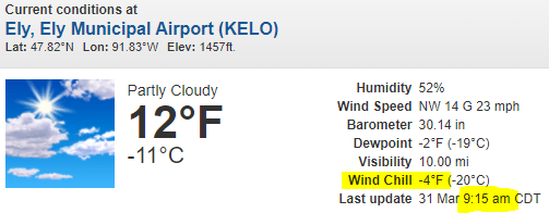
There is also a little light snow moving across northern Minnesota Wednesday morning that should produce no more than a dusting, and even southern Minnesota may see a stray flurry during the morning.
Turn Up Your Support
MPR News helps you turn down the noise and build shared understanding. Turn up your support for this public resource and keep trusted journalism accessible to all.
A mix of clouds and sunshine in the morning gives way to a bit more sun in the afternoon. Highs make it into the 30s for most of the state, which is about 10 degrees below average.
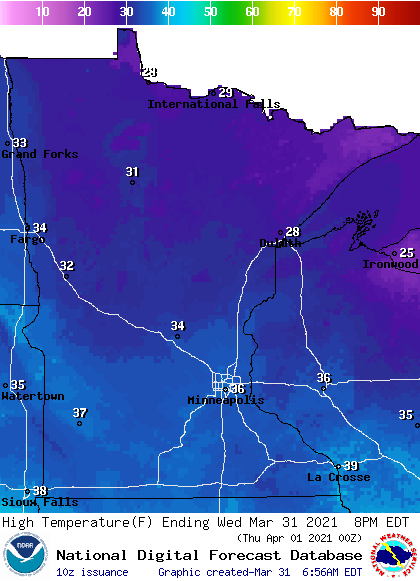
Because temperatures most of March have been so mild, it will be one of our few below-average days. For the Twin Cities, it will mark only the third time for all of March with a daily temperature that falls below average.
April begins warm and dry
By Thursday, high pressure slides directly over Minnesota bringing lighter winds, more sunshine, and returning temperatures into the 40s for most of the state, with a few 50s west.
As the high slides east on Friday, the state falls under breezy southerly winds again, shooting highs back into the 50s and 60s. Saturday and Sunday turn even milder, with more 60s across the state and 70s south.
A few isolated 80s are possible in southwestern Minnesota. This puts the state back into warmth that is 20 to 30 degrees above average for early April.
Here is that forecast for the Twin Cities:
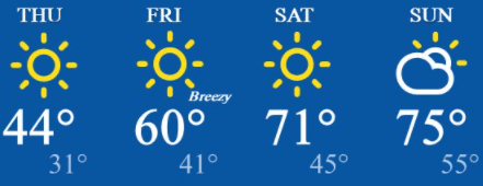
However, the warm, dry, and breezy conditions mean the fire risk will become more elevated again as we head into the weekend.
Rain returns
Following our extended dry pattern, the weather is expected to turn more active next week, with light rain chances returning by Monday.
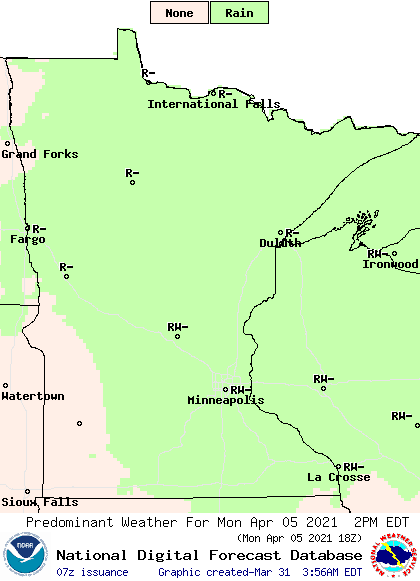
Then scattered showers and possibly storms could pass through the state midweek.
We’ll keep you posted on the potential timing and amounts as next week approaches, but any precipitation would be very beneficial to the dry conditions Minnesota has been experiencing.
Programming note
You can hear my live weather updates on Minnesota Public Radio at 7:49 a.m. Monday through Friday morning.

