
Temperatures climb as we head toward the weekend
Any rumors of snow are just April Fools' jokes
Go Deeper.
Create an account or log in to save stories.
Like this?
Thanks for liking this story! We have added it to a list of your favorite stories.


Weather across Minnesota goes from seasonable Thursday to soaring 20 to 30 degrees above average by the weekend, but it also elevates fire concerns.
Thursday’s forecast
Under the influence of high pressure, much of Minnesota saw clear skies and light to calm winds Wednesday night. Those conditions allowed temperatures to really drop, so Thursday started with most of the Arrowhead in the single digits, ranging to a couple low 20s in southern Minnesota.
With skies remaining mostly clear, the state will see plenty of sunshine through the day, helping highs to warm into the 40s for the majority of the state, which is about average for early April.
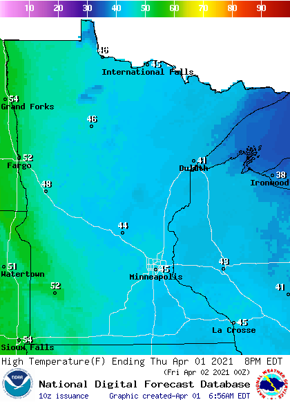
The one exception is western Minnesota’s high in the 50s, fueled by gusty winds from the south that increase in the afternoon, with gusts over 30 mph expected. The combination of low humidity, higher temperatures and gusty winds puts the northwestern corner of the state back in a red flag warning as the fire risk rises.
Turn Up Your Support
MPR News helps you turn down the noise and build shared understanding. Turn up your support for this public resource and keep trusted journalism accessible to all.
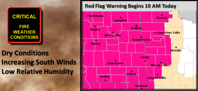
While the Thursday forecast above is the real one, remember Thursday is also April Fools’ Day, and weather jokes can be prime material.
So, keep your eyes out for any forecasts that do not seem quite right, like this joke from the Duluth National Weather Service:
Weekend warmup
By Friday, the breezy winds from the south pick up across all of Minnesota, with gusts over 30 mph at times.
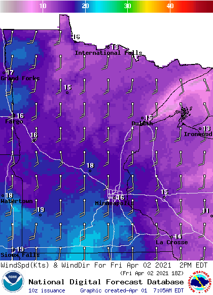
That warm flow pushes highs back into the 50s north and 60s south and west, but it also keeps the fire concerns elevated.
Saturday and Sunday turn even milder, with more 60s across the state and 70s south.
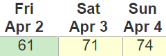
Western Minnesota may even see a couple 80s, particularly on Sunday.
Here is that forecast for the Twin Cities:
Rain returns
An updated drought monitor came out Thursday morning, capturing the soaking rain that parts of Minnesota saw March 23-24. Where the heaviest rain fell during that event, which was a corridor from about Mankato through the Twin Cities and up toward Duluth, there was enough precipitation to finally lift that area out of “abnormally dry” conditions.
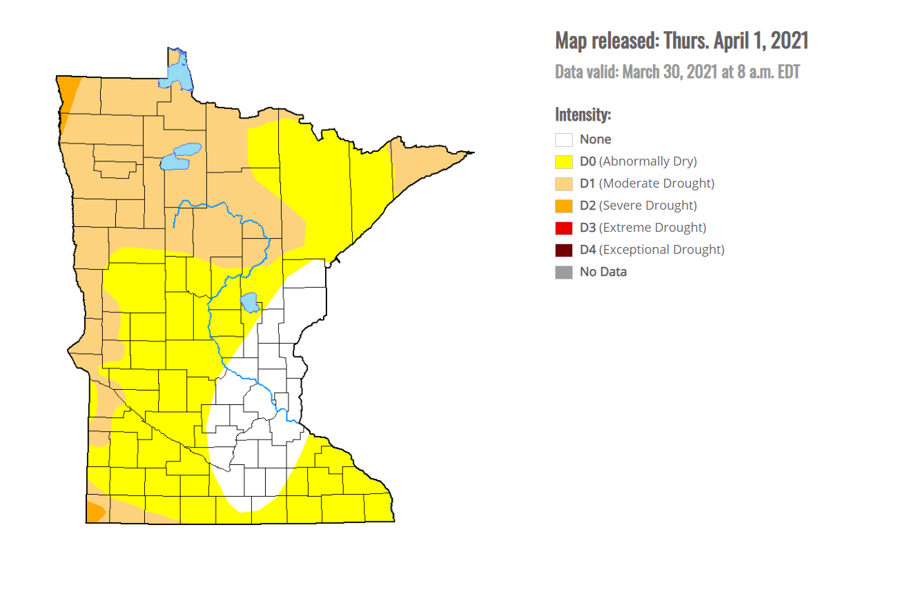
However, the rest of the state remains in dry or even drought conditions.
Next week could help with that, as a pattern shift brings rain chances to at least portions of Minnesota almost every day, beginning on Monday.
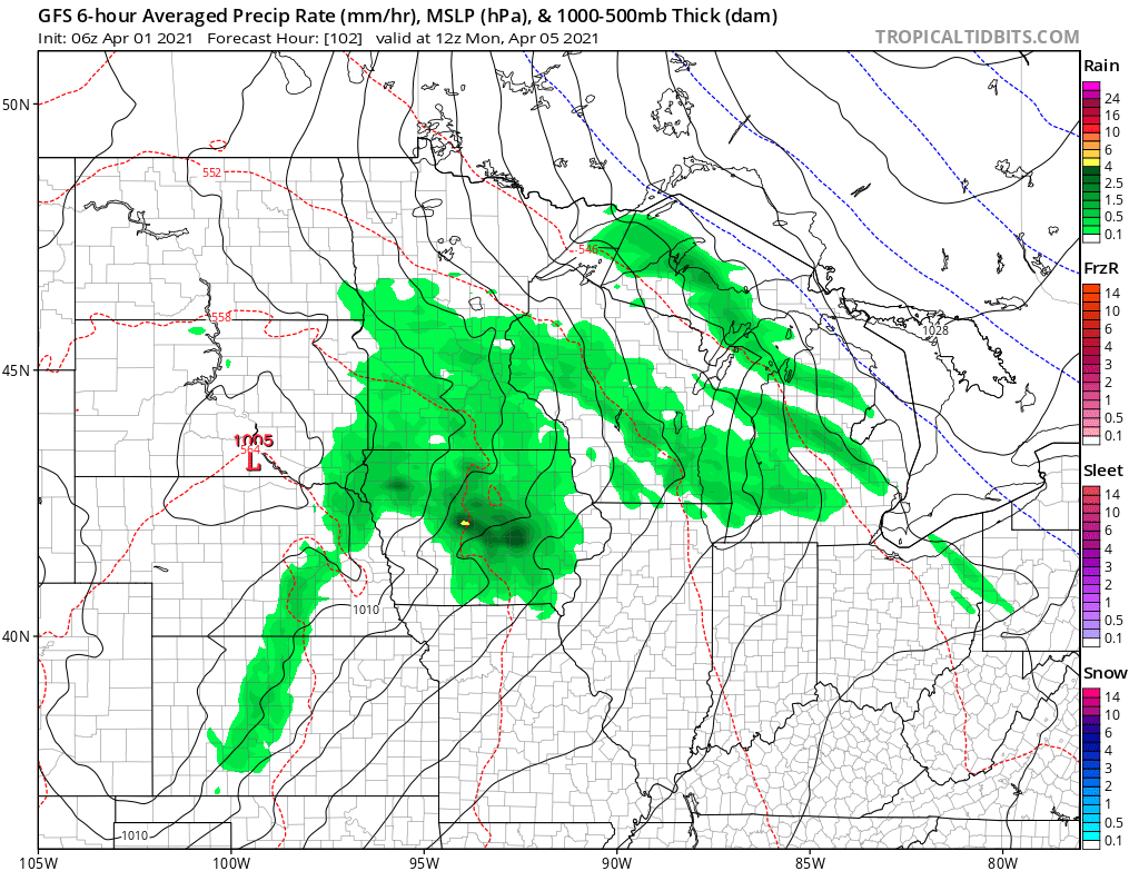
While some of the rain will only be spotty, there may be a midweek storm that brings more widespread rain. We will monitor that potential, but at the very least, most of the state should get some needed precipitation next week!
Programming note
You can hear my live weather updates on Minnesota Public Radio at 7:49 a.m. Monday through Friday morning.

