
Near-record temperatures for Easter
Dry and windy conditions increase fire concerns again
Go Deeper.
Create an account or log in to save stories.
Like this?
Thanks for liking this story! We have added it to a list of your favorite stories.


Temperatures climb through the weekend, with isolated record highs possible early next week. Then a pattern shift ends our dry trend and brings widespread rain chances back.
Friday’s forecast
Ahead of a strong warm front, Minnesota started very mild Friday morning, with most temperatures in the 30s.
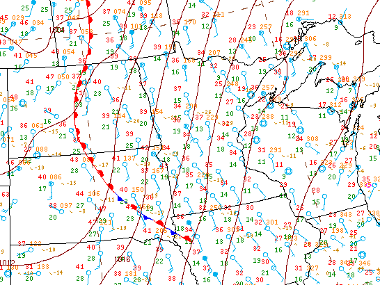
That southerly flow is already breezy Friday morning, and winds increase during the day, with gusts expected to top 30 mph in the afternoon. Combined with dry conditions and relative humidities that will go as low as 20 to 30 percent in the afternoon, fire conditions will be elevated again on Friday.
However, those same conditions keep Minnesota mostly sunny Friday, and push temperatures back above average. Highs will be predominantly in the 50s north, with 60s south and west.
Turn Up Your Support
MPR News helps you turn down the noise and build shared understanding. Turn up your support for this public resource and keep trusted journalism accessible to all.

Weekend warmth
Temperatures turn even milder over the weekend, with most of the state in the 60s north and 70s south by Saturday.
Highs nudge slightly warmer yet on Sunday, especially in southern Minnesota, where a few 80s are possible southwest.
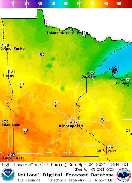
Similar warmth continues Monday.
It is possible a few records could be set around Minnesota, especially Sunday or Monday. For example, the record highs in the Twin Cities are respectively 81 and 80 for Sunday and Monday (April 4 and 5), so forecast highs in the mid- to upper 70s fall just shy of the record. But, it is likely some part of Minnesota will get just warm enough to hit a record. That’s a big contrast from last year’s Easter Sunday, when Minnesota was dealing with a snowstorm!
Wetter next week
Conditions remain dry and mostly sunny through the weekend, then spotty rain chances and perhaps isolated storms return by Monday. Although the precipitation early in the week currently looks sparse, weather models are showing more consistency that a persistent rain could move-in by Wednesday.
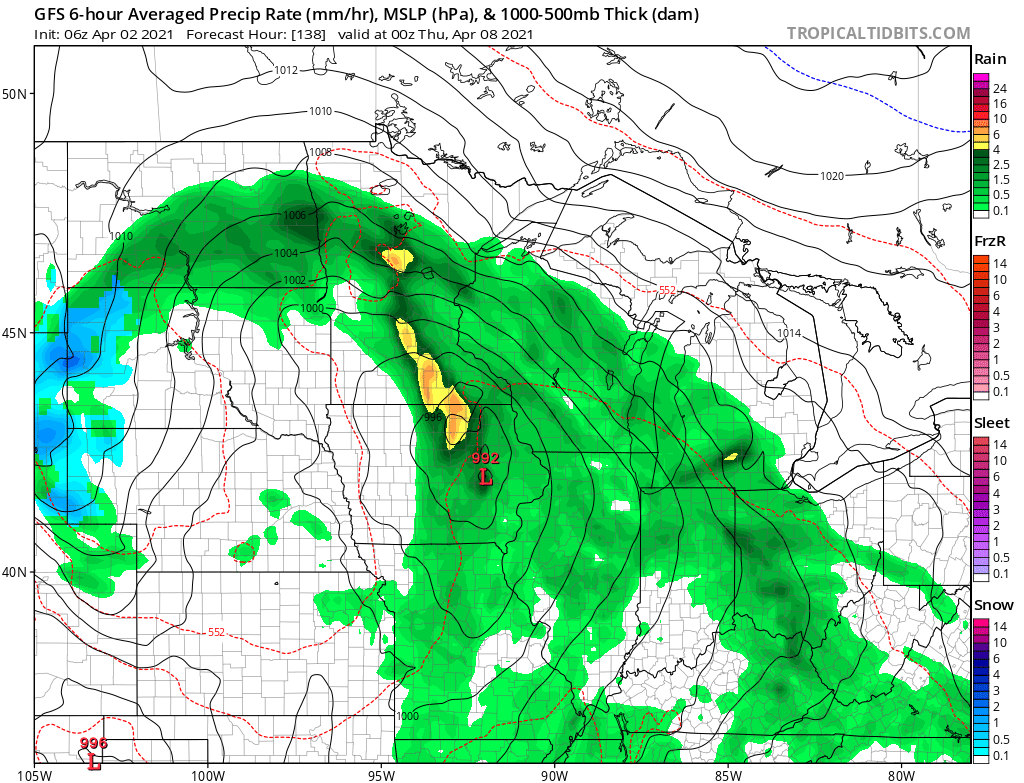
That would lead to wet weather Wednesday, Thursday and possibly into Friday. Any rain would be very beneficial given the dry conditions across most of the state.
That wetter pattern will also end our trend of near-record warm weather, and is likely to bring temperatures back to more seasonable highs in the 40s and 50s by midweek.
Programming note
You can hear my live weather updates on Minnesota Public Radio at 7:49 a.m. Monday through Friday morning.

