Beautiful, sunny Saturday; very warm Easter Sunday
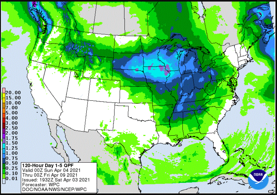
Forecast precipitation amounts through 7 p.m. next Thursday
NOAA Weather Prediction Center
Go Deeper.
Create an account or log in to save stories.
Like this?
Thanks for liking this story! We have added it to a list of your favorite stories.
