
An additional 2 to 3 inches of rain expected for parts of Minnesota
Drier weather finally returns Saturday
Go Deeper.
Create an account or log in to save stories.
Like this?
Thanks for liking this story! We have added it to a list of your favorite stories.


Gray skies along with rain and thunderstorms continue through Friday, then more sunshine returns in time for the weekend.
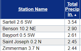
So far, the storm that started pushing rain into the state Tuesday has already produced some impressive rainfall totals across Minnesota. Here are the highest reports as of 8:30 a.m. Wednesday:
Most totals around the Twin Cities have been between 1 and 2 inches as of Wednesday morning.
Wednesday’s forecast

That storm system now slides south of the state during the day Wednesday.
Turn Up Your Support
MPR News helps you turn down the noise and build shared understanding. Turn up your support for this public resource and keep trusted journalism accessible to all.
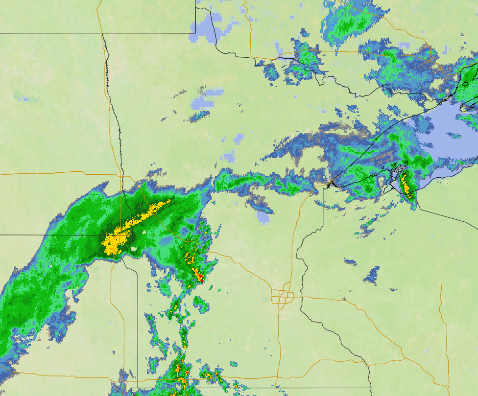
This keeps periods of showers and storms moving across the state throughout the day. As of 9 a.m., there is widespread rain across the Arrowhead, with scattered showers and storms extending to the southwest corner of the state.
The cloud cover and moisture kept temperatures from dropping much overnight, so morning temperatures were mostly in the 40s north and 50s south, which is closer to average highs for this time of year.
However, temperatures do not rise much, especially in north central Minnesota, where some of the heavier rain is expected to fall Wednesday. In that area, where new rainfall could total over an inch, temperatures are likely to stay stuck in the 40s.

Meanwhile, southeastern Minnesota sees more dry breaks, especially in the morning, and could make it into the low 70s.
Rain continues
Although Wednesday is likely to be the soggiest day of this event, the rain stays very persistent Thursday, too. The rain slowly becomes spottier and lighter through the day Friday and is currently forecast to clear out by Saturday morning.
Most of Minnesota can expect at least another inch of additional rainfall through Friday night, and portions of northern and central Minnesota could see between 1 and 3 inches, with localized higher amounts with thunderstorms.
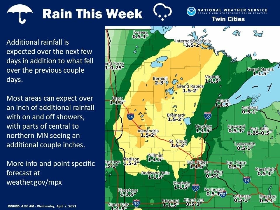
This will be very beneficial, especially in northern and western portions of the state, where some areas have been in drought conditions.
Weekend forecast
After the rain moves out, skies start to clear Saturday, with more sunshine by the end of the day. Sunday also starts sunnier, but more clouds move back in the afternoon as a light rain chance returns, especially for northern Minnesota.
Temperatures the rest of the week stay more seasonably cool with the clouds and rain, with highs mostly in the 40s and 50s, although southeastern Minnesota could still hang on to a few 60s Thursday.
The return of more sunshine over the weekend helps temperatures rebound slightly by Sunday, with above average 50s and 60s.
Programming note
You can hear my live weather updates on Minnesota Public Radio at 7:49 a.m. Monday through Friday morning.

