
Weekend forecast: Saturday a.m. shower chance; sunniest day is Sunday
Weekend temps near normal
Go Deeper.
Create an account or log in to save stories.
Like this?
Thanks for liking this story! We have added it to a list of your favorite stories.


April brings us some splashes of color. I was driving along Minnehaha Parkway in Minneapolis Tuesday afternoon and saw this blanket of blue flowers:

I took a closer look:

This appears to be Siberian squill, which some online sites describe as an invasive plant species.
A variety of additional colors were spotted Tuesday, and I’ve noticed that many magnolia trees are flowering right now. I haven’t seen any dandelions yet, but they’ll arrive before long.
Turn Up Your Support
MPR News helps you turn down the noise and build shared understanding. Turn up your support for this public resource and keep trusted journalism accessible to all.
The weekend
There could be a few lingering showers in eastern Minnesota and western Wisconsin Saturday morning. The National Oceanic and Atmospheric Administration’s North American Mesoscale (NAM) forecast model shows the potential precipitation pattern on Saturday:
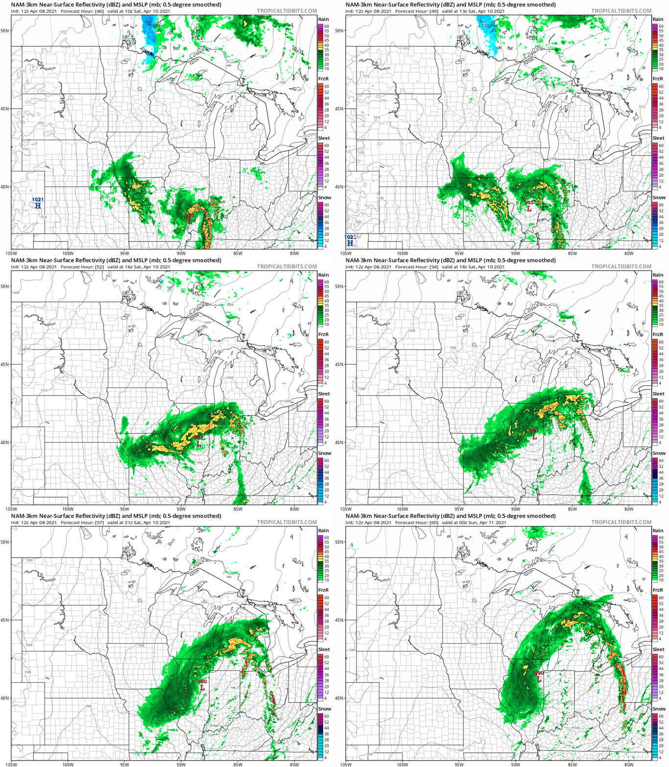
The best chance of showers in Minnesota Saturday morning will be in the northeast, and some spots in northeastern Minnesota could also see a few wet flakes. A few Saturday morning sprinkles are possible in the Twin Cities and west-central Wisconsin. Note the steady rain in southeastern Wisconsin in the NAM loop.
Western Minnesota will have the most Saturday sunshine. The NAM model shows the potential cloud cover as we go through Saturday:
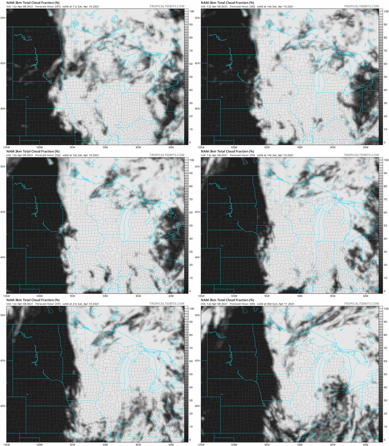
The clouds will lift of to the northeast on Sunday, with the clouds slowest to clear out in northeastern Minnesota. The Twin Cities metro area should see plenty of Sunday sunshine.
You can hear updated weather information for Minnesota and western Wisconsin on the MPR network, and you’ll see updated weather info on the MPR News live weather blog.
Weekend temps and winds
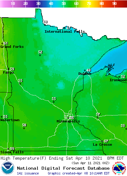
Our average April 10 high temp in the Twin Cities is 55 degrees. We’ll top out in the mid-50s this Saturday. Most of Minnesota and western Wisconsin will have Saturday highs in the 50s, with 40s in north-central and northeastern Minnesota:
Saturday will be breezy, with gusts in the 15-20 mph range:
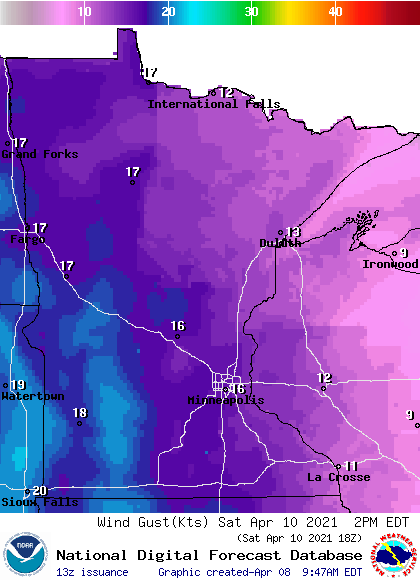
Plotted gusts are in knots, with 16 knots equal to 18.4 mph. Gusts over 20 mph are possible in southwestern Minnesota.
Back to temperatures, Sunday highs will be in the 60s south, with 50s in northern Minnesota:
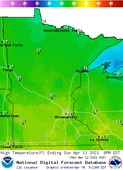
The metro area will probably top out in the lower 60s Sunday afternoon, and winds will be light.
Programming note
You can hear my live weather updates on MPR News at 7:35 a.m., 9:35 a.m. and 4:39 p.m. each Saturday and Sunday.

