
Chilly, damp weekend; temperatures turn higher Monday
Light snow possible over the weekend
Go Deeper.
Create an account or log in to save stories.
Like this?
Thanks for liking this story! We have added it to a list of your favorite stories.


A wetter pattern returns for Minnesota through the middle of next week. Meanwhile, temperatures continue their recent roller-coaster trend, going from chilly over the weekend to possible 70s Monday.
Friday’s forecast
A cold front is moving into Minnesota and has already pushed through the northwestern corner of the state as of 9 a.m. This is bringing a contrast in morning temperatures, with 30s behind the front, while the majority of Minnesota has stayed milder and in the 40s.
The change in the weather pattern also means the mostly sunny skies of Thursday have been replaced with scattered areas of predominantly light rain.
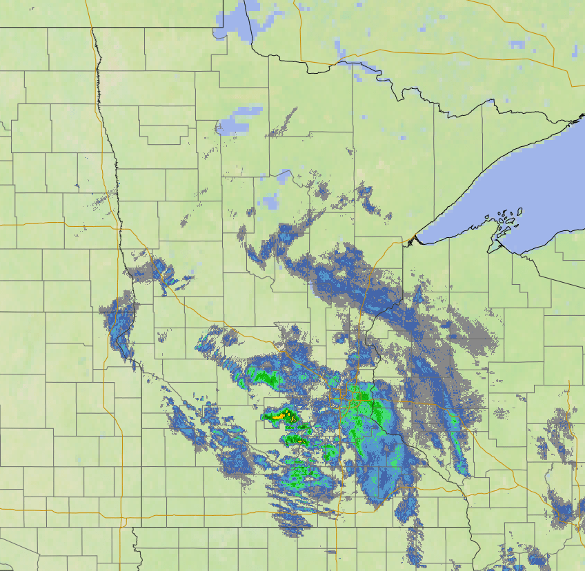
The front slowly travels across the state through the day, likely moving through the Twin Cities Friday evening, and clearing out of the southeastern corner of the state late Friday.
Turn Up Your Support
MPR News helps you turn down the noise and build shared understanding. Turn up your support for this public resource and keep trusted journalism accessible to all.
This keeps rain chances around through the day, although totals stay limited with most of the state expected to see under one-tenth of an inch of rain. Light snow could mix in north, especially late Friday.
Because the front goes through southern Minnesota later, that area makes it into the 50s for highs, while chillier 40s are expected north.

A chilly weekend
Saturday turns even chillier, with southern Minnesota struggling to make it to 50, and most of the state stuck in the 40s.
Any lingering precipitation from Friday front exits Saturday morning, but that could include continued light snow or flurries north. By Saturday afternoon, some sunshine returns.
Precipitation is already back Sunday, with a more active weather pattern that lasts at least through the middle of next week. This also brings back cloudier skies, which keep more of the state stuck in the 40s for highs Sunday.
The cooler temperatures mean that in the early morning Sunday, precipitation could come as light snow, then spotty light rain showers the rest of the day.
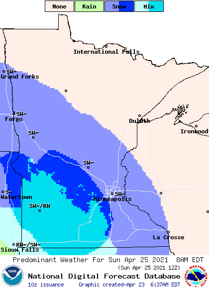
It will also be breezy Sunday, and those cool, breezy, and wet conditions could make the day feel somewhat raw.
Extended forecast
By Monday, temperatures take another dramatic turn as highs for most of Minnesota soar back into the 50s and 60s, with 70s south.
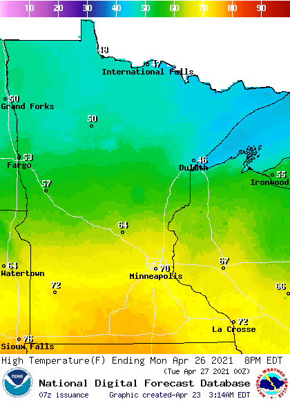
The dynamic weather does mean thunderstorms are likely Monday, and we are monitoring a possibility for strong storms. Highs Tuesday finally return a little closer to late April averages again, with 50s north and a few 60s south expected.
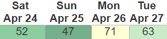
Here is that temperature trend for the Twin Cities showing the broad fluctuation in high temperatures:
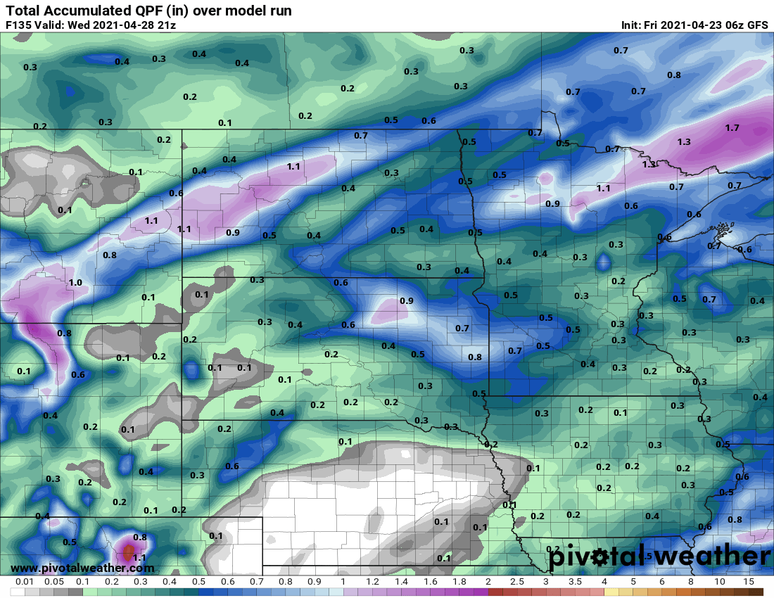
It currently appears like the soggier pattern that returns on Sunday brings periods of precipitation through at least Wednesday. Most of the state will see at least one-quarter inch of rain through Wednesday, with higher amounts forecast in northern Minnesota.
Programming note
You can hear my live weather updates on Minnesota Public Radio at 7:49 a.m. Monday through Friday morning.

