
Chilly and breezy Sunday; periods of rain and snow in many areas
Much warmer Monday
Go Deeper.
Create an account or log in to save stories.
Like this?
Thanks for liking this story! We have added it to a list of your favorite stories.


Wasn’t it great to see the sunshine return Saturday afternoon? It was still cool, but at least it was bright!
The highest temp at Minneapolis-St. Paul International Airport Saturday afternoon was 50 degrees. That’s well below our average April 24 Twin Cities high of 62 degrees. We’ll be even cooler on Sunday.
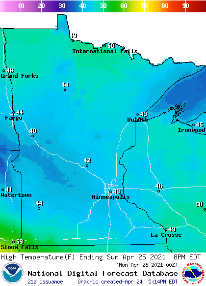
Minnesota and western Wisconsin highs will be mainly in the 40s on Sunday:
Winds will pick up by Sunday afternoon, with gusts in the 16-22 mph range in many locations and gusts close to 30 mph in southwestern Minnesota:
Turn Up Your Support
MPR News helps you turn down the noise and build shared understanding. Turn up your support for this public resource and keep trusted journalism accessible to all.

Plotted gust forecasts are in knots, with 18 knots equal to 20.7 mph and 27 knots equal to 31 mph.
Rain and snow chances Sunday
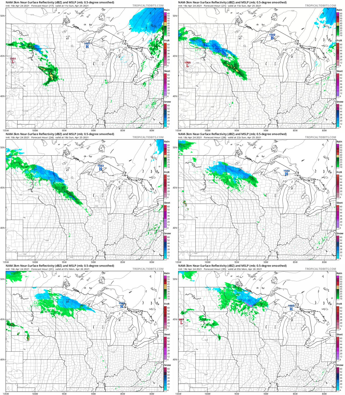
Periods of rain and snow are expected in Minnesota and western Wisconsin Sunday and Sunday evening. Parts of west-central and southwestern Minnesota could see an inch or more of snow on grassy areas on Sunday. The Twin Cities metro area looks dry most of Sunday morning, then a rain/snow mix is possible late Sunday morning followed by periods of mainly rain Sunday afternoon. In northeastern Minnesota, the rain/snow mix holds off until late Sunday afternoon, then it’ll continue into Sunday evening.
The National Oceanic and Atmospheric Administration’s North American Mesoscale (NAM) forecast model shows the potential precipitation pattern Sunday and Sunday evening:
You can hear updated weather information for Minnesota and western Wisconsin on the MPR network, and you’ll see updated weather info on the MPR News live weather blog.
Temperature trends
Southerly winds and much warmer temps are expected on Monday, with highs in the 70s in southern Minnesota, 60s in central Minnesota and 50s and 40s in northern Minnesota.
Twin Cities metro area highs are projected to reach about 70 degrees on Monday, followed by lower 60s Tuesday, mid 60s Wednesday and Thursday and upper 60s on Friday.
Above normal-temps may be with us next weekend into the start of the following week. The NWS Climate Prediction Center is now showing a slight tendency for above-normal temps in our neck of the woods from April 30 through May 4:
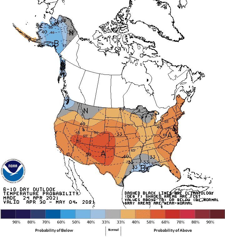
Our average Twin Cities high temperature on April 30 is 65 degrees.
Programming note
You can hear my live weather updates on MPR News at 7:35 a.m., 9:35 a.m. and 4:39 p.m. each Saturday and Sunday.

