
Chilly Sunday; periods of rain, mixed with snow in some areas
Gusty winds by afternoon
Go Deeper.
Create an account or log in to save stories.
Like this?
Thanks for liking this story! We have added it to a list of your favorite stories.


A low pressure system will spread moisture across Minnesota and western Wisconsin as we go through Sunday and Sunday evening.
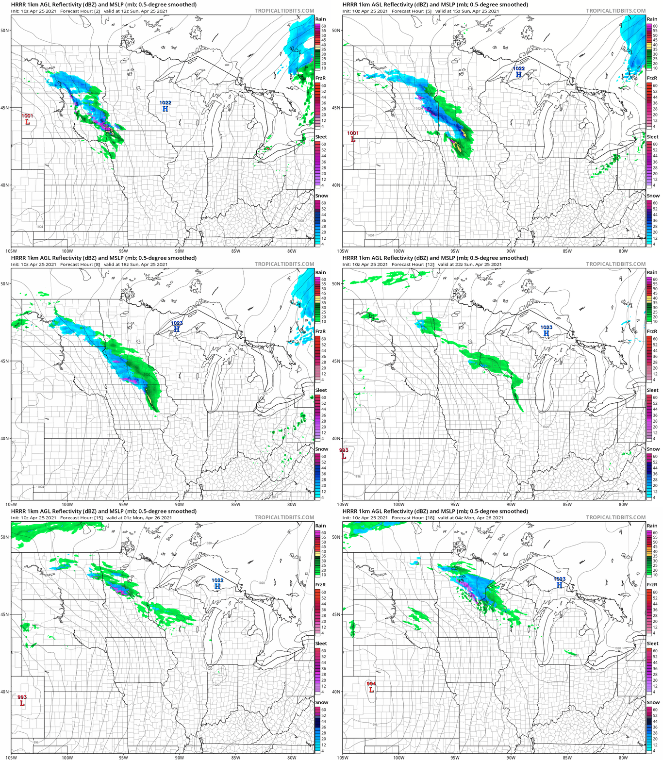
Parts of west-central and southwestern Minnesota could see some snow accumulation on grassy areas this Sunday. The Twin Cities 7-county metro area looks dry most of Sunday morning, then a rain/snow mix is possible late Sunday morning followed by periods of mainly rain Sunday afternoon. In northeastern Minnesota, the rain/snow mix holds off until late Sunday afternoon, then it’ll continue into Sunday evening and change to all snow overnight.
The National Oceanic and Atmospheric Administration’s High Resolution Rapid-Refresh (HRRR) forecast model shows the potential precipitation pattern Sunday and Sunday evening:
You can hear updated weather information for Minnesota and western Wisconsin on the MPR network, and you’ll see updated weather info on the MPR News live weather blog.
Turn Up Your Support
MPR News helps you turn down the noise and build shared understanding. Turn up your support for this public resource and keep trusted journalism accessible to all.
Temps and winds
Our average April 25 Twin Cities high temperature is 63 degrees. The metro area will share highs in the 40s with most of Minnesota this Sunday:
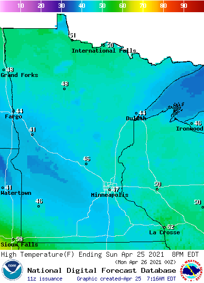
Parts of western Wisconsin could top 50.
Winds will pick up by Sunday afternoon, with gusts in the 16-22 mph range in many locations and gusts around 30 mph in southwestern Minnesota:
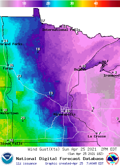
Plotted gust forecasts are in knots, with 18 knots equal to 20.7 mph and 29 knots equal to around 33 mph.
Updates
This Updraft blog will be updated around 10:15 a.m. with updated Sunday forecast details plus a look at the week ahead.
Programming note
You can hear my live weather updates on MPR News at 7:35 a.m., 9:35 a.m. and 4:39 p.m. each Saturday and Sunday.

