
A few stronger storms likely Tuesday
Highs in the 70s by the weekend
Go Deeper.
Create an account or log in to save stories.
Like this?
Thanks for liking this story! We have added it to a list of your favorite stories.


Wet weather lingers through Wednesday, with a few hail-producing storms expected Tuesday. Warmer temperatures return by the weekend, with 70s in the forecast.
Tuesday’s forecast
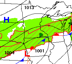
The same stationary front that brought Minnesota a wet day Monday is bringing more wet weather Tuesday. It has also led to widespread areas of fog that will lift through the morning.
With the front south of the state, southern Minnesota will get more of the rain Tuesday, including rainfall totals of one-tenth to a quarter of an inch and higher amounts with thunderstorms.
Some thunderstorms will develop, especially in the afternoon, and southern Minnesota may see a few storms produce large hail.
Turn Up Your Support
MPR News helps you turn down the noise and build shared understanding. Turn up your support for this public resource and keep trusted journalism accessible to all.
Here is forecast timing of that rain and thunderstorm activity:
Under widespread cloud cover, morning temperatures started in the 30s north and 40s south, which is seasonable for late April.
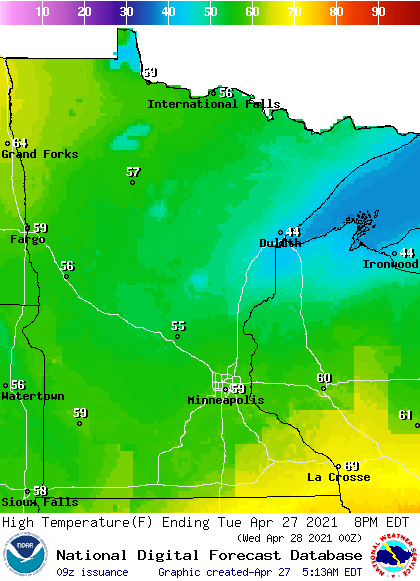
Unlike Monday, where highs varied from 30s in the Arrowhead to 70s southwest, temperatures will be much more consistent Tuesday afternoon, with most of Minnesota in the 50s.
Extended forecast
Rain lingers Wednesday, especially in the morning hours, although thunderstorms will be far less probable. Much of Minnesota will make it into the 60s, and more sunshine makes an appearance by the afternoon.
A disturbance moves through Thursday that could bring a few light showers, especially for northern Minnesota.
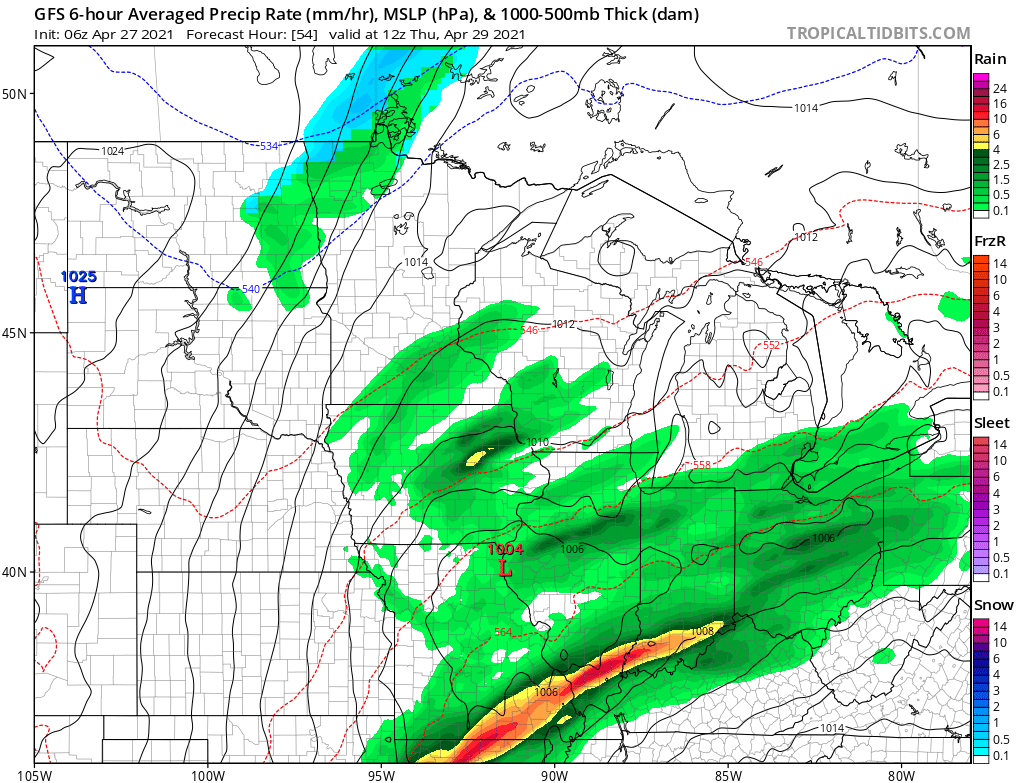
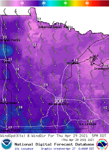
However, the day will still be predominantly dry with a fair amount of sunshine. Much of the state will drop back into the 50s, with a few 60s south, and it will be breezy, making it feel cooler.
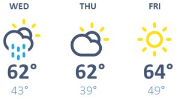
Friday brings dry and mostly sunny skies, with highs in the 50s and 60s. Here is that temperature trend for the Twin cities through Friday:
Temperatures soar over the weekend, with almost the entire state seeing highs in the 60s, and 70s are likely for southern and western Minnesota.
A few scattered shower or storms are possible, especially on Sunday, but there will also be plenty of dry and sunny breaks over the weekend to enjoy outdoor activities!
Programming note
You can hear my live weather updates on Minnesota Public Radio at 7:49 a.m. Monday through Friday.

