
Morning sprinkles, then more sunshine Thursday
Winds turn breezier by the afternoon
Go Deeper.
Create an account or log in to save stories.
Like this?
Thanks for liking this story! We have added it to a list of your favorite stories.


A weather system moving across Minnesota is bringing light rain and windier conditions Thursday, but plenty of sunshine also stays in the forecast.
Thursday’s forecast
A cold front moved through most of the state overnight, and as of 7 a.m. it has already passed through much of northern and central Minnesota, and extends from the eastern Arrowhead, through the Twin Cities, and across the southwestern corner of the state. It will continue to clear south of the state by midday.
A few light rain showers and sprinkles are moving with the front as it passes through.
Despite that weather system, morning temperatures are seasonable, with most of Minnesota in the 40s and a few 30s north.
Cooler air behind the front drops northern Minnesota back into the 50s for highs versus Wednesday’s mild 60s and a few 70s. Southern Minnesota keeps highs in the 60s.
Turn Up Your Support
MPR News helps you turn down the noise and build shared understanding. Turn up your support for this public resource and keep trusted journalism accessible to all.

Skies remain mostly sunny except for places yet to see the front go through, then there are briefly more clouds and light rain.
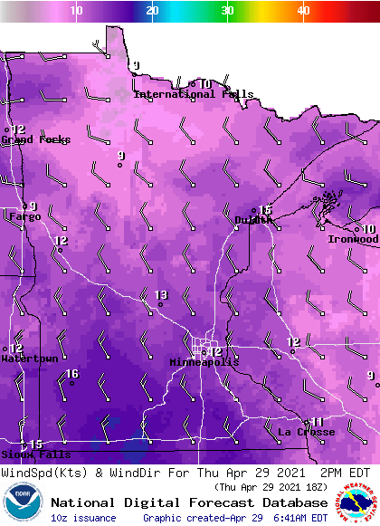
Winds are breezier behind the front, so most of Minnesota can expect gusts over 20 mph by the afternoon.
Highs will be similar Friday, then temperatures soar by Saturday. That extended forecast will be updated around 9 a.m.
Programming note
You can hear my live weather updates on Minnesota Public Radio at 7:49 a.m. Monday through Friday morning.

