
A summery first day of May
Daylight hours dry in most areas
Go Deeper.
Create an account or log in to save stories.
Like this?
Thanks for liking this story! We have added it to a list of your favorite stories.


Our average Twin Cities high temperature is 65 degrees on May 1. The Twin Cities metro area will top out in the middle 80s this Saturday afternoon. Roughly the southern two-thirds of Minnesota, plus west-central and southwestern Wisconsin, will have Saturday highs in the 80s:
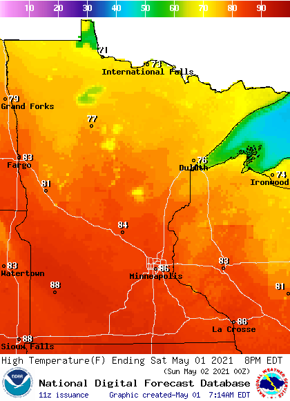
Most of northern Minnesota will have Saturday highs in the 70s.
Saturday afternoon wind gusts will be in the 16 to 22 mph range in many areas:
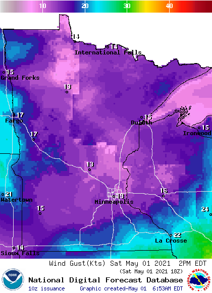
Plotted forecast gusts are in knots, with 15 knots equal to 17.3 mph.
Turn Up Your Support
MPR News helps you turn down the noise and build shared understanding. Turn up your support for this public resource and keep trusted journalism accessible to all.
Elevated fire weather conditions
Warm temps, low relative humidity and gusty winds will elevate the danger of wildfire spread this afternoon and evening. Here’s a note from the NWS:
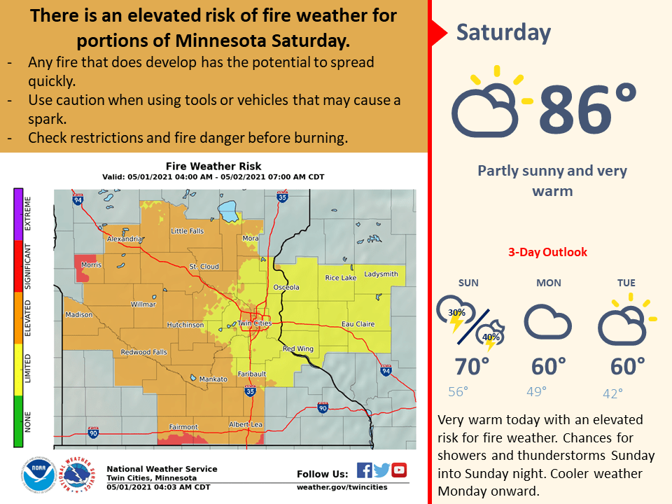
The shaded counties are the counties for which the Twin Cities NWS office issues forecasts and warnings.
You can hear updated weather information for Minnesota and western Wisconsin on the MPR network, and you’ll see updated weather info on the MPR News live weather blog.
Updates
This Updraft blog will be updated around 10:15 a.m. with Sunday forecast details plus a look at the week ahead.
Programming note
You can hear my live weather updates on MPR News at 7:35 a.m., 9:35 a.m. and 4:39 p.m. each Saturday and Sunday.

