
Cooler temperatures settle in across Minnesota
More sunshine by Tuesday as rain chances stay sparse
Go Deeper.
Create an account or log in to save stories.
Like this?
Thanks for liking this story! We have added it to a list of your favorite stories.


Below-average temperatures return across Minnesota and likely linger into next week. Meanwhile, precipitation chances stay limited.
Monday’s forecast
A weather system passed through Minnesota Sunday, moderating Saturday’s warmth and bringing predominantly light rain with it.
Some of that rain is still lingering in northern and southeastern Minnesota as of Monday morning. Those rain areas slowly diminish through the day, while the rest of the state stays mostly cloudy with a few breaks of sunshine.
There are also gusty winds behind that storm, so particularly southern Minnesota can expect gusts over 30 and even 40 mph into the afternoon.
Turn Up Your Support
MPR News helps you turn down the noise and build shared understanding. Turn up your support for this public resource and keep trusted journalism accessible to all.

Because of the clouds and moisture, temperatures stayed mild overnight, so much of Minnesota is starting Monday with above average lows in the 40s and 50s.
However, temperatures do not warm too much during the day, with almost all of the state in the 50s with a few low 60s south.

This puts all of Minnesota back below average highs. Most of Minnesota now has average highs in the 60s, including a “normal” of 66 in the Twin Cities for May 3.
Monday’s temperatures will also be appreciably cooler than the 70s and 80s the state saw over the weekend. For example, International Falls, on the Canadian border, went from a high of 72 Sunday to a forecast of 49 Monday — a noticeable change.
Cooler weather prevails
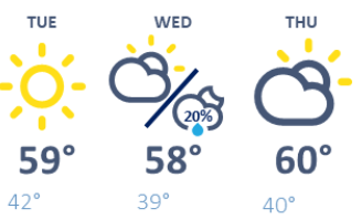
That cooler than average weather hangs on for what may be an extended period. Most of Minnesota is expected to stay in the 50s at least through Wednesday, with a few more 60s south as we get closer to the weekend.
Here is that forecast for the Twin Cities through Thursday:
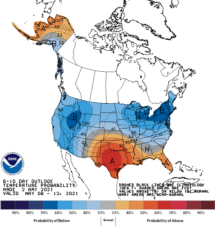
The trend of temperatures running about 5 to 10 degrees below average is likely to continue through at least early next week.
However, with limited precipitation chances in the upcoming week, those 50s and low 60s come with ample sunshine most days, keeping it comfortable for many outdoor activities.
The next rain chance is a minor one, with light rain possible Wednesday afternoon into the overnight, especially in southern Minnesota.
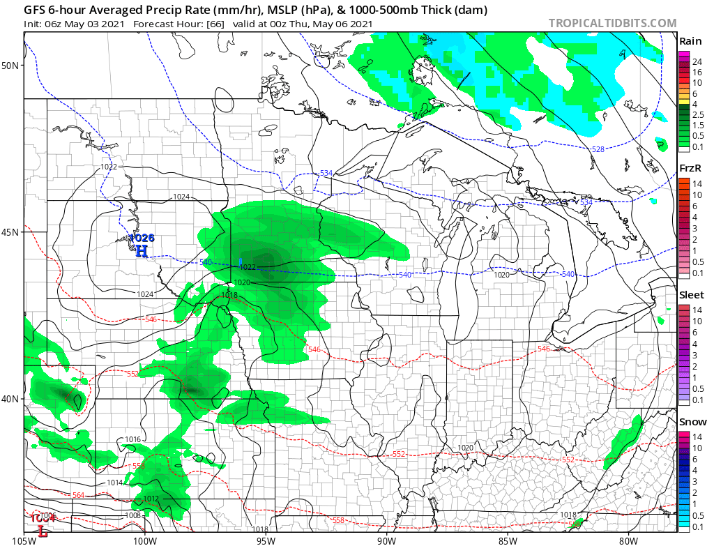
It looks like another area of rain showers could move across all of the state on Saturday, but that too is currently forecast to remain light.
Programming note
You can hear my live weather updates on Minnesota Public Radio at 7:49 a.m. Monday through Friday morning.

