
Frosty mornings ahead for much of Minnesota
Southern Minnesota sees mid-week rain
Go Deeper.
Create an account or log in to save stories.
Like this?
Thanks for liking this story! We have added it to a list of your favorite stories.


Minnesota temperatures stay slightly below average over the next week, and much of the state could see morning frost. Rain chances are limited but include some wet weather by Wednesday.
Tuesday’s forecast
Tuesday is off to a mostly sunny start for the majority of Minnesota and stays sunny through the day. The one exception is a few more clouds and a couple sprinkles in the Arrowhead that clear out during the morning, with more sunny breaks into the afternoon.
Morning temperatures were seasonably cool, with 30s north and a few more 40s south. However, western Minnesota was a little chillier than average for early May, with a few frosty 20s.
Highs also stay 5 to 10 degrees below average, with most of the state seeing afternoon temperatures in the 50s.

Staying cooler
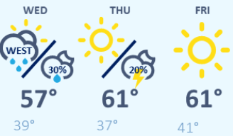
The slightly below average temperature trend is likely to continue for much of the next week, with most of Minnesota seeing highs in the 50s, with occasional low 60s south.
Here is that forecast for the Twin Cities through Friday:
Turn Up Your Support
MPR News helps you turn down the noise and build shared understanding. Turn up your support for this public resource and keep trusted journalism accessible to all.
Another side of that cool trend is chilly mornings. Particularly Wednesday and Thursday morning, most of Minnesota will be in the 30s with a few 20s north and west.
That could mean widespread areas of frost, even for portions of the Twin Cities metro region.
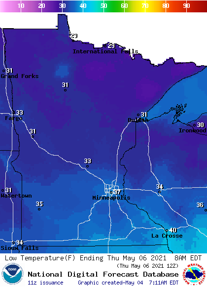
If you are wondering how the parts of the Twin Cities and other areas could get frost even with lows forecast to remain above freezing, remember that forecasts are for air temperature and those temperature readings often occur 5 to 10 feet above the ground.
So, the air temperature could be in the mid to upper 30s, while the ground temperature still drops to 32 or colder, producing frost. This is also influenced by local geography; for example a valley might be more likely to frost than a hillside.
Rain chances
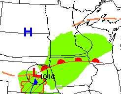
Precipitation looks limited in the week ahead, although there is already a chance for light rain in southern Minnesota Wednesday, as a storm passes to our south. The timing of that brings light rain into Minnesota Wednesday morning and out by early Thursday.
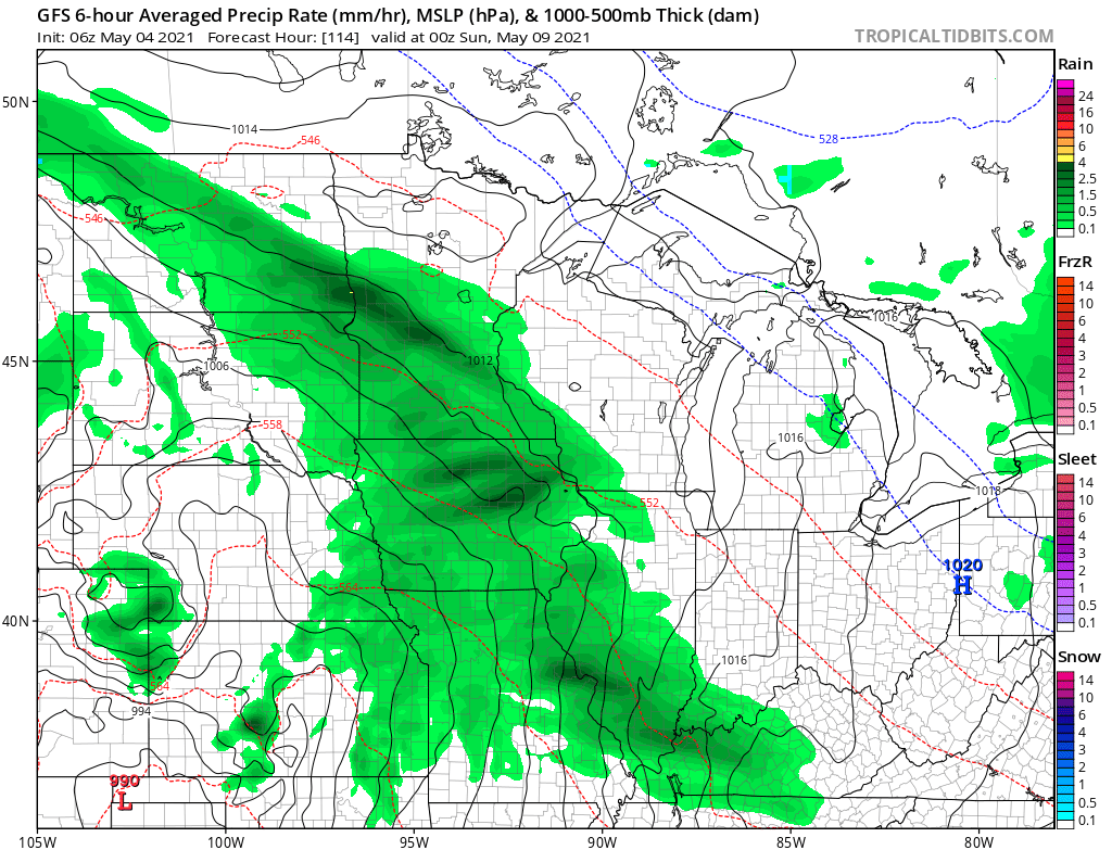
There could be some spotty activity late Thursday or Friday, then a more widespread rain chance returns Saturday into Sunday, although it currently looks like that may be predominantly lighter rain also.
Programming note
You can hear my live weather updates on Minnesota Public Radio at 7:49 a.m. Monday through Friday morning.

