
After a wet and stormy Thursday, Minnesota sees more dry breaks to start the weekend
Isolated severe weather is possible again Thursday and Friday
Go Deeper.
Create an account or log in to save stories.
Like this?
Thanks for liking this story! We have added it to a list of your favorite stories.


A wet pattern keeps Minnesota humid through early next week, with periods of showers and storms. Some of those storms may become severe, especially on Thursday.
Thursday’s forecast
A pattern of moisture flowing directly up from the Gulf of Mexico already brought increasing showers and storms Wednesday, and Thursday is likely to be even wetter for more of Minnesota.
Already as of 9 a.m., there were scattered rain showers around the state.
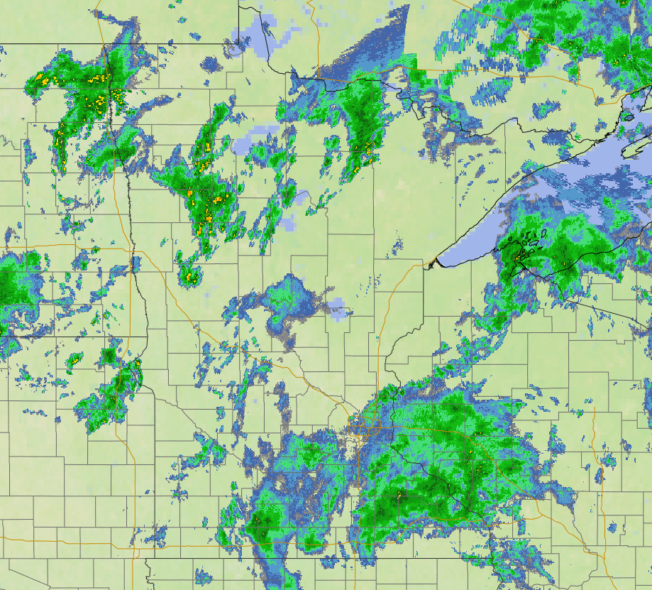
As the day progresses, a few thunderstorms are also forecast to develop, and some of them are likely to be strong.
Turn Up Your Support
MPR News helps you turn down the noise and build shared understanding. Turn up your support for this public resource and keep trusted journalism accessible to all.

Large hail and highs winds are the primary threat, but isolated tornadoes are also possible, similar to what southern Minnesota saw Wednesday.
Most of Minnesota is under a “marginal” risk area Thursday (shown in dark green), due to this possibility.
Meanwhile, the southerly wind flow associate with the current pattern keeps temperatures mild. Morning lows are well above average in the 60s, and although the state does not warm much due to the moisture and cloud cover, highs in the 70s are still slightly above average.

It remains humid throughout the day, even during breaks in the rain.
Staying wetter
The moisture flow from the gulf becomes less direct after Thursday, so the wet weather becomes spottier Friday, with breaks of sunshine returning. An isolated severe weather risk remains, especially for the southeastern corner of the state.
Saturday also brings spottier showers and storms with more sunny breaks.
However, Sunday and Monday look likely to turn cloudier and wetter again. Through Monday, much of Minnesota can expect at least an additional inch of rain.
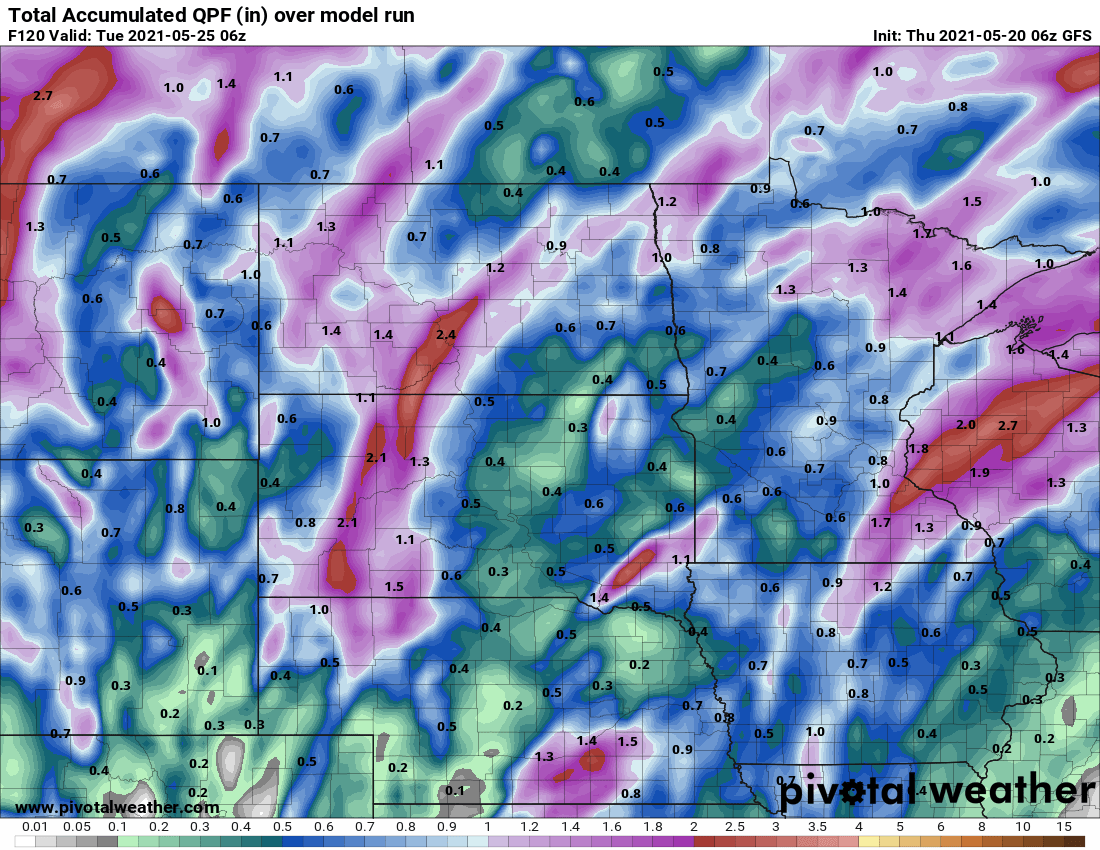
It currently looks like the brunt of the wetter pattern should end by Tuesday. That is also when the humidity is finally expected to drop into more comfortable ranges, following the stickiness Minnesota will experience through the weekend.
Staying warm
The same flow from the south holding the moisture in place also keeps warm air over the state. Overnight temperatures in particular stay mostly in the 60s and 70s, which is 15 to 25 degrees above average for this time of year.
With more sunshine back on Friday, much of the state makes it into the 80s, and a few 90s are possible in southern Minnesota Saturday depending on how much sunshine makes it through.
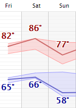
When more rain returns again Sunday, it cools temperatures slightly again, back into the 60s north, and 70s south, with a couple isolated 80s possible.
Here is that temperature forecast for the Twin Cities:
Programming note
You can hear my live weather updates on Minnesota Public Radio at 7:49 a.m. Monday through Friday morning.

