
Warm, humid and occasionally stormy over the weekend
Minnesota finally turns drier and less humid next week
Go Deeper.
Create an account or log in to save stories.
Like this?
Thanks for liking this story! We have added it to a list of your favorite stories.


Although there will be more breaks through the weekend in the recently soggy pattern, the weather stays very warm and humid with severe storms still a risk.
Friday’s forecast
The flow of Gulf of Mexico moisture that has caused the recent rain across Minnesota is less direct Friday and has shifted the brunt of the rain east of the state. However, there were still lingering showers and storms along the eastern edge of Minnesota as of 9:30 a.m.
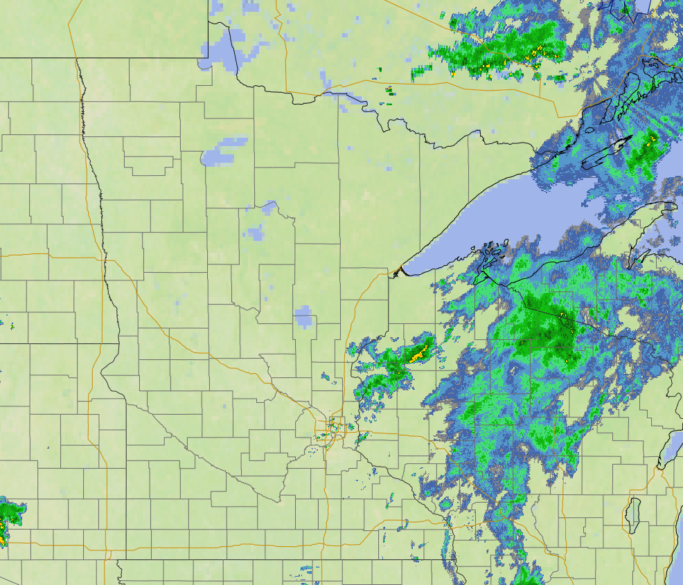
Those showers and storms continue to diminish and move east through the morning, although some wet weather may linger in southeastern Minnesota into the afternoon.
There will also be a separate area of low pressure that brings active weather into northern Minnesota by Friday evening.
With the two areas of moisture, there is a “marginal” (isolated) severe weather risk for both northwestern and southeastern Minnesota Friday. Large hail is the primary threat northwest, and damaging wind with maybe a couple isolated, weak tornadoes are possible southeast.
Turn Up Your Support
MPR News helps you turn down the noise and build shared understanding. Turn up your support for this public resource and keep trusted journalism accessible to all.
Despite those wet areas, much of Minnesota will see more breaks of sunshine by the afternoon, and that will drive highs into the 80s for most of the state.
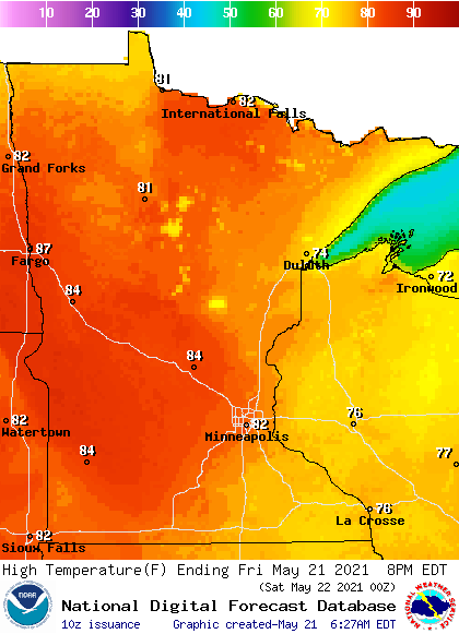
This follows another warm and humid morning, with lows predominantly in the 60s.
Rain chances
The low pressure that starts moving in Friday evening continues to bring rain and thunderstorm chances to northern Minnesota Saturday, while most of southern Minnesota should stay dry until evening.
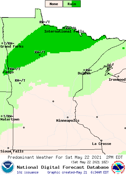
The western edge of central Minnesota could see isolated strong storms Saturday.
That severe weather risk spreads statewide Sunday as showers and storms return across the state. It is predominantly an isolated risk for large hail and high winds, but a weak tornado potential cannot be ruled out.
Like Sunday, Monday is also forecast to be cloudier with scattered showers and storms for all of Minnesota.
Finally by Tuesday, the wet pattern is expected to abate with more sunshine returning and the humidity returning to far more comfortable levels. While it currently looks like there could be more rain late next week, it appears that will be a less tropical air mass without the warm and humid conditions Minnesota is currently experiencing.
Seasonable weather returns
The same flow from the south holding the moisture in place has kept above average temperatures across Minnesota the past few days.
Saturday will be another day with most of the state in the 80s for highs, and southern Minnesota could see a couple 90s depending on how much sunshine that area gets. This is 10 to 20 degrees above average for this time of year.
When more rain returns state-wide on Sunday, it cools temperatures slightly again, back into the 60s north, and 70s south, with a couple isolated 80s possible. Monday and Tuesday stay in the 70s and 80s.
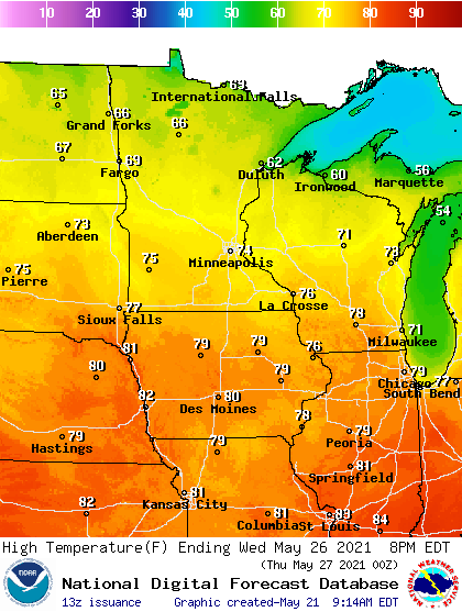
It currently looks like more seasonable highs in the 60s north and 70s south should return by Wednesday, once the drier air settles back over the state.
Programming note
You can hear my live weather updates on Minnesota Public Radio at 7:49 a.m. Monday through Friday morning.

